| Saturday | Saturday Night | Sunday | |
|---|---|---|---|
| Cloud Cover: | Warming and sunny. | Clear. | Sunny and Warm. |
| Temperatures: | 35-47 deg. F. | 23-28 deg. F. | 42-57 deg. F. |
| Wind Direction: | S | S | S |
| Wind Speed: | 5-6 | 4-5 | 4 |
| Snowfall: | 0 in. | 0 in. | 0 in. |
| Snow Line: |
Whitefish Range
Swan Range
Flathead Range and Glacier National Park
How to read the forecast
The avalanche danger is MODERATE, but will rise on sunny slopes today. The quick transition from winter to spring-like conditions will bring a host of avalanche problems. Pay attention to the affect of sun and warming temperatures on the recent snow as both human triggered and natural loose, wet avalanches are possible. Large cornices could also weaken and fail. Lingering wind slabs in the alpine and weak snow above a crust 2-3 feet from from the surface still exist.

2. Moderate
?
Above 6500 ft.
2. Moderate
?
5000-6500 ft.
1. Low
?
3500-5000 ft.
- 1. Low
- 2. Moderate
- 3. Considerable
- 4. High
- 5. Extreme
-
Type ?
-
Aspect/Elevation ?
-
Likelihood ?CertainVery LikelyLikelyPossible
 Unlikely
 -
Size ?HistoricVery LargeLargeSmall

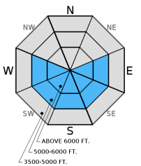
Another sunny day is in store for today with slightly warmer temperatures than yesterday. In the morning expect to see a surface crust on sun exposed slopes. As temperatures rise and the sun starts to break down this crust the surface snow will become less stable and the likelihood of human triggered and natural loose, wet avalanches will increase. Early indicators that it is time to move to a more shaded slope are the surface becoming moist and roller balls/pinwheels forming on steep slopes. Also, stay out from under sunny slopes as the day progresses. Though loose snow avalanches are a manageable problem, they are still dangerous as they can entrain a lot of snow and move very fast, especially in terrain traps like gullies.
-
Type ?
-
Aspect/Elevation ?
-
Likelihood ?CertainVery LikelyLikelyPossible
 Unlikely
 -
Size ?HistoricVery LargeLargeSmall

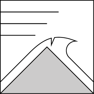
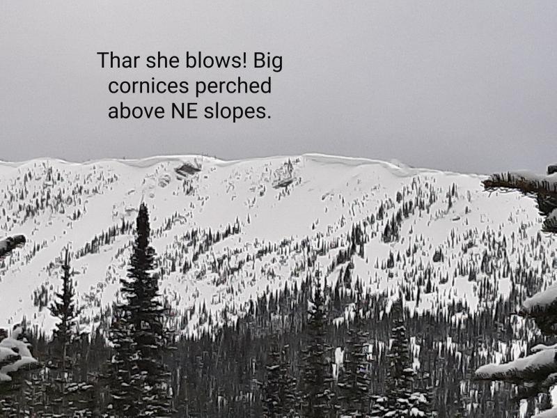
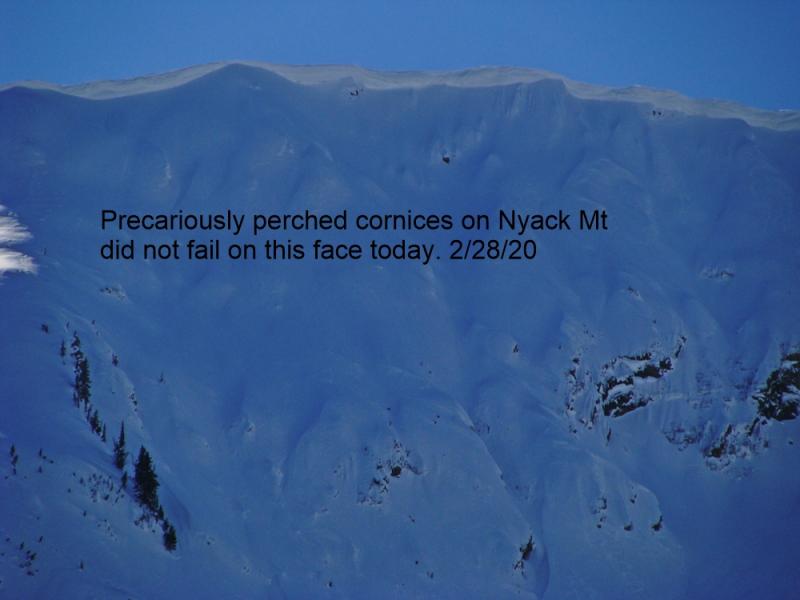
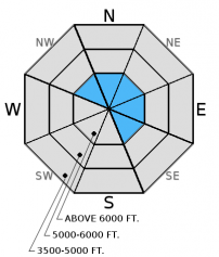
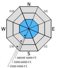
We have recently observed some monster cornices across the area. The sun and warming temperatures expected today will weaken these and may cause them to fail and trigger a slab avalanche below. Cornices can release farther behind the ridgeline than expected so it is important to keep a safe distance when traveling above them and limit your exposure time when traveling below. The huge amount of stress a falling cornice puts on the snowpack can trigger deeper weak layers like lingering windslabs and weak snow around the late February crust. Yesterday, a skier on Peak 6996 near Marias Pass unintentionally broke of a block of cornice from a safe distance behind the ridgeline. The blocks of cornice triggered an avalanche that propagated 40-60 feet across the slope.
With warming and intense sunshine today creating more cohesive slabs, it is still possible that you could also trigger a lingering wind slab even without the help of a cornice fall.
-
Type ?
-
Aspect/Elevation ?
-
Likelihood ?CertainVery LikelyLikelyPossible
 Unlikely
 -
Size ?HistoricVery LargeLargeSmall

Weak, sugary snow and buried surface hoar atop a crust from late February located 1.5 to 2 feet from the surface are still on our radars. While we have not had recent reports of avalanches releasing on these weak layers, stability tests in most locations show these weak layers still have the potential to break across a slope (video1, video2). These are the types of layers I just don't trust; the kind that will bite you when you are least expecting it. These layers aren't providing obvious signs of instability like cracking or collapsing which makes digging into the snow and doing stability tests important. Though it requires hard force, it shows that a large load (like a cornice fall, perhaps) could trigger these deeper layers especially as temperatures rise above freezing over the next 2 days. A trigger like a skier or a snowmobiler in a more shallow spot could also awaken this deeper layer.
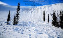
Friday: Skiers on Peak 6996 near Marias Pass in the Flathead Range unintentionally broke two blocks of cornice from a safe distance behind the ridgeline. The cornice triggered an avalanche that propagated 40-60 feet across the slope and ran about 400 feet. Skiers on Essex Mountain in the Flathead Range found the late February crust 2 feet from the surface with small, facetes above. They also noted another round of surface hoar forming on the surface (observation). Snowmobilers in Kimmerly Basin in the Whitefish Range noted glide cracks opening on sunny slopes. Snow bikers in the Lost Johnny/Strawberry Lake area in the Swan Range found excellent riding conditions. The snow surface softened as the day progressed and they observed small, loose, wet avalanches in the upper elevation terrain (observation).
Thursday: Erich and I rode around the Doris Creek/Blaine Mountain area in the Swan Range yesterday. We found excellent riding with 16-20 inches of snow above the rain crust from last weekend. Wind slabs near the ridges produced isolated cracking, but we avoided steep wind loaded terrain. We also found weak snow above two crusts about 2 -3 feet from the surface that fractured and propagated in our stability tests (observation and video).
Wednesday: In the Skyland area of the Flathead Range, Erich found 16 inches of new snow sitting atop the rain crust from last Sunday. They also found weak, sugary snow atop the crust from late February that fractured and propagated in every stability test they conducted (video and observation). With good visbility they observed no new natural avalanche activity. Skiers in Rescue Creek yesterday found the new snow to be bonding well to the old snow and noted facets surrounding a crust in the upper snowpack (observation).
Visit our Observations page and our You Tube channel for more observations from the entire season.
Thanks to everyone for submitting observations. They are extremely useful and could help save lives.
HOW TO SUBMIT OBSERVATIONS:
Email: [email protected]
Call and leave a message: 406.387.3821
You can also submit quick observations via text: 406.241.4571 (FAC mobile)
OR
Submit Snowpack Observations: http://www.flatheadavalanche.org/node/add/snowobs
Submit Avalanche Observations: http://www.flatheadavalanche.org/node/add/avyobs
After a week of winter-like conditions and substantial snow accumulation a ridge of high pressure started to build over the region yesterday. The ridge brought sunny skies, mild temperatures, and light winds. The spring-like weather should continue today with mostly sunny skies, and temperatures warming to the low 40s. Currently, temperatures above 6000 feet range from 8º-19º F, and winds are 2-12 mph with gusts from 10-14 mph out of the east and southeast.
| 0600 temperature: | 8-18 deg. F. |
| Max. temperature in the last 24 hours: | 25-35 deg. F. |
| Average wind direction during the last 24 hours: | SW-SE |
| Average wind speed during the last 24 hours: | 5-10 mph |
| Maximum wind gust in the last 24 hours: | 11-14 mph |
| New snowfall in the last 24 hours: | 0-1 inches |
| Total snow depth: | 83-109 inches |
This advisory applies only to backcountry areas outside established ski area boundaries. This advisory describes general avalanche conditions and local variations always occur. This advisory expires at midnight on the posted day unless otherwise noted. The information in this advisory is provided by the USDA Forest Service who is solely responsible for its content.


