| Thursday | Thursday Night | Friday | |
|---|---|---|---|
| Cloud Cover: | Tapering snow this afternoon. | High pressure builds with clearing skies. | Warmer temperatures and clear skies. |
| Temperatures: | 25 to 39 deg. F. | 6 to 17 deg. F. | 29 to 40 deg. F. |
| Wind Direction: | North-Northeast | North-Northeast | East |
| Wind Speed: | 5-10 mph with gusts to 20 mph. | 5-10 mph. | 1-5 mph. |
| Snowfall: | 2-5 in. | 0 in. | 0 in. |
| Snow Line: |
Whitefish Range
Flathead Range and Glacier National Park
How to read the forecast
More snow overnight created heightened avalanche conditions. Up to 1.5 feet of snow fell since Sunday night. This new snow and wind formed wind slabs in upper elevation terrain, and continues to stress deeper weak layers on top of a crust 2 to 3 feet from the surface. Careful snowpack and terrain evaluation are important. Human triggered avalanches are possible today. The danger is MODERATE* but could rise if snowfall persists longer than expected today. Swan Range advisory here.

2. Moderate
?
Above 6500 ft.
2. Moderate
?
5000-6500 ft.
2. Moderate
?
3500-5000 ft.
- 1. Low
- 2. Moderate
- 3. Considerable
- 4. High
- 5. Extreme
-
Type ?
-
Aspect/Elevation ?
-
Likelihood ?CertainVery LikelyLikelyPossible
 Unlikely
 -
Size ?HistoricVery LargeLargeSmall

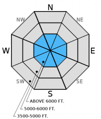
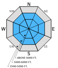
The new snow appears to be bonding fairly well to the old snow surface from Sunday. However, there is plenty of new snow available for wind to transport and form wind slabs. Today's winds will be out of the east-northeast. So, wind slabs are likely to form in atypical locations on the southern half of the compass. Older wind slabs that formed earlier in the week are located on more typical leeward slopes. Given the amount of new snow this week, give the snowpack time to adjust to the new load especially at upper elevations, it's important to carefully evaluate all slopes before skiing or riding. Due to a lack of recent observations there is a bit of uncertainty that exists with wind slab development and distribution.
-
Type ?
-
Aspect/Elevation ?
-
Likelihood ?CertainVery LikelyLikelyPossible
 Unlikely
 -
Size ?HistoricVery LargeLargeSmall

Weak, sugary snow and buried surface hoar atop a crust from late February located 1.5 to 2 feet from the surface are still on our radars. While we have not had recent reports of avalanches releasing on these weak layers, stability tests in most locations show these weak layers have the potential to break across a slope. These are the types of layers I just don't trust; the kind that will bite you when you are least expecting it. These layers aren't providing obvious signs of instability like cracking or collapsing which makes digging into the snow and doing stability tests important.
In the Whitefish Range, a layer of buried surface hoar preserved on top of a crust displays variable results in stability tests, but has fracture and propagated in some. In other ranges, a layer of weak, sugary snow (facets) located atop the crust exists and, just yesterday, fractured and propagated in every test on multiple aspects (video). Keep in mind that while we have not put a large, rapid load on these layers the incremental snowfall over the past week will add stress and may cause them to become more reactive. Though it requires hard force, it shows that a large load (like a cornice fall, perhaps) could trigger these deeper layers, or a trigger like a skier or a snowmobiler in a more shallow spot could also awaken this deeper layer.
-
Type ?
-
Aspect/Elevation ?
-
Likelihood ?CertainVery LikelyLikelyPossible
 Unlikely
 -
Size ?HistoricVery LargeLargeSmall

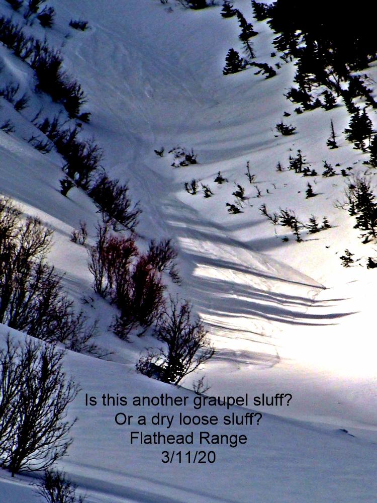
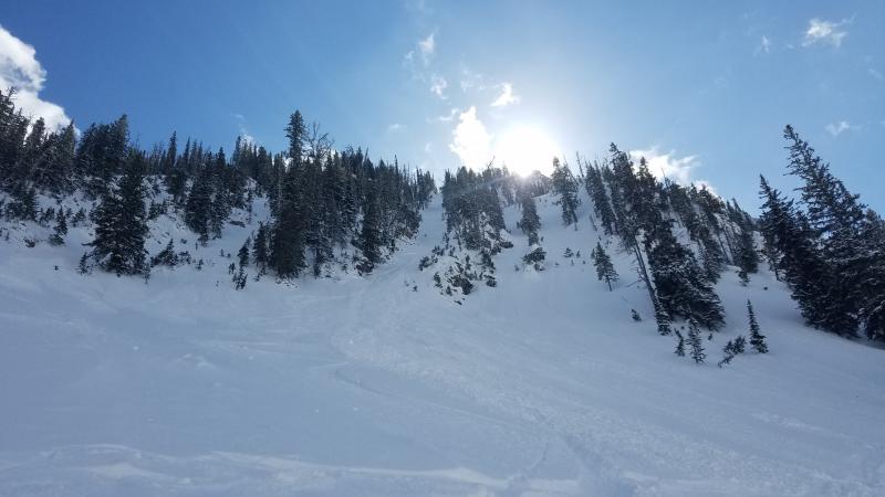
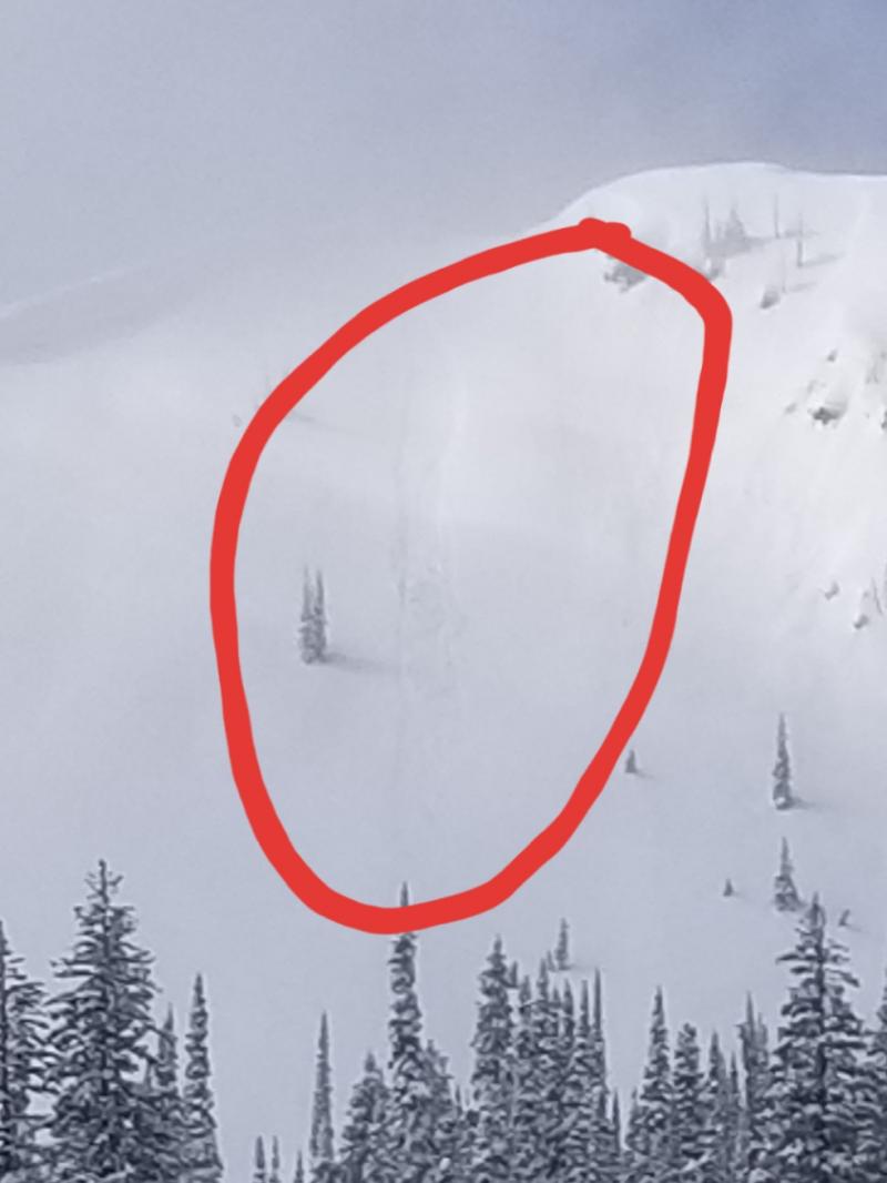
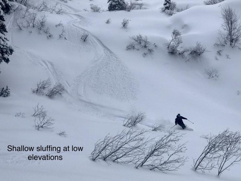
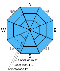
The nearly 20 inches of low density new snow that we received over the past few days accumulated on top of a rain crust in many locations. This new snow was sluffing easily on steep terrain on Tuesday. In the southern Whitefish Range, we were able to initiate loose snow avalanches that traveled long distances and entrained a fair amount of snow. The combination of relatively cold dry surface snow and the strong mid-March sun will create a loose avalanche problem if we have breaks in the clouds today. Yesterday, we noticed that it only took a few minutes of sunshine and warming to initiate rollerball/pinwheel activity on steep sunny aspects. This is an easy problem to manage and just requires you to move to a more shaded aspect.
*We have limited recent observations from upper elevation alpine zones where more snow accumulated, and avalanches may be more problematic. Thus, use today's danger rating as a starting point, and, as always, make your own site specific decisions. The danger could be higher in those zones especialy in wind loaded terrain. Also, let us know what you are seeing out there. Public observations have been very limited over the past 2 weeks, and please know that your observations are extremely useful.
Additional Concerns: Also, as we approach spring and daily maximum temperatures rise above freezing on a more regular basis, cornices will likely become more sensitive and glide cracks could begin to fail. Cornices can trigger avalanches that release on deeper weak layers on the slopes below making the consequences more severe. Give cornices a wide berth while traveling along ridges and limit your exposure time when traveling below them.
Wednesday: In the Skyland area of the Flathead Range, my partner and I found 16 inches of new snow sitting atop the rain crust from last Sunday. We also found weak, sugary snow atop the crust from late February that fractured and propagated in every stability test we conducted yesterday (video and observation). With good visbility we observed no new natural avalanche activity. Skiers in Rescue Creek yesterday found the new snow to be bonding well to the old snow and noted facets surrounding a crust in the upper snowpack (observation).
Tuesday: Mark toured east of the Whitefish Mountain Resort ski area boundary in the southern Whitefish Range where he found 16 inches of new snow since Sunday and evidence of recent wind transport (observation). I was just west of the ski area and found large grain surface hoar 3 feet below the surface that propagated in his ECT tests with hard force. We both found an impressive layer of graupel that was 8 inches below the surface which was adding to the new snow instability.
Monday: Mark traveled to the Marion Lake area of the Flathead Range. Above 6200 feet I found 4-6 inches of new snow sitting atop a rain crust. He were unable to locate buried surface hoar but we did find evidence of recent and current wind loading (observation). Skiers in the southern Whitefish Range had propagation in their stability tests on a layer of facets atop a melt freeze crust 90 cm from the surface (observation)
Sunday: Skiers in the Tranquil Basin/Mt. Furlong area in the Flathead Range found a breakable crust below 5500 feet. At upper elevations they noted multiple crusts within the top 16 inches of the snowpack with weak, facets between them. Their stability tests produced fractures with propagation in this weak snow using hard force (observation).
Saturday: Todd and Mark rode up to Hash Mountain in the Swan Range. On the ride through the Lost Johnny drainage they observed 2 small, recent slab avalanches (observation). Skiers on Paola Ridge in the Flathead Range found small, decomposing surface hoar buried 14 inches from the surface. This layer fractured with easy force in compression tests (observation).
Visit our Observations page and our You Tube channel for more observations from the entire season.
Thanks to everyone for submitting observations. They are extremely useful and could help save lives.
HOW TO SUBMIT OBSERVATIONS:
Email: [email protected]
Call and leave a message: 406.387.3821
You can also submit quick observations via text: 406.241.4571 (FAC mobile)
OR
Submit Snowpack Observations: http://www.flatheadavalanche.org/node/add/snowobs
Submit Avalanche Observations: http://www.flatheadavalanche.org/node/add/avyobs
1 to 6 inches of snow fell in the past 24 hours with light to moderate winds from the southwest. Since Sunday night 16-20 inches of snow has fallen in a series of storms with up to 1.5 inches of snow water equivalent. Currently, temperatures above 6000 feet range from 16º-24º F, and winds are out of the north-northwest at 3-11 mph with gusts from 8-27 mph. Today expect 3-5 inches of snow through the morning before tapering this afternoon with winds out of the north-northeast at 10-20 mph. Tomorrow, high pressure builds with warming temperatures and clear skies.
| 0600 temperature: | 16 to 24 deg. F. |
| Max. temperature in the last 24 hours: | 28 to 34 deg. F. |
| Average wind direction during the last 24 hours: | southwest switching to north |
| Average wind speed during the last 24 hours: | 3-20 mph |
| Maximum wind gust in the last 24 hours: | 19-31 mph |
| New snowfall in the last 24 hours: | 1-6 inches |
| Total snow depth: | 87-113 inches |
This advisory applies only to backcountry areas outside established ski area boundaries. This advisory describes general avalanche conditions and local variations always occur. This advisory expires at midnight on the posted day unless otherwise noted. The information in this advisory is provided by the USDA Forest Service who is solely responsible for its content.


