| Friday | Friday Night | Saturday | |
|---|---|---|---|
| Cloud Cover: | Brief break in precipitation until another shot of moisture arrives this afternoon. | Warming temps, snow and rain. | Snow and rain. |
| Temperatures: | 36 to 53 deg. F. | 28 to 35 deg. F. | 37 to 50 deg. F. |
| Wind Direction: | South-Southwest | South-Southwest | Southwest |
| Wind Speed: | 5-10 mph with gusts to 20 mph. | 5-10 mph. | 10-15 mph with gusts to 25 mph. |
| Snowfall: | 0 in. | 0 in. | 0-1 in. |
| Snow Line: |
Whitefish Range
Swan Range
Flathead Range and Glacier National Park
How to read the forecast
Heavy, wet snow and strong winds created sensitive storm and wind slabs yesterday. Triggering a wind slab at upper elevations is likely due to continued strong winds. Allow lingering storm slabs to settle and also assess buried surface hoar. It is becoming more reactive in stability tests. Today requires careful snowpack evaluation, cautious route finding, and conservative decision making. The danger is CONSIDERABLE on wind loaded terrain at upper elevations and MODERATE elsewhere. Below 5000 feet, the danger is LOW.

3. Considerable
?
Above 6500 ft.
2. Moderate
?
5000-6500 ft.
1. Low
?
3500-5000 ft.
- 1. Low
- 2. Moderate
- 3. Considerable
- 4. High
- 5. Extreme
-
Type ?
-
Aspect/Elevation ?
-
Likelihood ?CertainVery LikelyLikelyPossible
 Unlikely
 -
Size ?HistoricVery LargeLargeSmall

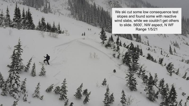
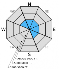
Given the recent quick load over the past day and a half, I expect wind slabs at upper elevations to remain sensitive to human triggering today. Lingering storm slabs could also be a problem so pay close attention on all aspects. Yesterday, we remotely triggered a storm slab from a safe ridge 15 feet away (image). Heavy, wet snow fell on lighter, drier snow from the previous 48 hours creating an upside down snowpack. This all sits atop a rain crust to at least 6500-7000 feet. This rain crust provides a great bed surface for wind and storm slabs to slide on. Expect wind slabs to be up to 2 feet thick at upper elevations.
-
Type ?
-
Aspect/Elevation ?
-
Likelihood ?CertainVery LikelyLikelyPossible
 Unlikely
 -
Size ?HistoricVery LargeLargeSmall

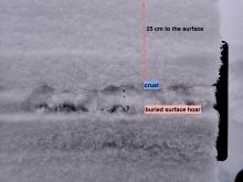
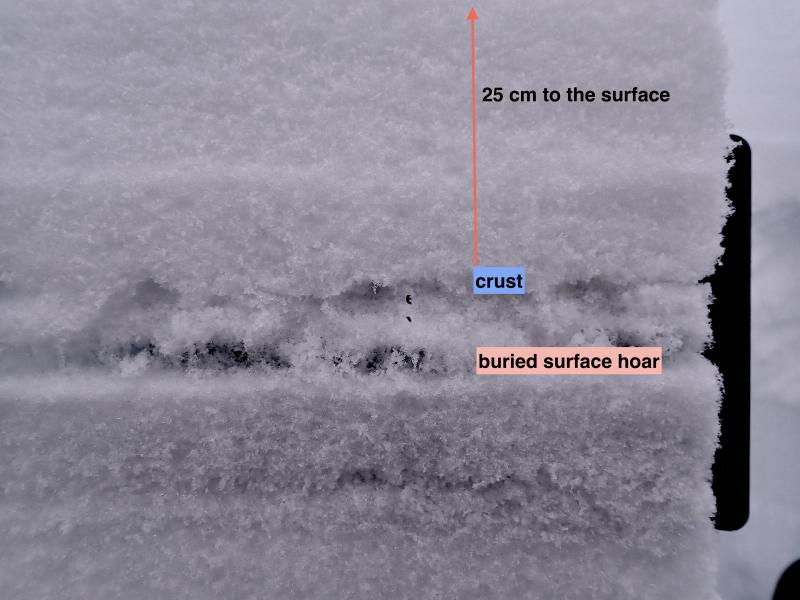
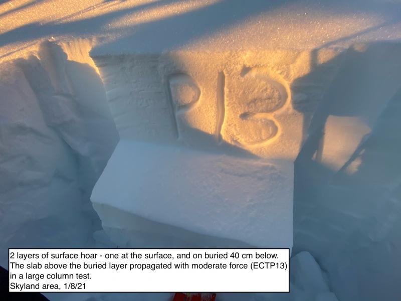
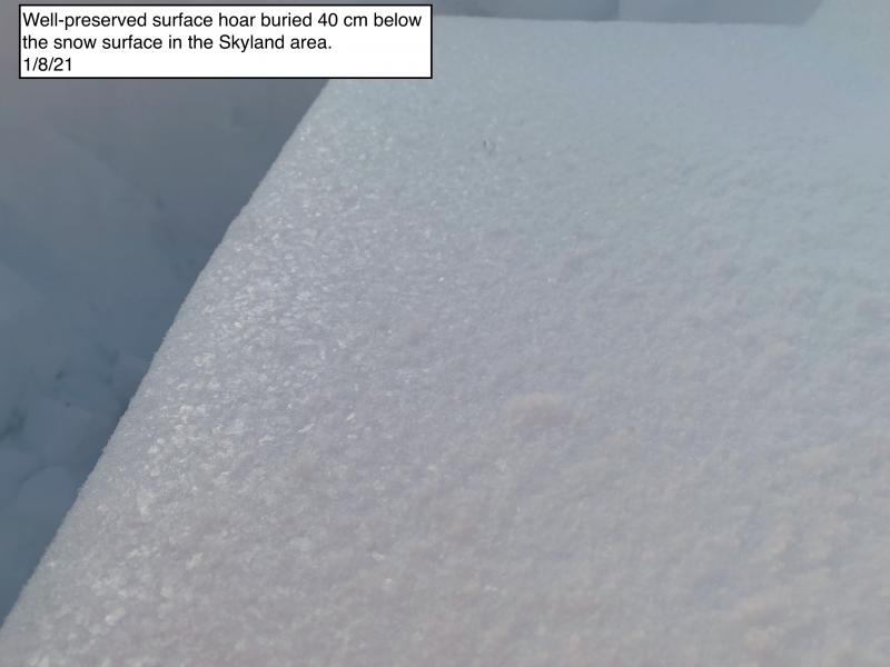
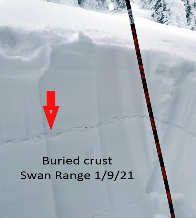
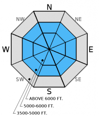
A layer of buried surface hoar 1.5 to 2 feet from the surface in most places is becoming more reactive in stability tests. While we have not yet heard of any avalanches on this layer, I don't trust it. It is becoming easier to initiate fracture and propagation in stability tests now that there is a sufficient slab on top of it (video 1, video 2). This layer could begin to rear its ugly head at any time. This emphasizes the importance of digging into the snow and doing stability tests. The layer can be identified by a grey stripe in your snowpit sitting on top of a crust about 1.5 to 2 feet from the surface. Surface hoar is notoriously tricky and research indicates it accounts for the most uninentional human triggered avalanches by professionals. If in doubt, choose low angled terrain.
-
Type ?
-
Aspect/Elevation ?
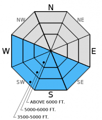
-
Likelihood ?CertainVery LikelyLikelyPossible
 Unlikely
 -
Size ?HistoricVery LargeLargeSmall

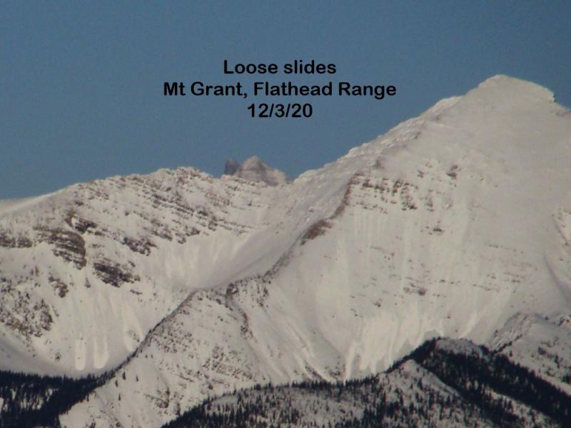
If skies remain clear as temperatures warm today, then loose, wet avalanches could become a problem. Pay attention to signs of wet snow instability like rollerballs and pinwheels and move to more shaded terrain.
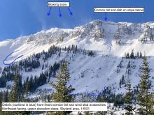
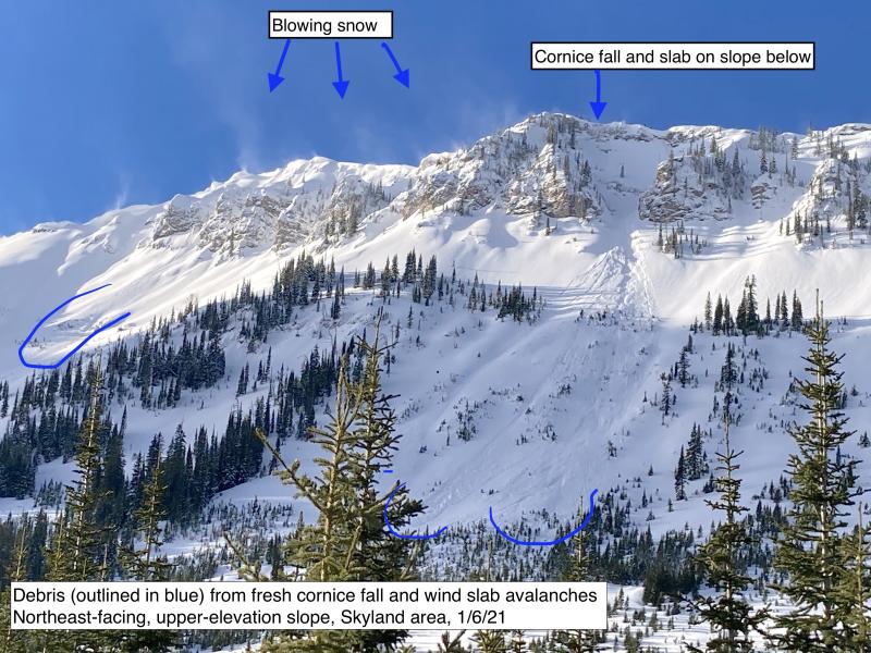
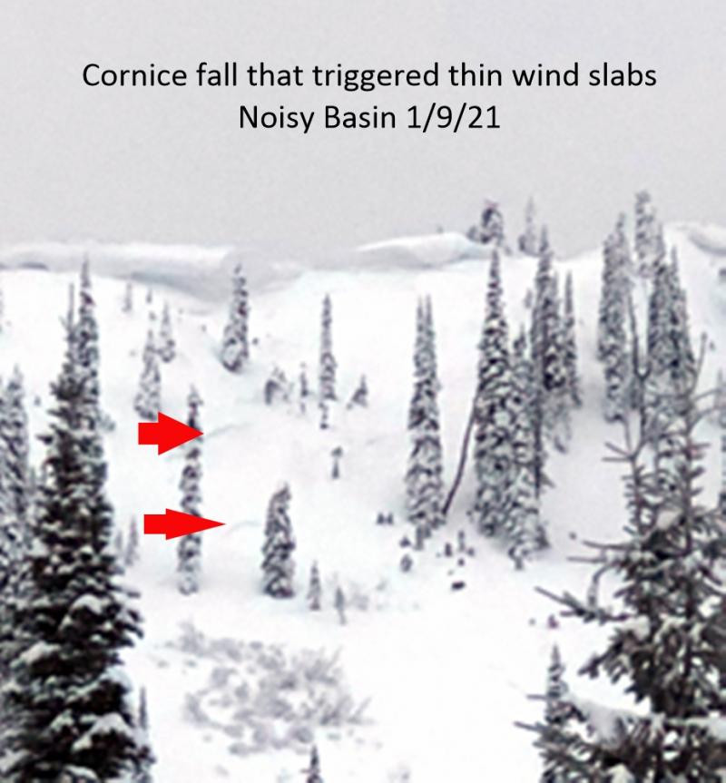
Additional Concerns: Also, as we approach spring and daily maximum temperatures rise above freezing on a more regular basis, cornices will likely become more sensitive and glide cracks could begin to fail. Cornices can trigger slab avalanches on the slopes below making the consequences more severe. Skiers in the Swan Range noted a large slab avalanche triggered by a cornice fall last Friday (observation). Give cornices a wide berth while traveling along ridges and limit your exposure time when traveling below them.
Avalanche Danger Scale: The National Avalanche Center developed a great video for helping backcountry users visually understand the avalanche danger scale (video).
We are saddened to hear about a fellow avalanche professional being killed in an avalanche on March 8 in the Wallowa Mountains in Oregon. Our thoughts are with the family and friends of Kip Rand and those at the Wallowa Avalanche Center (info).
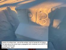
Thursday: Todd and I traveled along a safe ridge outside the ski area boundary yesterday and remotely triggered a small storm slab avalanche from the ridge (observation 1) and observed widespread shooting cracks and a collapse (observation 2). We also found buried surface hoar 1.5 to 2 feet from the surface to fracture and propagate in our stability test with moderate force (video). Whitefish Mountain Resort Ski Patrol also reported very reactive storm and wind slabs during their avalanche mitigation work Thursday morning (observation).
Wednesday: My partner and I traveled to Red Meadow Peak in the northern Whitefish Range where we found up to 5 inches of low density snow sitting atop a firm rain crust all the way to 7500 feet. We also found buried surface hoar up to 2 feet from the surface that fractured and propagated in stability tests (observation, video). We noted wet, loose avalanche debris from the weekend, but no new avalanche activity.
Monday: Mark visited Rescue Creek in the Flathead Range and found evidence of a wet loose avalanche cycle from the weekends warm rainy weather. We also noted 2 glide cracks that had formed and a surface rain crust at all elevations (observation).
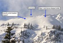
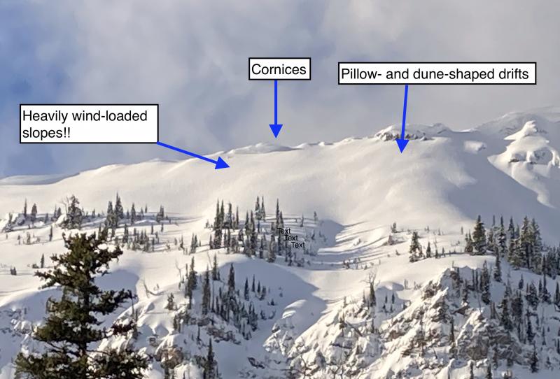
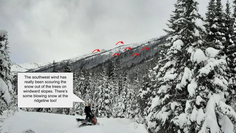
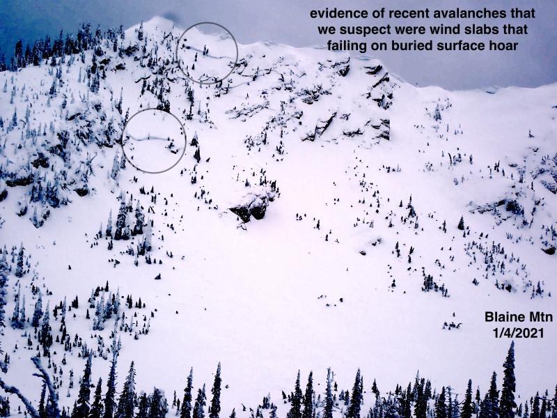
Saturday: Skiers in the Swan Range noted a cornice failure that triggerred a wind slab avalanche on an upper elevation slope. They also noted sevcral glide cracks that had increased in size during their 4 day tour, including one that had failed (observation). Snow bikers were in the Red Meadow area in the northern Whitefish Range and observed natural loose, wet avalanche activity in the afternoon (photo). They also noted southwest winds cross-loading slopes and increasing the size of cornices in the area. We were on Skookoleel Ridge in the southern Whitefish Range, and in isolated areas we found buried surface hoar about 14 inches from the surface (photo). Stability test results were variable due to variability in slab formation above.
Visit our Observations page and our You Tube channel for more observations from the entire season.
Thanks to everyone for submitting observations. They are extremely useful and could help save lives.
HOW TO SUBMIT OBSERVATIONS:
Email: [email protected]
Call and leave a message: 406.387.3821
You can also submit quick observations via text: 406.241.4571 (FAC mobile)
OR
Submit Snowpack Observations: http://www.flatheadavalanche.org/node/add/snowobs
Submit Avalanche Observations: http://www.flatheadavalanche.org/node/add/avyobs
Mountain weather stations report storm totals of 4 to 10 inches of snow with 0.6 to 1.6 inches of snow water equivalent in the past 36 hours. The storm has ceased until another shot of moisture enters the advisory area this afternoon. Currently, mountain temperatures range from 23°-29° F with southwest winds moving at 5-24 mph and gusting to 35 mph. Wind speeds will increase to 15-25 mph with gusts to 30 mph today and temperatures will rise to the mid- to upper 30s F. As precipitation moves in temperatures will rise and snow levels will creep up to 5500-6500 feet.
| 0600 temperature: | 23 to 29 deg. F. |
| Max. temperature in the last 24 hours: | 32 to 39 deg. F. |
| Average wind direction during the last 24 hours: | Southwest |
| Average wind speed during the last 24 hours: | 5-36 mph |
| Maximum wind gust in the last 24 hours: | 33-54 mph |
| New snowfall in the last 24 hours: | 2-6 inches |
| Total snow depth: | 77-106 inches |
This advisory applies only to backcountry areas outside established ski area boundaries. This advisory describes general avalanche conditions and local variations always occur. This advisory expires at midnight on the posted day unless otherwise noted. The information in this advisory is provided by the USDA Forest Service who is solely responsible for its content.


