| Friday | Friday Night | Saturday | |
|---|---|---|---|
| Cloud Cover: | Sunny and warm. | Mostly clear. | Becoming cloudy with potential for snow in the afternoon. |
| Temperatures: | 38 to 50 deg. F. | 28 to 34 deg. F. | 40 to 50 deg. F. |
| Wind Direction: | Southwest | Southwest | Southwest |
| Wind Speed: | 5-10 mph. | 5-10 mph. | 5-10 mph with gusts to 25 mph. |
| Snowfall: | 0 in. | 0 in. | 0-2 in. |
| Snow Line: |
Whitefish Range
Swan Range
Flathead Range and Glacier National Park
How to read the forecast
Sunshine and warm temperatures today will cause wet snow avalanche problems. With recent snow as ammunition, natural and human triggered wet loose avalanches will become more likely on sunny slopes. Avoid sunny aspects as the day progresses and move to more shaded terrain. Also watch for cornices and lingering wind slabs in steep, upper elevation terrain. The hazard is MODERATE but could rise to CONSIDERABLE on steep, sunny aspects this afternoon.

2. Moderate
?
Above 6500 ft.
2. Moderate
?
5000-6500 ft.
2. Moderate
?
3500-5000 ft.
- 1. Low
- 2. Moderate
- 3. Considerable
- 4. High
- 5. Extreme
-
Type ?
-
Aspect/Elevation ?
-
Likelihood ?CertainVery LikelyLikelyPossible
 Unlikely
 -
Size ?HistoricVery LargeLargeSmall

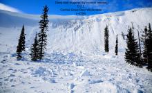
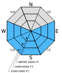
Both natural and human triggered wet, loose avalanches will become more likely as the day progresses and clouds dissipate. Today will be the day of warming and sunshine in 7 days after a period of recent stormy and cool weather. Thus, I expect the new surface snow to become unstable on slopes with intense sun exposure. Rollerballs, pinwheels, and a wet snow surface are signs that it is time to move to more shaded terrain. Wet, loose avalanches are a very manageable problem. Simply avoid being on or under sunny slopes this afternoon. Even small wet loose avalanches can pile up quickly in terrain traps.
-
Type ?
-
Aspect/Elevation ?

-
Likelihood ?CertainVery LikelyLikelyPossible
 Unlikely
 -
Size ?HistoricVery LargeLargeSmall

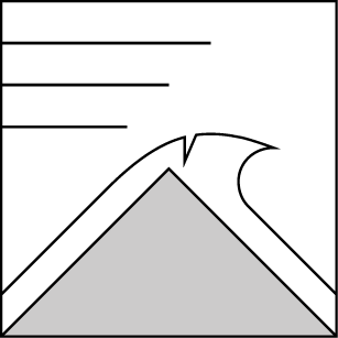
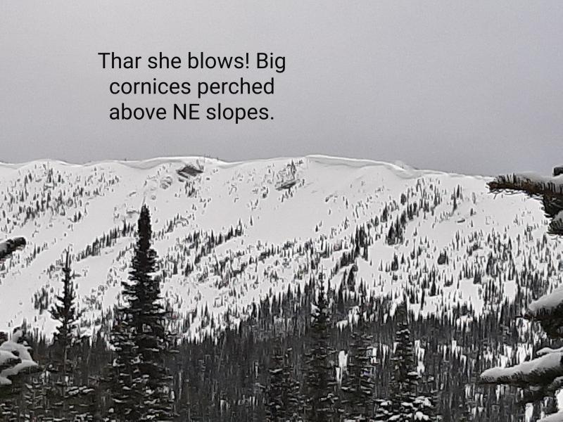
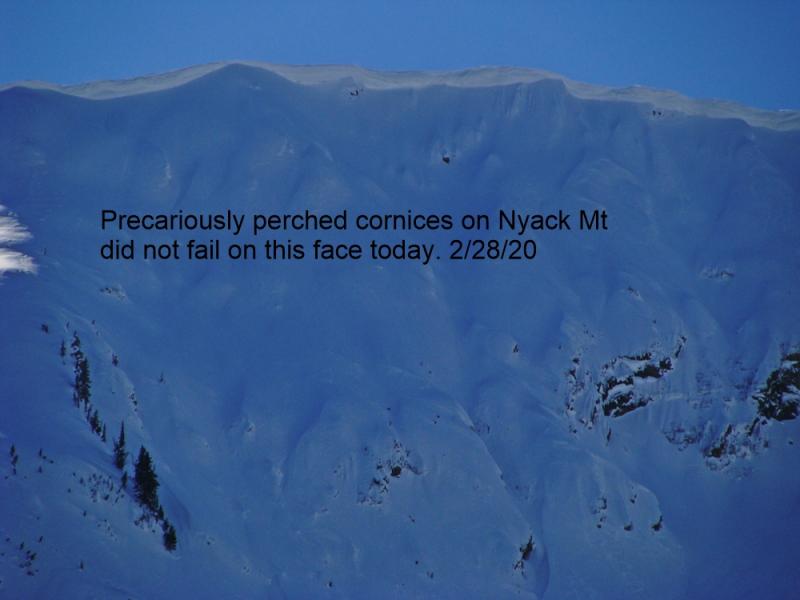
Recent strong winds have added size and weight to existing cornices. Today's warming could cause cornices to become unstable. As we approach spring and daily maximum temperatures rise above freezing, cornices will likely become more sensitive. Cornice failure can also be triggered by the weight of a skier or rider, and Tuesday we found cornices that failed easily from the weight of a skier (observation). Cornices can also trigger slab avalanches on the slopes below making the consequences more severe. Give these large pieces of overhanging snow a wide berth while traveling along ridges and limit your exposure time when traveling below them, especially later in the day.
-
Type ?
-
Aspect/Elevation ?
-
Likelihood ?CertainVery LikelyLikelyPossible
 Unlikely
 -
Size ?HistoricVery LargeLargeSmall

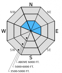
Strong to extreme winds combined with up to a foot of new snow over the past six days formed wind slabs. These slabs have likely strengthened over the past 24-48 hours, but human triggering is still possible at upper elevations. Today's warming and sunshine could cause cornice failure which, in turn, could trigger a wind slab on the slope below. In some areas slabs may have formed on a preserved layer of surface hoar making them more sensitive.
Additional Conerns: A layer of buried surface hoar exists 6-14 inches below the surface in some areas. Currently, this layer is fracturing, but not propagating in stability tests. This could change with today's warming. It is important to dig into the snow, see where the layer is, and test the reactivity of this layer with stability tests. There is a reason surface hoar accounts for most uninentional human triggered avalanches by professionals. It can be tricky and spotty in distribution.
Thursday: Skier in the Marion Lake area of the Flathead Range reported a couple of recent and somewhat reactive graupel layers within the top foot of the snowpack (observation).
Wednesday: In Cascade Creek in the Flathead Range, we found stubborn wind slabs on wind loaded slopes, but still did not trust wind loaded terrain. We also found buried surface hoar 6-14 inches from the surface in more shaded areas sheltered from the wind (observation) that fractured but did not propagate in extended column tests. Lower elevation snowpack is dwindling rather quickly and has become more spring-like.
Tuesday: We traveled to Sub-Shields in southern Glacier Park and found evidence of recently formed wind features and cornices at mid and upper-elevations. The cornices were soft and broke easily with the weight of a skier. There was a supportable crust to 6300 feet with a thin layer of new snow on top of this. We also found a decomposing layer of surface hoar 10 inches below the snow surface (observation).
Monday: USFS snowmobile observers were in the Doris/Alpha area of the northern Swan Range. They noted substantial ridgetop winds with associated wind loading down to 6000'.They were able to intentionally release small thin wind slabs in the new snow by kicking and ski cutting wind features (observation). Skiers in the southern Whitefish Range reported sluffing of the new snow in Canyon Creek.
Sunday: Skiers in Cascade Creek in the Flathead Range noted a 1 inch thick surface crust to 6000 feet. They reported good skiing above that and "interesting" skiing at low elevations.
Saturday: Erich was instructing an avalanche class in the Ghoulie Point area in the southern Whitefish Range. He noted active windloading along the ridgelines and surface hoar that was preserved and buried beneath 1-2 inches of new snow. Participants in the class also noted surface hoar in the area. Stability tests produced variable fractures in the upper snowpack without propagation (observation). Mark and Guy traveled to the Napa Point area in the Swan Range and noted the snow level was at 5900 feet and the area picked up 4 inches of dense snow above that. They also had minimal results in stability tests (observation).
Visit our Observations page and our You Tube channel for more observations from the entire season.
Thanks to everyone for submitting observations. They are extremely useful and could help save lives.
HOW TO SUBMIT OBSERVATIONS:
Email: [email protected]
Call and leave a message: 406.387.3821
You can also submit quick observations via text: 406.241.4571 (FAC mobile)
OR
Submit Snowpack Observations: http://www.flatheadavalanche.org/node/add/snowobs
Submit Avalanche Observations: http://www.flatheadavalanche.org/node/add/avyobs
Yesterday, intermittent snow showers dropped another 1 to 3 inches of new snow in the past 24 hours with moderate southwest winds. This brings new snow totals over the past 6 days to a foot or more. As of 6:00 a.m.temperatures above 6000 feet are 26-31° F and winds are out of the southwest 4-16 mph with gusts to 30 mph. Today will be a pleasant spring-like day with temperatures warming to the upper 30s to low 40s above 6000 feet, clear skies, and winds blowing out of the southwest at 5-10 mph. High pressure will continue tonight and tomorrow morning before another shot of moisture enters the region Saturday afternoon/evening.
Note: The Big Mountain Summit precipitation gauge (measuring liquid water content) is currently down. We hope to have it back up in the near future.
| 0600 temperature: | 26 to 31 deg. F. |
| Max. temperature in the last 24 hours: | 30 to 34 deg. F. |
| Average wind direction during the last 24 hours: | Southwest |
| Average wind speed during the last 24 hours: | 9-28 mph |
| Maximum wind gust in the last 24 hours: | 22-39 mph |
| New snowfall in the last 24 hours: | 1-3 inches |
| Total snow depth: | 78-102 inches |
This advisory applies only to backcountry areas outside established ski area boundaries. This advisory describes general avalanche conditions and local variations always occur. This advisory expires at midnight on the posted day unless otherwise noted. The information in this advisory is provided by the USDA Forest Service who is solely responsible for its content.


