| Wednesday | Wednesday Night | Thursday | |
|---|---|---|---|
| Cloud Cover: | Snow showers ending with windy conditions continuing. | Clearing with diminishing winds. | Snow showers and wind return in the afternoon. |
| Temperatures: | 31-43 deg. F. | 23-29 deg. F. | 34-45 deg. F. |
| Wind Direction: | W-SW | S-SW | SW |
| Wind Speed: | 15-22 gusts 32-41 | 7-12 gusts 25 in the Flathead Range | 9-14 gusts 21-23 |
| Snowfall: | 0-2 in. | 0 in. | 0-1 in. |
| Snow Line: |
Whitefish Range
Swan Range
Flathead Range and Glacier National Park
How to read the forecast
Due to strong to extreme winds and new snow over the past 48 hours the avalanche danger on steep wind loaded terrain above 6000 feet is CONSIDERABLE. Treat all wind loaded terrain as suspect and carefully evaluate recent windslabs before committing to a slope. All other terrain above 5000 feet is MODERATE and below 5000 feet the danger is LOW.

3. Considerable
?
Above 6500 ft.
2. Moderate
?
5000-6500 ft.
1. Low
?
3500-5000 ft.
- 1. Low
- 2. Moderate
- 3. Considerable
- 4. High
- 5. Extreme
-
Type ?
-
Aspect/Elevation ?

-
Likelihood ?CertainVery LikelyLikelyPossible
 Unlikely
 -
Size ?HistoricVery LargeLargeSmall

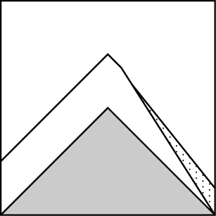
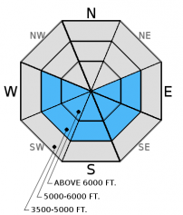
Strong winds this morning continue to load mid and upper elevation terrain and has created dangerous avalanche conditions. Fresh wind slabs that have formed over the past 2 days will increase in depth and size. These slabs are found on leeward slopes and cross-loaded features. In some areas recent windslabs may have formed on a preserved layer of surface hoar making them more sensitive. In other areas they may have been deposited on a recently formed sun crust or rain crust, both of which will provide a great bed surface for these fresh slabs to slide on. With these abnormally brisk winds be aware that fresh wind slabs could be found lower on upper elevation terrain than what we are used to seeing along with unusual cross loading of mid and upper elevation terrain features. Abnormally strong winds form abnormal avalanche conditions. Treat all wind loaded terrain as suspect. Continue to carefully evaluate all wind loaded terrain. Look for rounded pillows of wind drifted snow on leeward sides of ridges and cross-loaded areas in gullies at both mid and upper elevations.
-
Type ?
-
Aspect/Elevation ?
-
Likelihood ?CertainVery LikelyLikelyPossible
 Unlikely
 -
Size ?HistoricVery LargeLargeSmall

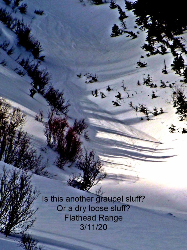
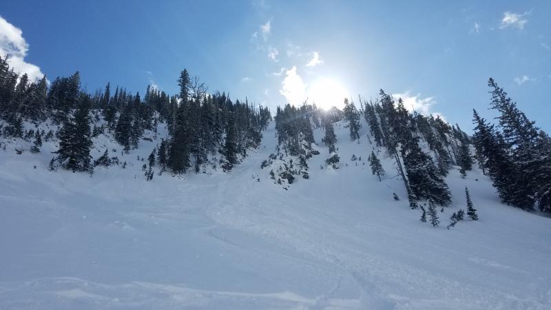
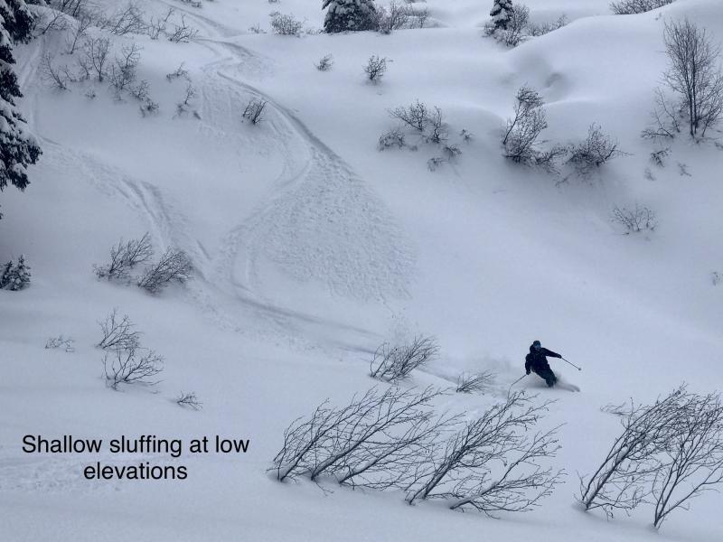
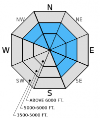
Recent new snow from Monday and Tuesday was relatively low density and, on sunny aspects, was deposited on a sun crust formed 2/26. Skiers in the southern Whitefish Range noted "lots of sluffing" in steep terrain on Monday. Yesterday, in southern Glacier Park, we found that the new snow was not adhering to the underlying crust and was sluffing on steeper terrain. On shaded aspects you may find that the new snow may have fallen on a rain crust formed 2/27. These loose dry slides will be small but can be consequential if you are knocked off your feet or machine. This is an easy problem to recognize because these crusts are located just below the snow surface.
-
Type ?
-
Aspect/Elevation ?
-
Likelihood ?CertainVery LikelyLikelyPossible
 Unlikely
 -
Size ?HistoricVery LargeLargeSmall

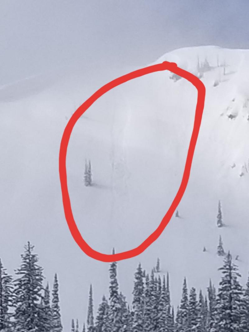
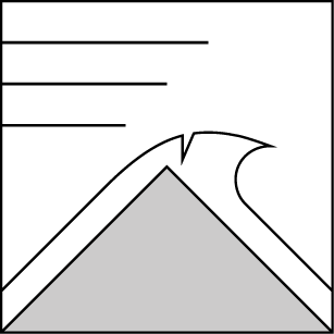
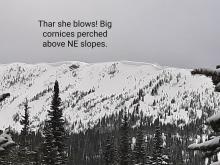
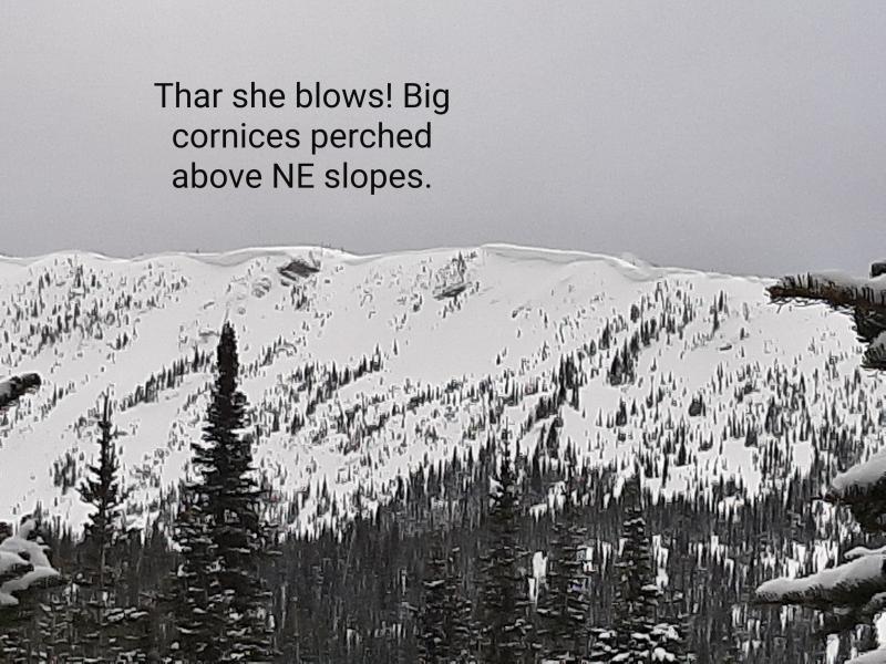
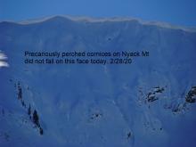
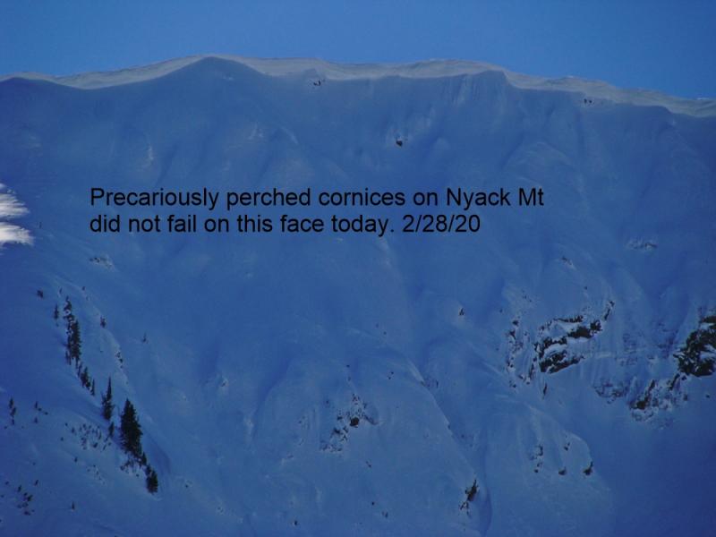
Recent strong winds have added size and weight to existing cornices at both mid and upper elevations. Cornice failure can occur naturally during periods of formation and, with continued windy conditions today, cornices should continue to grow. Cornice failure can also be trigerred by the weight of a skier or rider and yesterday we found cornices that failed easily from the weight of a skier (observation). As these cornices gain strength they will become more difficult to trigger but the consequence of a failure will increase.
This season we dealt with an ever evolving persistent slab problem associated with widespread rain crusts and weak snow surrounding these crusts. As time has passed so has our concern with some of these rain crusts. Currently, we are still tracking the strength of the snow around the February 14 crusts. The Valentine's Day crust now has 1.5-3 feet of snow sitting on top of it. Keep in mind that even small avalanches can step down into this deeper layer.
Tuesday: We traveled to Sub-Shields in southern Glacier Park and found evidence of recently formed wind features and cornices at mid and upper-elevations. The cornices were soft and broke easily with the weight of a skier. There was a supportable crust to 6300 feet with a thin layer of new snow on top of this. We also found a decomposing layer of surface hoar 10 inches below the snow surface (observation).
Monday: USFS snowmobile observers were in the Doris/Alpha area of the northern Swan Range. They noted substantial ridgetop winds with associated wind loading down to 6000'.They were able to intentionally release small thin wind slabs in the new snow by kicking and ski cutting wind features (observation). Skiers in the southern Whitefish Range reported sluffing of the new snow in Canyon Creek.
Sunday: Skiers in Cascade Creek in the Flathead Range noted a 1 inch thick surface crust to 6000 feet. They reported good skiing above that and "interesting" skiing at low elevations.
Saturday: Erich was instructing an avalanche class in the Ghoulie Point area in the southern Whitefish Range. He noted active windloading along the ridgelines and surface hoar that was preserved and buried beneath 1-2 inches of new snow. Participants in the class also noted surface hoar in the area. Stability tests produced variable fractures in the upper snowpack without propagation(observation). Mark and Guy traveled to the Napa Point area in the Swan Range and noted the snow level was at 5900 feet and the area picked up 4 inches of dense snow above that. They also had minimal results in stability tests (observation).
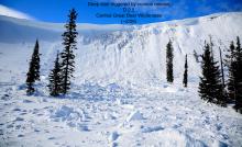
Friday: Skiers in Rescue Creek in the Flathead Range witnessed large loose, wet avalanches on sunny slopes (observation). Skiers east of Marias Pass in the Flathead Range found variable snow conditions and noted strong winds and active wind drifting (observation). Erich was instructing an avalanche class in the southern Whitefish Range and observed small, loose wet avalanches (photo) and noted widespread surface hoar formation. Skiers on Skookoleel Ridge in the southern Whitefish Range found large surface hoar on multiple aspects that remained preserved through the heat of the day. They also observed large cornices that showed signs of weakening due to rising temperatures (observation).
Visit our Observations page and our You Tube channel for more observations from the entire season.
Thanks to everyone for submitting observations. They are extremely useful and could help save lives.
HOW TO SUBMIT OBSERVATIONS:
Email: [email protected]
Call and leave a message: 406.387.3821
You can also submit quick observations via text: 406.241.4571 (FAC mobile)
OR
Submit Snowpack Observations: http://www.flatheadavalanche.org/node/add/snowobs
Submit Avalanche Observations: http://www.flatheadavalanche.org/node/add/avyobs
A fast moving storm passed through our area yesterday afternoon and evening. A cold front arrived early this morning dropping temperatures, increasing wind speeds and keeping lingering showers in a few locations. In the past 24 hours we have received 1-4" of new snow with high temperatures in the upper 20s to low 30s. The big story is WIND SPEED! Hornet, in the northern Whitefish Range, has reported maximum gusts over the past 3 hours averaging 56 mph with Snowslip, in southern Glacier Park reporting a max gust this morning of 53 mph! As of 6:00 a.m.temperatures above 6000 feet are 20-29° F and winds are out of the southwest 7-25 mph with gusts from 13-56 mph. Today temperatures should climb to the low to mid-30s, and winds will blow out of the south-southwest at 15-25 mph with maximum gusts along ridgelines between 40-55 mph. Winds and snow showers will taper off through the day.
| 0600 temperature: | 20-29 deg. F. |
| Max. temperature in the last 24 hours: | 28-389 deg. F. |
| Average wind direction during the last 24 hours: | WSW |
| Average wind speed during the last 24 hours: | 10-20 mph |
| Maximum wind gust in the last 24 hours: | 25-56 mph |
| New snowfall in the last 24 hours: | 1-4 inches |
| Total snow depth: | 76-102 inches |
This advisory applies only to backcountry areas outside established ski area boundaries. This advisory describes general avalanche conditions and local variations always occur. This advisory expires at midnight on the posted day unless otherwise noted. The information in this advisory is provided by the USDA Forest Service who is solely responsible for its content.


