| Sunday | Sunday Night | Monday | |
|---|---|---|---|
| Cloud Cover: | Partly cloudy. | Showers return late. | Lingering showers in the morning. |
| Temperatures: | 29-40 deg. F. | 20-26 deg. F. | 28-38 deg. F. |
| Wind Direction: | S-SW | SW | W-SW |
| Wind Speed: | 6-7 | 12-18 gusts 29-47 | 12-18 gusts 24-36 |
| Snowfall: | 0 in. | 1-2 in. | 1 in. |
| Snow Line: |
Whitefish Range
Swan Range
Flathead Range and Glacier National Park
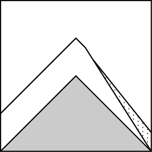
How to read the forecast
Dangerous conditions will exist today due to substantial new, unsettled snow and wind drifted snow combined with warming temperatures and sun exposure. Don't let the deep snow and sunny skies lure you into bad decision making. Terrain choices will be very important. The avalanche danger is CONSIDERABLE above 5000 feet. Human triggered avalanches are likely particularly in wind loaded terrain and on sunny slopes. Natural avalanches will also be possible. The danger below 5000 feet is MODERATE.

3. Considerable
?
Above 6500 ft.
3. Considerable
?
5000-6500 ft.
2. Moderate
?
3500-5000 ft.
- 1. Low
- 2. Moderate
- 3. Considerable
- 4. High
- 5. Extreme
-
Type ?
-
Aspect/Elevation ?
-
Likelihood ?CertainVery LikelyLikelyPossible
 Unlikely
 -
Size ?HistoricVery LargeLargeSmall

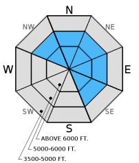
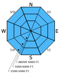
Moderate wind continued to transport the abundant new snow yesterday and form slabs that could be up to 2.5 feet thick. Expect these fresh slabs to be sensitive to human triggers today. Also, pay attention to cross-loaded terrain features that can exist well below the ridgeline. Look for rounded pillows of wind drifted snow on leeward sides of ridges and cross-loaded areas in gullies at both mid and upper elevations. Carefully evaluate all wind loaded terrain before committing to a slope.
In more sheltered terrain keep in mind that it has not even been 24 hours since the intense snowfall subsided. Storm slabs formed yesterday that have not had adequate time to settle. Storm slabs will be thicker and likely more reactive in the northern part of the advisory area. Look for areas where more dense snow (slab) sits on less consolidated snow.
-
Type ?
-
Aspect/Elevation ?
-
Likelihood ?CertainVery LikelyLikelyPossible
 Unlikely
 -
Size ?HistoricVery LargeLargeSmall

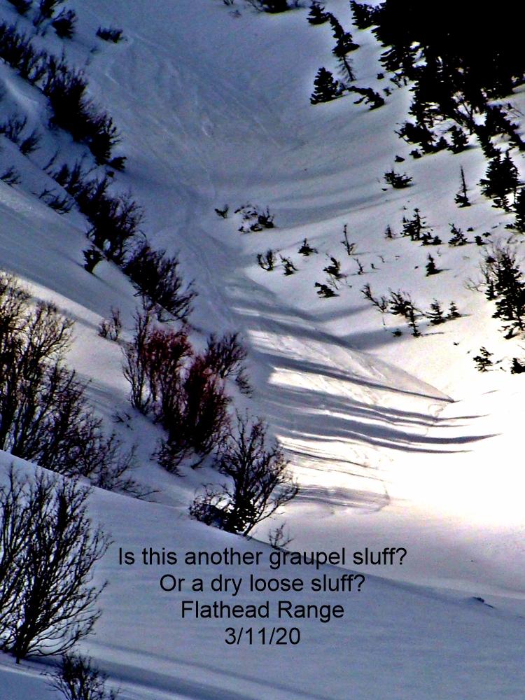
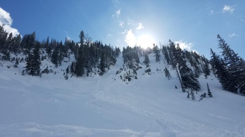
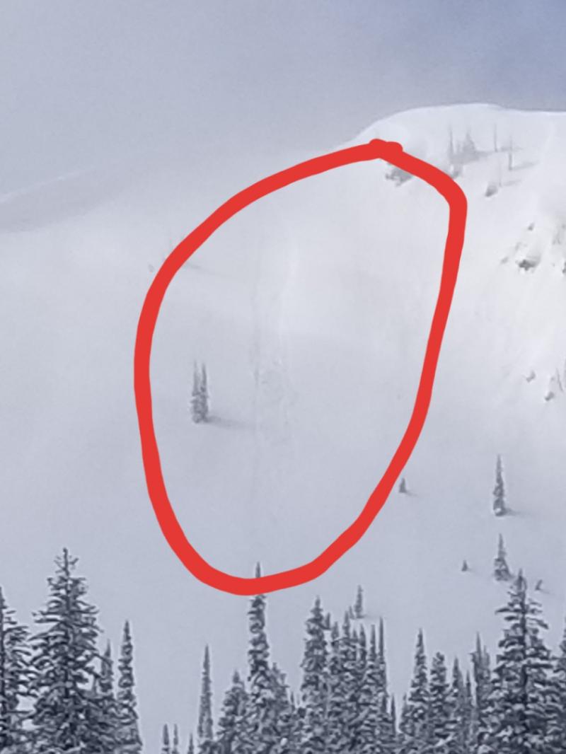
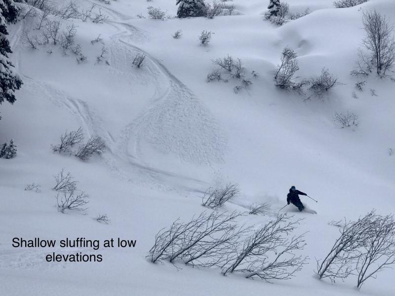
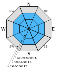
The compass will divide this problem into wet and dry loose avalanches today. In sheltered, shaded terrain expect to see loose, dry avalanches (sluffs) continue to release easily on steep slopes. These sluffs can start small, but rapidly entrain a substantial amount of snow and do a lot of damage. Particularly when traveling in or around terrain traps like narrow gullies, trees, and cliffs.
If the sun stays out for extended periods today look for rapidly deteriorating conditions on sun exposed slopes. Early indicators that the surface snow is becoming unstable are roller balls forming on steep cut banks, or the snow surface becoming moist. It is important to pay attention to these changing conditions and to move into more shaded terrain.
-
Type ?
-
Aspect/Elevation ?
-
Likelihood ?CertainVery LikelyLikelyPossible
 Unlikely
 -
Size ?HistoricVery LargeLargeSmall

The Valentine's Day (2/14) rain crust now has 1.5-3 feet of snow sitting on top of it. In most recent observations we found a thin layer of facets above this crust. While it took hard force to initiate fracture, it propagated across the column in our stability tests on Thursday (video). Since this layer is relatively new and we added a recent heavy load it remains important to continue to treat this layer with caution on all slopes. Also keep in mind that small avalanches have the potential to stress this layer more than skiers or riders can. So a small avalanche could step down into this deeper layer. Dig into the snow to assess its reactivity. The slab above this crust will be much thicker in wind loaded areas.
Large cornices formed over the past few storm cycles may be weakened by the sun today. The rapid stress a falling cornice puts on these deeper weak layers can trigger deeper and more destructive avalanches.
Saturday: There were two close calls in the advisory area yesterday. A skier was caught in an avalanche adjacent to the Whitefish Mountain Resort boundary, and sustained minor injuries. Another snowboarder in the Cascadilla Drainage in the Flathead Range triggered a slab avalanche and was able to ride out (observation).
Snowmobile observers were in the Skyland area in the Flathead Range and noted 10-12 inches of new snow. Wind was drifting the snow, but only building very soft slabs. They found the Valentine's (2/14) crust 1.5 feet from the surface that fractured and propagated with moderate force in stability tests. Additionally, there was a thick rain crust formed in late January with underlying weak snow that also fractured and propagated with hard force. Skiers on Paola ridge reported steady moderate winds that drifted snow throughout the day and periods of heavy snowfall. On a few short test slopes they observed shooting cracks (observation). Skiers in Dickey Creek, also in the Flathead Range found 12 inches of new snow at upper elevations and noted sluffing and shooting cracks on their decscent. Skiers in the Marion Lake area observed wind drifting the snow along ridgelines and cross-loading mid-slopes. They also noted obvious signs of instability like shooting cracks (observation).
Friday: We headed to Noisy Basin in the Swan Range. Strong winds continued on the ridgelines, but there was minimal drifting of snow due to scouring on windward sides of ridges. Recent wind slabs were not as sensitive as Erich found the previous day, but still showed signs of instability as they cracked as we traveled the ridgeline. We also found the Valentine's rain crust 1-2 feet from the surface with a thin layer of weak snow above (photo). This layer fractured in stability tests with moderate force (observation). Skiers on Skookoleel Ridge in the southern Whitefish Range found 4-6 inches of recent snow and evidence of strong, recent winds (observation).
Thursday: Erich spent a soggy day in the Marion and Dickey Creek drainages where they observed strong winds and wind loading, touchy wind slabs, and a reactive slab sitting on top of the 2/14 rain crust (video and observation).
Visit our Observations page and our You Tube channel for more observations from the entire season.
Thanks to everyone for submitting observations. They are extremely useful and could help save lives.
HOW TO SUBMIT OBSERVATIONS:
Email: [email protected]
Call and leave a message: 406.387.3821
You can also submit quick observations via text: 406.241.4571 (FAC mobile)
OR
Submit Snowpack Observations: http://www.flatheadavalanche.org/node/add/snowobs
Submit Avalanche Observations: http://www.flatheadavalanche.org/node/add/avyobs
SNOTEL sites put up some good numbers yesterday. Stahl Peak SNOTEL in the northern Whitefish Range lead with a storm total of atleast 15 inches of snow and 2 inches of snow water equivalent (SWE). What's even more impressive (and surprising) is that most of that came in a 5 hour period. Other areas picked up 4-11 inches of snow and 0.5-0.8 inches of SWE. Winds were out of the west southwest at 5-15 mph with gusts from 10-33 mph. Currently, the sky is clearing and mountain temperatures range from 15º-22º F. Winds are out of the west-southwest at 3-8 mph gusting to 12 mph. Today should see partly cloudy skies and temperatures warming to the low 30s. Winds will blow out of the south and southwest at 5-15 mph with gusts in the upper teens. Another round of snow showers moves into the area tonight.
| 0600 temperature: | 17-22 deg. F. |
| Max. temperature in the last 24 hours: | 21-28 deg. F. |
| Average wind direction during the last 24 hours: | WSW |
| Average wind speed during the last 24 hours: | 5-15 mph |
| Maximum wind gust in the last 24 hours: | 10-33 mph |
| New snowfall in the last 24 hours: | 4-11 inches |
| Total snow depth: | 79-105 inches |
This advisory applies only to backcountry areas outside established ski area boundaries. This advisory describes general avalanche conditions and local variations always occur. This advisory expires at midnight on the posted day unless otherwise noted. The information in this advisory is provided by the USDA Forest Service who is solely responsible for its content.


