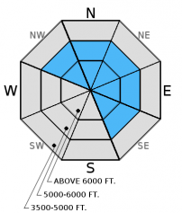
Saturday | Saturday Night | Sunday | |
---|---|---|---|
Cloud Cover: | Cooling today, light snow showers in the afternoon. | Continued snow. | Light/moderate snow continues with lower snow levels. |
Temperatures: | 32-41 deg. F. | 22-29 deg. F. | 26-35 deg. F. |
Wind Direction: | S | S-SW | W-SW |
Wind Speed: | 5-6 gusts 18 | 6-7 gusts 18 | 7-10 gusts 20 |
Snowfall: | 0-1 in. | 2-4 in. | 1-4 in. |
Snow Line: |
Whitefish Range
Swan Range
Flathead Range and Glacier National Park
How to read the forecast
The avalanche danger is CONSIDERABLE above 5000 feet. Strong, gusty winds drifted recent snow and formed fresh windslabs that may extend far below leeward ridglines. The existing snowpack harbors several persistent weak layers that vary in distribution and reactivity that make travel in avalanche terrain tricky. Careful snowpack evaluation, cautious route-finding, and conservative decision making are essential. Below 5000 feet the danger is MODERATE.
![](/sites/all/themes/responsive_sac/img/advisory-mountain.png)
3. Considerable
?
Above 6500 ft.![](/sites/all/themes/responsive_sac/img/dli/3.png)
3. Considerable
?
5000-6500 ft.![](/sites/all/themes/responsive_sac/img/dli/3.png)
2. Moderate
?
3500-5000 ft.![](/sites/all/themes/responsive_sac/img/dli/2.png)
- 1. Low
- 2. Moderate
- 3. Considerable
- 4. High
- 5. Extreme
-
Type ?
-
Aspect/Elevation ?
-
Likelihood ?CertainVery LikelyLikelyPossibleUnlikely
-
Size ?HistoricVery LargeLargeSmall
Moderate to strong southwest winds with gale force gusts overnight continued to load leeward and cross-loaded slopes. Given the recent wind speeds expect to find wind slabs lower on leeward slopes than usual. Also, look for cross-loaded terrain features like rock outcrops, tree islands, and spur ridges at mid elevations (photo). Keep in mind that wind drifted snow adds weight to the snowpack just like new snow, and can stress existing weak layers that may fail deeper and propagate wider. Look for smooth, rounded features on the snow surface or deeper looking pillows. Stick to sheltered terrain today while these new slabs gain strength.
-
Type ?
-
Aspect/Elevation ?
-
Likelihood ?CertainVery LikelyLikelyPossibleUnlikely
-
Size ?HistoricVery LargeLargeSmall
There is a lot of variability across the advisory area with this problem that warrants careful snowpack evaluation and cautious route-finding. Buried surface hoar and weak faceted snow exist in all ranges, but you won't find them on all slopes. These weak layers are now 2.5 to 4.5 feet deep after the recent storm, and are still fracturing and propagating in stability tests (see observations). Given the tricky distribution of these persistent slabs it would be wise to avoid steep, open slopes and convexities. Look for obvious signs of instability like recent avalanche activity, shooting cracks, and whumpfing. The only way to know if these layers are reactive is to dig into the snow and perform stability tests.
Yesterday, BNSF Avalanche Safety reported several natural avalanches in their program area. Visibility was limited, but the avalanches appeared to be loose, wet.
Yesterday we were in the Red Meadow area in the northern Whitefish Range. Warm temperatures at low to mid elevations began to moisten the snow surface early in the day. We noted roller balls, tree bombs, and small, loose, wet avalanches in these elevation bands. Below 6000 feet the warm temperatures formed a more cohesive recent storm layer that slid on the January 17 rain crust along steep gully walls while skiing out (Photo). We found the January 12 and January 17th rain crusts that were buried 1-2 feet deep with weak, faceted snow forming around them.
Two separate skiing parties near Essex in the Flathead Range on Thursday reported reactive layers 2-3 feet from the surface in their stability tests . Their tests showed these layers fracturing and propagating (observations) in Extended Column Tests. In the southern Whitefish Range we noted active wind loading from moderate southerly wind. Skiers on Patrol Ridge in the Flathead Range found instability in recent storm snow as well as buried surface hoar that was reactive in stability testing (observation).
On Hash Mountain in the Lost Johnny drainage in the Swan Range on Wednesday, we were able to easily trigger three wind slabs on northerly aspects from the safety of the ridge above. All slabs were about 12-14 inches deep and propagated wide across each slope (video and observation). In our stability tests, the layer of facets and surface hoar below the 1/12 rain crust fractured and propagated as well (observation). We also observed a small natural avalanche at about 5200 feet that likely occurred within the past 24 hours (photo).
Also on Wednesday, a couple of skiing parties just outside the boundary of Whitefish Mountain Resort reported triggering a wind slab on a north aspect up to 16 inches deep (observation), and no one was caught.
On Tuesday, Mark and Erich observed active wind loading throughout the day onto north and east aspects on Tunnel Ridge in the Flathead Range. On a north aspect They found a new, very thin rain crust that formed on January 17 and, at that time, was buried beneath 6 inches of surface snow. Stability tests resulted in fracture propagation with easy force below this crust and fracture propagation with hard force below the January 12 rain crust (observation, video, photo).
Also on Tuesday, BNSF avalanche safety noted active windloading on east and northeast aspects and windslab conditions on northeast - south aspects. They also observed shooting cracks and were able to intentionally trigger small soft slabs on leeward slopes (observation).
Visit our Observations page and our You Tube channel for more observations from the entire season.
Thanks to everyone for submitting observations. They are extremely useful and could help save lives.
HOW TO SUBMIT OBSERVATIONS:
Email: [email protected]
Call and leave a message: 406.387.3821
You can also submit quick observations via text: 406.241.4571 (FAC mobile)
OR
Submit Snowpack Observations: http://www.flatheadavalanche.org/node/add/snowobs
Submit Avalanche Observations: http://www.flatheadavalanche.org/node/add/avyobs
In the past 24 hours we picked up an additional 1-3 inches of heavy snow (0.2-0.6 inches of snow water equivalent). Temperatures warmed well above freezing yesterday, but cooled late in the day. Gusty winds were out of the west and southwest ranging from 5-15 mph with gusts recorded from 22 mph to 47 mph (Hornet Weather Station). Currently, mountain temperatures range from 23º-29º F and winds are out of the southwest at 5-10 mph with gusts from 8-14 mph. Today the temperatures should inch back toward the freezing mark early but begin cooling in the afternoon as light showers move back into the area. Winds will be out of the south and southwest at 5-10 mph with gusts in the mid-20s.
0600 temperature: | 22-29 deg. F. |
Max. temperature in the last 24 hours: | 30-37 deg. F. |
Average wind direction during the last 24 hours: | West-Southwest |
Average wind speed during the last 24 hours: | 5-15 mph |
Maximum wind gust in the last 24 hours: | 22-47 mph |
New snowfall in the last 24 hours: | 0-3 inches |
Total snow depth: | 57-83 inches |
This advisory applies only to backcountry areas outside established ski area boundaries. This advisory describes general avalanche conditions and local variations always occur. This advisory expires at midnight on the posted day unless otherwise noted. The information in this advisory is provided by the USDA Forest Service who is solely responsible for its content.