| Friday | Friday Night | Saturday | |
|---|---|---|---|
| Cloud Cover: | Light snow flurries ending this morning. | Cloudy and cool. | Cloudy. Transition day before a potential incoming storm. |
| Temperatures: | 28-36 deg. F. | 15-24 deg. F. | 28-35 deg. F. |
| Wind Direction: | West-Southwest | Southwest | Southwest |
| Wind Speed: | 5-10 mph with gusts to 20 mph. | 3-5 mph. | 5-10 mph. |
| Snowfall: | 0-1 in. | 0 in. | 0-1 in. |
| Snow Line: |
Whitefish Range
Swan Range
Flathead Range and Glacier National Park
How to read the forecast
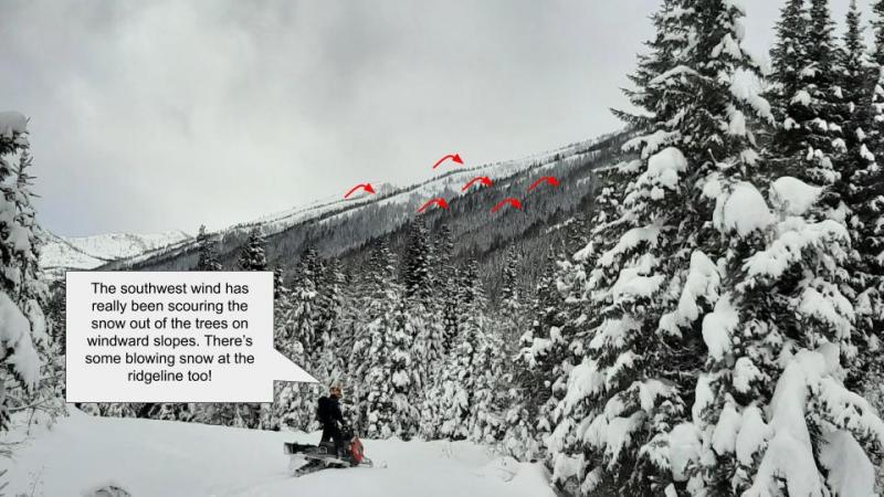
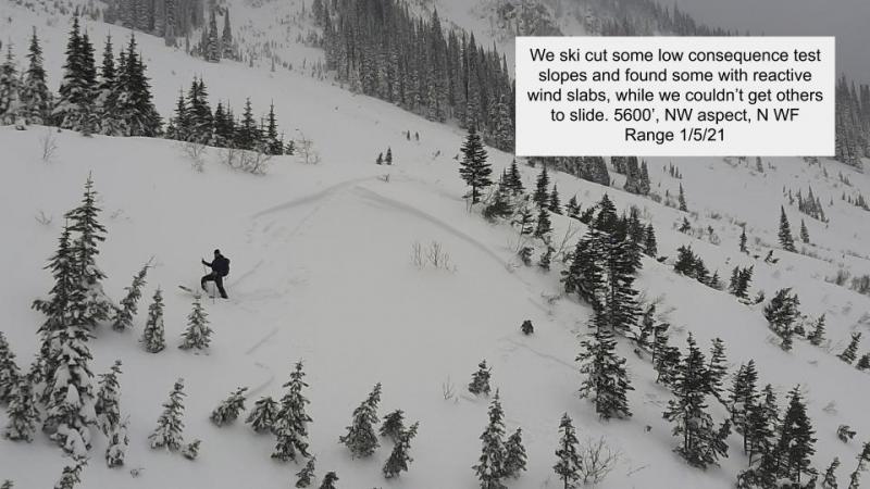
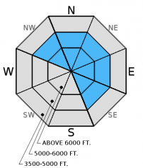
The danger on wind loaded slopes above 6000 feet is CONSIDERABLE, and human triggered avalanches are likely. Careful snowpack evaluation and cautious route-founding are essential. The danger on all other slopes is MODERATE. A bit of new snow on the rain crust and prior strong southwest winds created wind slabs on leeward and cross-loaded slopes and gullies. Most of these slopes are confined to above 6500 feet, but treat all wind loaded slopes as suspect prior to traveling on them.

3. Considerable
?
Above 6500 ft.
2. Moderate
?
5000-6500 ft.
1. Low
?
3500-5000 ft.
- 1. Low
- 2. Moderate
- 3. Considerable
- 4. High
- 5. Extreme
-
Type ?
-
Aspect/Elevation ?
-
Likelihood ?CertainVery LikelyLikelyPossible
 Unlikely
 -
Size ?HistoricVery LargeLargeSmall

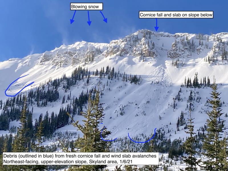
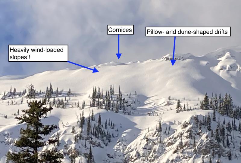
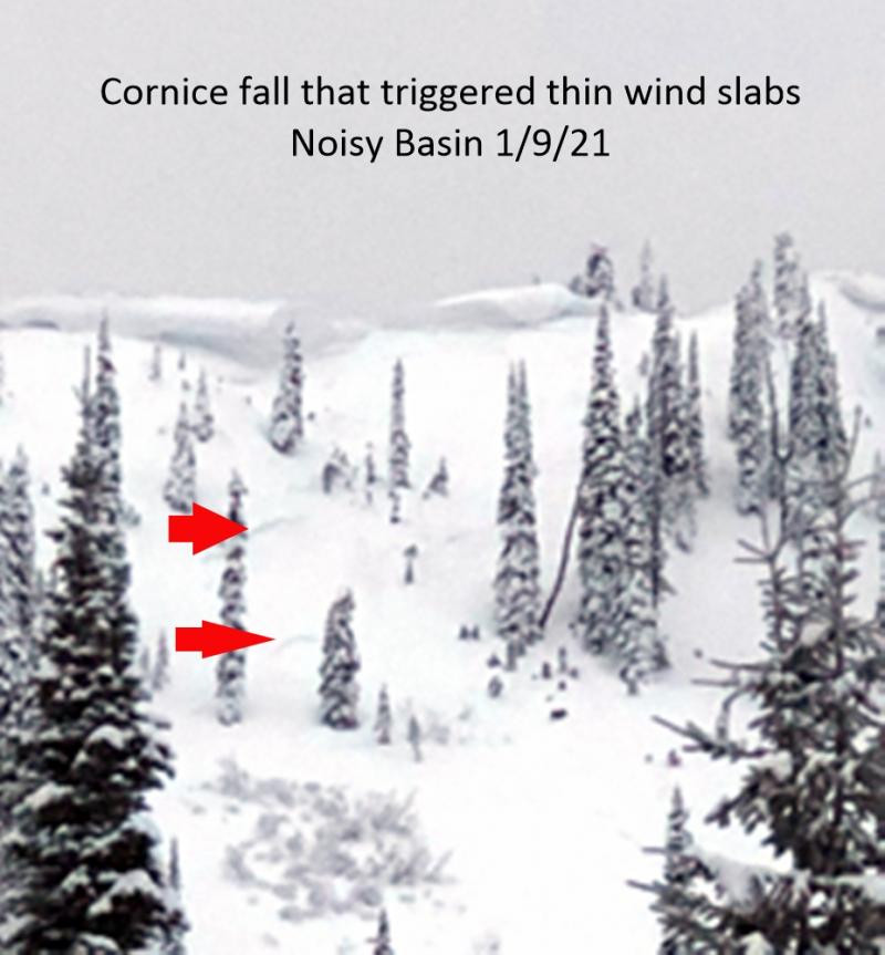
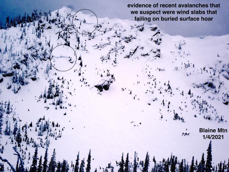
Strong winds from this past week combined with a bit of new snow yesterday created wind slabs at upper elevations. On Wednesday plumes of snow could be seen coming off of the peaks and ridge tops in the Whitefish Range at elevations above the rain level (~7000 feet). At elevations below this the new snow sits atop a slippery rain crust (Dec. 9). In wind loaded areas this crust will provide a superb bed surface for new wind slabs to slide upon. Look for convex pillows of wind drifted snow on the lee sides of ridges and gullies, and avoid wind loaded slopes again today. Expect these wind slabs to be sensitive to human triggering and up to 1 foot deep where there is a rain crust beneath. In areas above the rain level these slabs could be 2-3 feet deep. Look for signs of instability like cracking, collapsing, "whumpfing", and, of course, recent avalanche activity.
-
Type ?
-
Aspect/Elevation ?
-
Likelihood ?CertainVery LikelyLikelyPossible
 Unlikely
 -
Size ?HistoricVery LargeLargeSmall

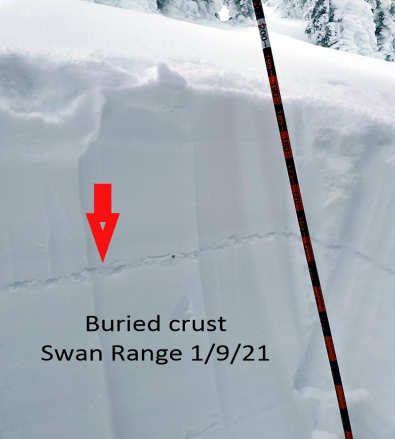
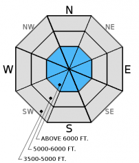
We still don't have detailed information about alpine slopes across the advisory area, so for now I'm including persistent slab as a problem in the alpine rather than just mentioning it as an isolated issue. The most recent storm was a good test for the persistent weak layers including the weak, sugary snow (facets) above the mid-November rain crust or the early December melt-freeze crust on sunny aspects. Though, it would still be wise to treat these deeper crusts (and the weak snow above it) as suspect until you can determine otherwise. Shallow, early season snowpacks have surprised many in the past. Pay attention to obvious signs of instability, like whumpfing and collapsing, and avoid shallow, rocky areas where these layers are more easily triggered. With all of these crusts it appears that we have been involuntarily enrolled in the "Crust of the Month" club, and it may be difficult to unsubscribe.
This new snow sits atop a smooth rain crust where sluffing will occur on steep slopes today. These sluffs shouldn't be large, but could entrain a decent amount of snow on larger slopes. Consider this near terrain traps or high consequence terrain.
The lowest elevation band (3500-5000 feet) has no to very little snow making travel and subsequent access to the upper elevations difficult in certain areas. However, as you approach the upper end of this elevation band and begin to encounter more snow, then treat those slopes as you would terrain in the mid- and upper elevation bands.
We observed widespread natural activity debris on Wednesday at Red Meadow in the northern Whitefish Range before the storm ended. One large avalanche traveled 1600-1800 vertical feet, mowing over brush, and depositing debris into the lake (video and observation).
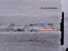
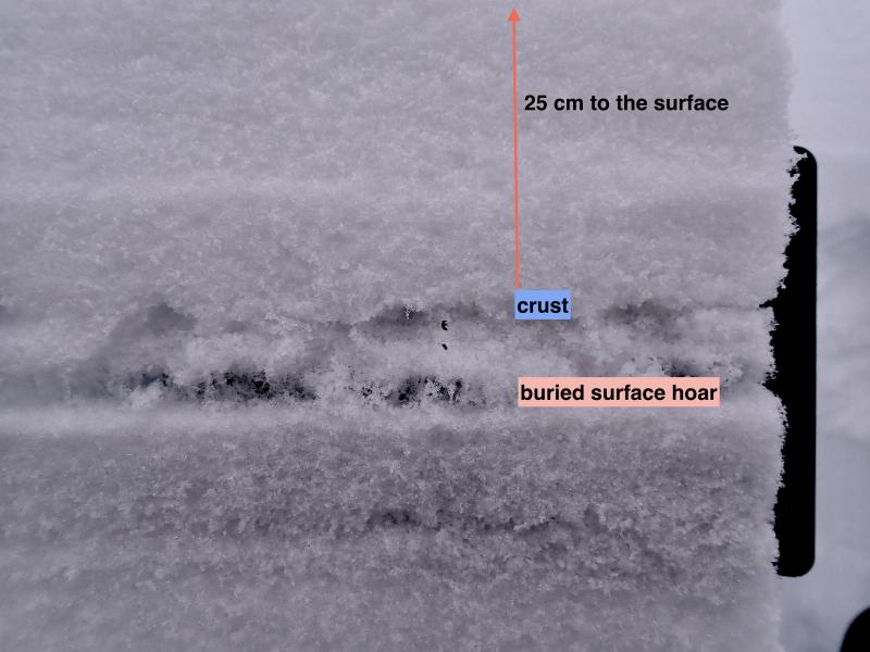
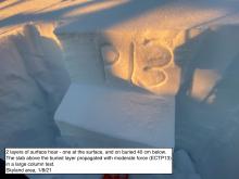
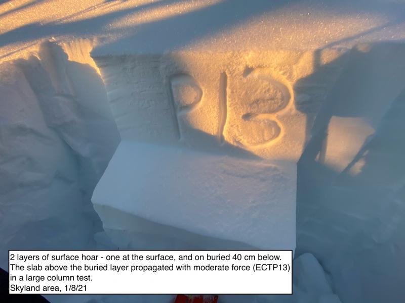
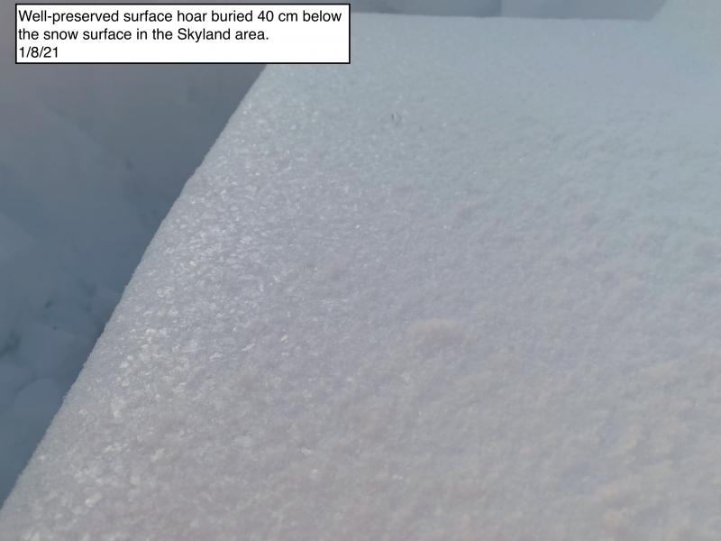
Yesterday, Todd and another separate party were at Ghoulie Point in the southern Whitefish Range (observations). Weak snow has already formed underneath the new rain crust, and I suspect it will begin to form above that crust, too (image). It is also worth mentioning that Todd found decomposing surface hoar about 16 inches below the surface in hit snow pit.
Please let us know what you are seeing out there. Your observations are important and valued.
HOW TO SUBMIT OBSERVATIONS:
Email: [email protected]
Call and leave a message: 406.387.3821
You can also submit quick observations via text: 406.241.4571 (FAC mobile)
OR
Submit Snowpack Observations: http://www.flatheadavalanche.org/node/add/snowobs
Submit Avalanche Observations: http://www.flatheadavalanche.org/node/add/avyobs
It was nice to see some snow yesterday despite it being relatively short-lived. Most of the precipitation ended by dusk depositing 4-7 inches of snow (0.3-0.6 inches of snow water equivalent) at weather stations throughout the advisory area. This obviously translates to more snow in the alpine. Currently, remote weather stations above 6000 feet report temperatures from 21º-28º F with winds out of the southwest at 5-17 mph gusting to 30 mph. Light snowfall will taper this morning with the potential for another inch. Wind speeds should decrease to 5-10 mph out of the southwest.
| 0600 temperature: | 21-28 deg. F. |
| Max. temperature in the last 24 hours: | 23-30 deg. F. |
| Average wind direction during the last 24 hours: | West-Southwest |
| Average wind speed during the last 24 hours: | 8-21 mph |
| Maximum wind gust in the last 24 hours: | 24-38 mph |
| New snowfall in the last 24 hours: | 2-7 inches |
| Total snow depth: | 22-43 inches |
This advisory applies only to backcountry areas outside established ski area boundaries. This advisory describes general avalanche conditions and local variations always occur. This advisory expires at midnight on the posted day unless otherwise noted. The information in this advisory is provided by the USDA Forest Service who is solely responsible for its content.


