| Sunday | Sunday Night | Monday | |
|---|---|---|---|
| Cloud Cover: | Mostly sunny, becoming partly cloudy | Mostly clear | Mostly sunny and warm |
| Temperatures: | 44-55 deg. F. | 33-38 deg. F. | 48-61 deg. F. |
| Wind Direction: | SW | W/SW | SW |
| Wind Speed: | 11-16 gusts 24-31 | 11-15 gusts 28-31 | 8-12 gusts 21-25 |
| Snowfall: | 0 in. | 0 in. | 0 in. |
| Snow Line: |
Flathead Range and Glacier National Park
How to read the forecast
The Hazard is CONSIDERABLE above 6000 feet and MODERATE above 5000 feet. The Flathead Range picked up an inch of water in the past 24 hours. Strong winds with the system created sensitive wind slabs at upper elevations. Warming temperatures and ample sunshine will also increase the wet avalanche hazard as the day progresses. Careful snowpack evaluation and cautious route-finding are essential. See separate advisory for Whitefish and Swan Ranges.

3. Considerable
?
Above 6500 ft.
2. Moderate
?
5000-6500 ft.
1. Low
?
3500-5000 ft.
- 1. Low
- 2. Moderate
- 3. Considerable
- 4. High
- 5. Extreme
-
Type ?
-
Aspect/Elevation ?
-
Likelihood ?CertainVery LikelyLikelyPossible
 Unlikely
 -
Size ?HistoricVery LargeLargeSmall

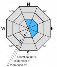
Strong winds over the past 24 hours drifted the new snow at high elevations and formed fresh wind slabs. These slabs will vary in thickness across the advisory area, from 1 foot in the Swan Range to over 2 feet in the Flathead Range. Look for these new slabs in the upper elevations (likely above 6500 feet) on leeward slopes and near cross loaded features like gully walls and outcrops. Give these new slabs time to adjust, and avoid steep wind loaded areas today. Remember that even triggering a small avalanche can be deadly if you are caught in consequential terrain.
-
Type ?
-
Aspect/Elevation ?
-
Likelihood ?CertainVery LikelyLikelyPossible
 Unlikely
 -
Size ?HistoricVery LargeLargeSmall

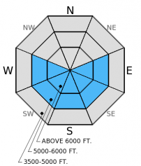
Temperatures have been relatively warm, even at night, the lack of a solid melt-freeze crust to start the day gives the sun a head start in thawing the surface. Most of mid-elevation snow has had time to settle (or melt) and is not as much of a concern, but could still produce a small loose, wet avalanche in steep terrain. Pay close attention to the new snow that has not yet been exposed to the sun and warming. If you start to notice roller balls and pinwheels forming on steep slopes it is time to move to shaded terrain.
-
Type ?
-
Aspect/Elevation ?
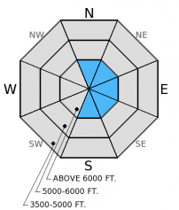
-
Likelihood ?CertainVery LikelyLikelyPossible
 Unlikely
 -
Size ?HistoricVery LargeLargeSmall

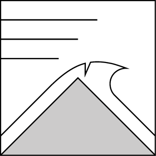
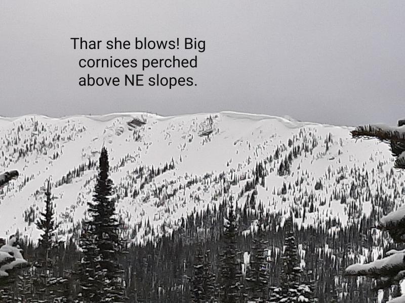
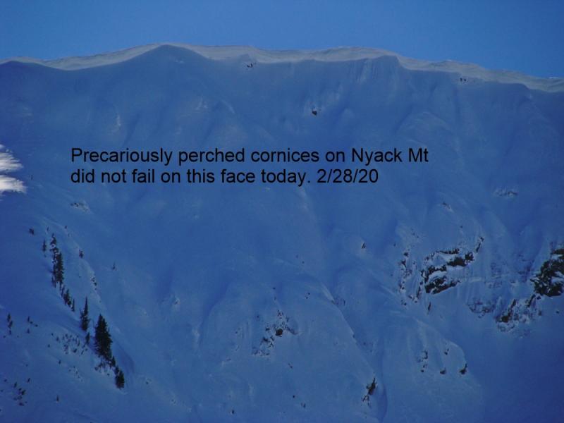
Longer days, higher sun angle, and warmer temperatures may cause large cornices to weaken and fail. Its the time of year to avoid traveling below cornices and stay well behind them while traveling along ridgelines as they can break farther back than expected.
Potential weak layers about a foot from the surface exists on all aspects. On north (shaded) aspects it is a thin layer of small faceted grains above the mid-March rain crust. On sunny aspects it is a layer of very soft and still wet grains. The crust near the surface, however, is likely preventing much impact from reaching that layer, but as the surface crust potentially breaks down with rain, warming, and sunshine then these layers could become reactive. These layers have yet to become a problem, but it is worth checking out before you commit to a slope.
Yesterday we traveled to the northern Whitefish Range in the Red Meadow Lake area. The rain transitioned to snow at about 5000 feet early in the day and the snow level continued to drop to 4500 feet in the afternoon. There was not much for accumulation until about 7000 feet since the snow was falling on the warm, wet surface and melting. Ridge top winds were strong and drifting the new snow (photo). We found nearly a foot of moist snow from the recent storms on top of the mid-March rain crust. We noted recent melt and rain water pooling above this thick crust (photo).
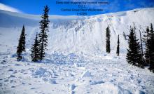
Snowmobile observers Lucas and Guy were in the Lost Johnny/Strawberry Lake areas in the Swan Range on Friday where they saw wind slabs and wet slabs that appeared to have released on Thursday (photo 1, photo 2)
The weather roller coaster continues. Yesterday a cold front moved through the area and brought strong winds and snow to the upper elevations. The Flathead Range picked up the most precipitation, Flattop Mountain and Pike Creek SNOTEL sites both recorded 1.0 inch of water since the storm began. Other stations recorded between 0.3-0.6 inch. Currently, mountain temperatures range from 25º-33º F and wind sensors are down this morning. For today, expect some sunshine early with clouds building later in the day. Temperatures will rise to the mid to upper-40s, and winds will continue out of the west and southwest at 10-20 mph with gusts in the 30s on the high ridges.
| 0600 temperature: | 25-33 deg. F. |
| Max. temperature in the last 24 hours: | 29-41 deg. F. |
| Average wind direction during the last 24 hours: | SW |
| Average wind speed during the last 24 hours: | 15-25 mph |
| Maximum wind gust in the last 24 hours: | 25-35 mph |
| New snowfall in the last 24 hours: | 0-2 inches |
| Total snow depth: | 59-98 inches |
This advisory applies only to backcountry areas outside established ski area boundaries. This advisory describes general avalanche conditions and local variations always occur. This advisory expires at midnight on the posted day unless otherwise noted. The information in this advisory is provided by the USDA Forest Service who is solely responsible for its content.


