| Sunday | Sunday Night | Monday | |
|---|---|---|---|
| Cloud Cover: | Becoming partly/mostly cloudy this afternoon | Mostly cloudy, light snow showers begin late | Cooler, snow showers continue |
| Temperatures: | 43-55 deg. F. | 28-33 deg. F. | 37-48 deg. F. |
| Wind Direction: | SW | SE | S |
| Wind Speed: | 6-10 gusts 24 | 4-5 | 7 gusts 24 |
| Snowfall: | 0 in. | 0 in. | 1-4 in. |
| Snow Line: |
Whitefish Range
Swan Range
Flathead Range and Glacier National Park
How to read the forecast
The snow surface froze last night, but it shouldn't take long for the sun and warm temperatures to thaw the new crust. The hazard above 5000 feet is MODERATE on sunny slopes steeper than 35º and LOW elsewhere. The potential to trigger loose, wet avalanches will rise in mid to upper elevations as the sun breaks down the surface crust. At upper elevations where recent snow remains light enough to drift, assess slopes for recently formed and sensitive wind slabs.

2. Moderate
?
Above 6500 ft.
2. Moderate
?
5000-6500 ft.
1. Low
?
3500-5000 ft.
- 1. Low
- 2. Moderate
- 3. Considerable
- 4. High
- 5. Extreme
-
Type ?
-
Aspect/Elevation ?
-
Likelihood ?CertainVery LikelyLikelyPossible
 Unlikely
 -
Size ?HistoricVery LargeLargeSmall

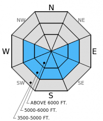
Overnight the moist snow surface re-froze and temporarily decreased the loose, wet hazard. With some sun expected today and above freezing temperatures it wont take long for this new crust to thaw and expose the weak, moist snow below. After a few of these melt-freeze cycles we will start to see some good corn snow. But timing is everything in enjoying spring conditions. Up early and out early. While the crust is supportable and just starts to loosen the conditions can be really good, but once the surface becomes wet and you start sink to your knees when stepping out of skis or machine, its time to move to a more shaded slope. Roller balls and pin wheels are also indicators that the surface has become unstable. With the overall weak, moist structure of the snow pack, it is possible that a small wet avalanche could gouge deep into the snow pack and entrain a substantial amount of snow.
-
Type ?
-
Aspect/Elevation ?
-
Likelihood ?CertainVery LikelyLikelyPossible
 Unlikely
 -
Size ?HistoricVery LargeLargeSmall

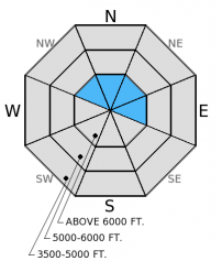
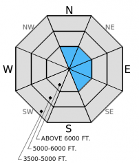
At the upper reaches of elevation where 6-16 inches of recent snow remained light enough for gusty winds to drift it, look for wind slabs that may still be sensitive to human triggers. These slabs should be easy to identify with rounded features that look deeper than sheltered areas. You'll find them along leeward ridgelines and near mid-slope cross-loaded features like rock outcrops and spur ridges. Wind slabs can take up to a week to gain strength, so its best to just avoid these areas for a few days.
-
Type ?
-
Aspect/Elevation ?
-
Likelihood ?CertainVery LikelyLikelyPossible
 Unlikely
 -
Size ?HistoricVery LargeLargeSmall

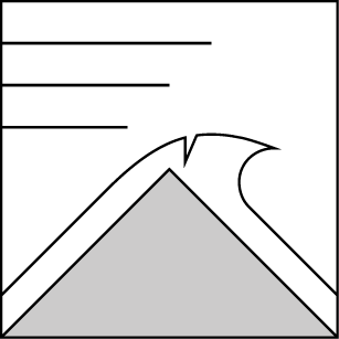
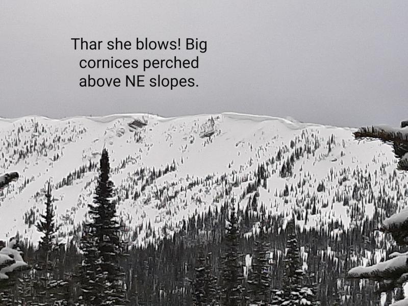
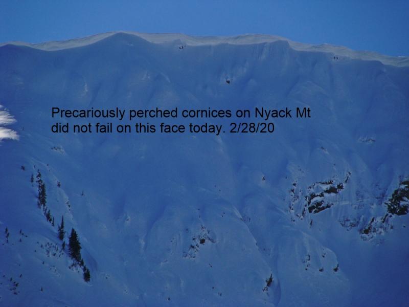
Given the time of year with longer days and warmer temperatures and some sun expected today, large cornices may begin to weaken and fail. Avoid traveling below cornices and stay well behind them while traveling along ridgelines as they can break farther back than expected.
Additional concern: The possibility exists that a wind slab or wet loose avalanche could step down into deeper wet snow layers and fail as a wet slab avalanche. Thus, it is important to assess not only the recent storm snow, but the wet snow beneath.
The next scheduled advisory will be Tuesday, March 24, 2015.
Yesterday we enjoyed spring weather at it's finest with periods of light rain, moderate snow, blowing snow, and blue skies. We were on Patrol Ridge in the Flathead Range. Gusty southwest winds were actively drifting recent snow onto leeward slopes at upper elevations. We found 4-6 inches of recent moist snow a top a melt-freeze crust. In most areas water had penetrated the entire snow pack and left an overall weak and wet structure (photo). On slopes that were fully shaded we found the once robust, late-January crust 1.5-2 feet deep that had recent rain and melt water pooled above it.
Yesterday, above freezing temperatures continued for most of the day, but all mountain stations dropped below freezing late in the afternoon or overnight. Low to mid elevations got a bit of light rain while higher elevations received up to 2 inches of snow. Snow water equivalents ranged from 0.05 inches at Big Mountain Summit to 0.4 inches at Stahl Peak SNOTEL. Currently mountain temperatures range from 27º-31º F and winds are out of the southwest at 5-9 mph with gusts from 14-18 mph. Today, expect mostly sunny skies becoming partly/mostly cloudy this afternoon. Temperatures should rise to the mid 40s, and winds will continue out of the southwest at 5-10 mph with stronger gusts on the ridgetops, particularly near the divide. Another system is expected to move in to the area late tonight/early tomorrow with some additional snow accumulation at lower snow levels.
| 0600 temperature: | 23-31 deg. F. |
| Max. temperature in the last 24 hours: | 35-43 deg. F. |
| Average wind direction during the last 24 hours: | SW |
| Average wind speed during the last 24 hours: | 5-15 mph |
| Maximum wind gust in the last 24 hours: | 28-33 mph |
| New snowfall in the last 24 hours: | 0-2 inches |
| Total snow depth: | 59-95 inches |
This advisory applies only to backcountry areas outside established ski area boundaries. This advisory describes general avalanche conditions and local variations always occur. This advisory expires at midnight on the posted day unless otherwise noted. The information in this advisory is provided by the USDA Forest Service who is solely responsible for its content.


