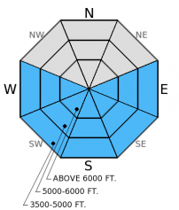
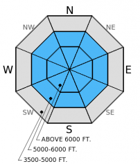
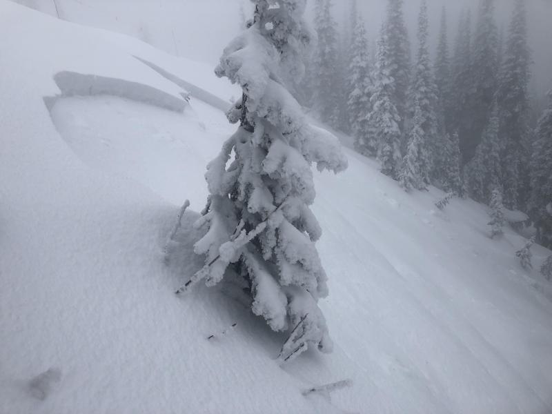
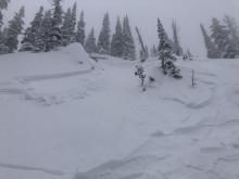
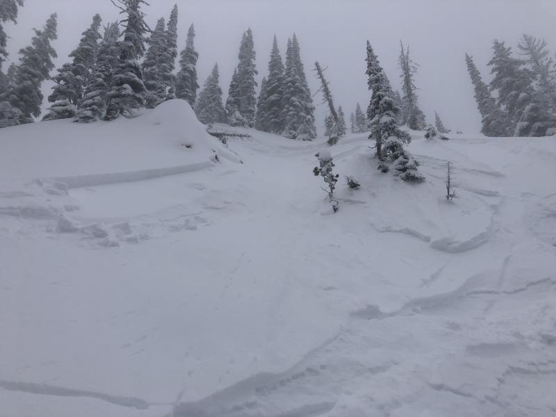
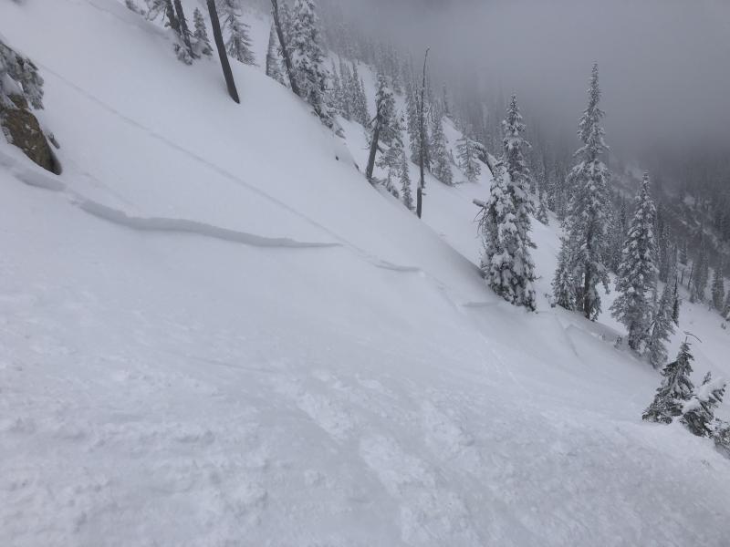
Thursday | Thursday Night | Friday | |
---|---|---|---|
Cloud Cover: | High pressure building over region. Clearing and warming. | High pressure. Temps cool overnight. | Even warmer and clear. |
Temperatures: | 42-53 deg. F. | 31-36 deg. F. | 48-59 deg. F. |
Wind Direction: | Southwest | Southwest | Southwest |
Wind Speed: | 5-10 mph with gusts to 20 mph. | 5-10 mph with gust to 20 mph. | 5-6 mph. |
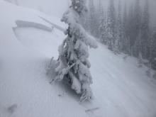
Snowfall: | 0 in. | 0 in. | 0 in. |
Snow Line: |
Whitefish Range
Swan Range
Flathead Range and Glacier National Park
How to read the forecast
The hazard today is CONSIDERABLE above 5000 feet due to expected unseasonably warm temperatures and sunshine combined with new snow from yesterday. Dangerous avalanche conditions will develop as temperatures rise well above freezing and the sun begins to destabilize the new storm snow. Natural and human triggered wet, loose avalanches are likely and storm slab avalanches could become more likely. Avoid being on or under sunny slopes as the day progresses, and carefully evaluate all slopes.
![](/sites/all/themes/responsive_sac/img/advisory-mountain.png)
3. Considerable
?
Above 6500 ft.![](/sites/all/themes/responsive_sac/img/dli/3.png)
3. Considerable
?
5000-6500 ft.![](/sites/all/themes/responsive_sac/img/dli/3.png)
2. Moderate
?
3500-5000 ft.![](/sites/all/themes/responsive_sac/img/dli/2.png)
- 1. Low
- 2. Moderate
- 3. Considerable
- 4. High
- 5. Extreme
-
Type ?
-
Aspect/Elevation ?
-
Likelihood ?CertainVery LikelyLikelyPossibleUnlikely
-
Size ?HistoricVery LargeLargeSmall
With temperatures expected to climb into the mid-40s F today in the mountains and plenty of sunshine, widespread wet, loose avalanches are likely on sunny slopes today. Dangerous conditions will develop as the day progresses. Expect both natural and human triggered wet, loose avalanches today and tomorrow. These wet avalanches could be rather large in the Swan Range (and large enough to bury a person). The new snow sits on a thin crust, but some of these avalanches could gouge below this crust and entrain more wet snow. If you see bulls eye signs of wet snow instability like rollerballs and pinwheels on a slope then you are already too late. Move off of and out from under those slopes as wet snow conditions can change rapidly. Avoid sunny slopes and runout zones as well as the day progresses.
-
Type ?
-
Aspect/Elevation ?
-
Likelihood ?CertainVery LikelyLikelyPossibleUnlikely
-
Size ?HistoricVery LargeLargeSmall
The storm snow seemed to bond fairly well to the old wet snow surface. However, storm slabs are still possible on steep slopes particularly as the day warms. The Swan Range could see storm slabs up to 18 inches thick and more on wind loaded terrain (winds were moderate yesterday, but strong enough to form wind slabs near ridgetops). Combined new snow totals in the Flathead Range would make storm slabs about a foot thick, and about six inches thick in the Whitefish Range. Warming and sunshine over the next two days could easily weaken the bond between the new and old snow and make human triggering more likely. Allow time for this new snow to settle and stick to lower angled slopes (less than 35 degrees). Also, as the days warm pay close attention to how the new snow behaves in response to warm and sunny weather. Evaluate each slope carefully before committing to it.
Additional concern: The possibility exists that a storm slab or wet loose avalanche could step down into deeper wet snow layers and fail as a wet slab avalanche. Thus, it is important to assess not only the new storm snow, but the wet snow beneath.
Then next regularly scheduled advisory will be issued Saturday, March 21, 2015.
Winter came back the past couple of days (at least up high)! I was rather taken aback by the amount of moisture the Swan Range received over the past 48 hours, and the rate at which 16 inches of new snow accumulated. As we rode out of the pouring rain into snow above 5000 feet in Noisy Basin, we expected to find very unstable conditions and even see some natural avalanche activity. Instead we found that the new snow bonded fairly well to the underlying wet snow which was pretty surprising (video). This will change today with warm temps and increasing sunshine as the storm slab destabilizes. We only observed minor cracking on one small, steep test slope. However, we heeded the travel advice of the Considerable danger rating by carefully evaluating the snowpack and using cautious route finding and conservative decision making. We assumed all slopes guilty.
While we found that the new snow in the Swan Range bonded fairly well to the old wet surface, it is important to remember that this is only one observation from one basin. Additionally, while we investigated upper elevations, we did not venture into open, alpine terrain nor could we see this terrain due to poor visibility. The wet snow below the new snow is still wet and very soft making for a wet weak layer (photo).
The snowpack below 5000 feet is meager to non-existent. Access to upper elevations is becoming more difficult as the rain decimated existing snow. Many trails and forest roads have substantial sections of bare ground.
We received no other observations yesterday. In fact, observations have been very limited. I've resorted to messaging folks and badgering them about what they found in the backcountry. Remember, all information is important to us and we greatly appreciate it even if you don't see avalanches. I suspect though that recent less than ideal conditions (rain) have kept many folks out of the backcountry. That is a pretty good reason.
Moist storms rolled through over the past few days. Over the past 48 hours it rained to over 6000 feet in most locations then turned to snow early Wednesday morning. Two day storm total snow amounts vary across the advisory area:
Swan Range = 16 inches (3.8 inches of SWE, this includes rain)
Whitefish Range = 5-7 inches (0.6-0.8 inches of SWE)
Flathead Range and GNP = 5-6 inches (1.0 inch SWE)
Currently, temperatures above 6000 feet range from 22º-33º F with southwest winds moving at 5-6 mph with gusts to 14 mph. Today, spring returns with clearing skies throughout the day, well above normal temperatures reaching into the mid-40s F and winds moving out of the southwest at 5-10 with gust to 30 mph.
0600 temperature: | 22-33 deg. F. |
Max. temperature in the last 24 hours: | 29-35 deg. F. |
Average wind direction during the last 24 hours: | Southwest |
Average wind speed during the last 24 hours: | 7-9 mph |
Maximum wind gust in the last 24 hours: | 16-24 mph |
New snowfall in the last 24 hours: | 5-16 inches |
Total snow depth: | 64-99 inches |
This advisory applies only to backcountry areas outside established ski area boundaries. This advisory describes general avalanche conditions and local variations always occur. This advisory expires at midnight on the posted day unless otherwise noted. The information in this advisory is provided by the USDA Forest Service who is solely responsible for its content.