| Sunday | Sunday Night | Monday | |
|---|---|---|---|
| Cloud Cover: | Warm temperatures and rain continues | Continued rain with lowering snow levels | Cooler, precipitation tapers |
| Temperatures: | 44-54 deg. F. | 24-33 deg. F. | 35-46 deg. F. |
| Wind Direction: | SW | S/N | E/S |
| Wind Speed: | 16-20 gusts 33-37 | 9-10 gusts 25-29 | 11-14 gusts 24 |
| Snowfall: | 0 in. | 2-6 in. | 1-2 in. |
| Snow Line: |
Whitefish Range
Swan Range
How to read the forecast
A warm and wet weather system moved into the region yesterday, rain on snow at high elevations continued overnight and weakened the snow pack. The hazard is CONSIDERABLE above 5000 feet and MODERATE below 5000 feet. We could see natural and human triggered wet avalanches today that manifest as loose, wet and wet slabs. If venturing out in the rain today, choose low angle conservative terrain.

3. Considerable
?
Above 6500 ft.
3. Considerable
?
5000-6500 ft.
2. Moderate
?
3500-5000 ft.
- 1. Low
- 2. Moderate
- 3. Considerable
- 4. High
- 5. Extreme
-
Type ?
-
Aspect/Elevation ?
-
Likelihood ?CertainVery LikelyLikelyPossible
 Unlikely
 -
Size ?HistoricVery LargeLargeSmall

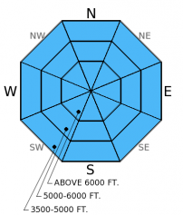
Substantial rain on snow created a wet and unstable snow surface on all aspects and at high elevations across the advisory area. With continued rain today, we could see natural and human triggered loose, wet avalanches that entrain more snow and are much larger than those observed in the warm sunny period last week. Loose, wet avalanches are possible in the upper band of the low elevation range, while rain simply melts what is left of the lower end snow. Stick to low angle terrain and avoid terrain traps like narrow gullies and cliff bands even on small slopes.
-
Type ?
-
Aspect/Elevation ?
-
Likelihood ?CertainVery LikelyLikelyPossible
 Unlikely
 -
Size ?HistoricVery LargeLargeSmall

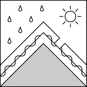
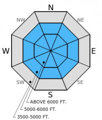
The surface hoar above the late-January crust is likely no longer a concern with the substantial rain over the past 24 hours, now the concern is the underlying crust. As rain penetrates the snow pack and pools on this robust crust, it weakens the bond between slab and crust and may fail as a wet slab. The wet slab problem is more difficult to manage than loose, wet avalanches as it can potentially propagate across the slope and above you. A smaller loose, wet avalanche may stress an underlying slab and trigger a larger, wet slab. If you venture out into the rain today, be aware of the wet slab potential and avoid steep terrain. Identify areas where a deeper crust exists and pools water flowing through the snow pack. Additionally, as water has been moving through the snow for several days, keep recently opened glide cracks in mind. Glide avalanche failure is difficult to predict and can produce destructive avalanches that fail at the ground. Given the uncertainty, avoid slopes where glide cracks are present.
-
Type ?
-
Aspect/Elevation ?
-
Likelihood ?CertainVery LikelyLikelyPossible
 Unlikely
 -
Size ?HistoricVery LargeLargeSmall

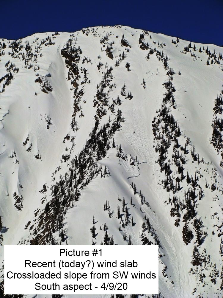
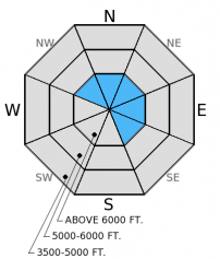
You would have to travel through a lot of rainy vertical feet to find fresh windslabs, however with strong gusty winds and new snow at the upper-most elevations they will exist. Give these slabs time to adjust, and avoid steep, wind loaded terrain today. Visibility will likely be poor in recently wind loaded areas, making these slabs difficult to identify. Carefully assess leeward slopes for sensitive windslabs and be aware of mid-slope cross loaded features like rock outcrops and tree islands.
We are coming out of a period with a generally safe and benign snow pack, and now the overall hazard is elevated. Given the uncertainty in the amount of precipitation we are expecting, timing of falling snow levels, and just how this snow pack will react to such a rapid change it is important to pay attention to these changing conditions and recognize that the hazard may continue to rise.
The next scheduled advisory will be on Tuesday, March 17, 2014.
Yesterday was rainy and windy in the Skyland area in the Flathead Range. With the onset of steady rain, there was a rapid transition to unstable surface snow. We observed roller balls and large pinwheels forming on steep slopes below, and easily triggered loose, wet avalanches while traveling over steep terrain. In our snow pits on aspects that were exposed to a lot of sun in the past few days we found that the crusts in the snow pack had decomposed due to water moving through, but on shadier aspects they were still present and pooled yesterday's rain water (video).
Yesterday, a warm and wet storm system moved into the area and brought substantial rain to the upper elevations. In the past 24 hours weather stations reported between .3 inches to and impressive 2.2 inches of rain at Flattop Mountain SNOTEL. Most of that rain came in the last 15 hours. Currently, mountain temperatures are between 28-40º F and winds are out of the southwest at 7-10 mph with gusts in the 20s. For today expect temperatures to reach the mid to upper 40s and steady rain should continue.
| 0600 temperature: | 28-40 deg. F. |
| Max. temperature in the last 24 hours: | 38-46 deg. F. |
| Average wind direction during the last 24 hours: | SW |
| Average wind speed during the last 24 hours: | 10-15 mph |
| Maximum wind gust in the last 24 hours: | 30-40 mph |
| New snowfall in the last 24 hours: | 0 inches |
| Total snow depth: | 57-85 inches |
This advisory applies only to backcountry areas outside established ski area boundaries. This advisory describes general avalanche conditions and local variations always occur. This advisory expires at midnight on the posted day unless otherwise noted. The information in this advisory is provided by the USDA Forest Service who is solely responsible for its content.


