| Saturday | Saturday Night | Sunday | |
|---|---|---|---|
| Cloud Cover: | Continued warm temps and light rain developing mid-day | Increasing precipitation intensity with high snow levels | Slightly cooler with continued rain/snow showers |
| Temperatures: | 46-57 deg. F. | 35-43 deg. F. | 44-54 deg. F. |
| Wind Direction: | southwest | southwest | southwest |
| Wind Speed: | 15-20 gusts 31-41 | 17-21 gusts 32-39 | 9-12 gusts 20-28 |
| Snowfall: | 0 in. | 0 in. | 0 in. |
| Snow Line: |
Whitefish Range
Swan Range
Flathead Range and Glacier National Park
How to read the forecast
Today the hazard will start out as LOW at all elevations. However, with the onset of predicted rain and upper elevation snow, the hazard will rise to MODERATE due to the increased wet avalanche potential. It will be important to pay close attention to changing conditions over the next couple of days as we move into a period of elevated hazard. The hazard could rise more than expected due to uncertainty with timing of the onset of rain this afternoon.

2. Moderate
?
Above 6500 ft.
2. Moderate
?
5000-6500 ft.
1. Low
?
3500-5000 ft.
- 1. Low
- 2. Moderate
- 3. Considerable
- 4. High
- 5. Extreme
-
Type ?
-
Aspect/Elevation ?

-
Likelihood ?CertainVery LikelyLikelyPossible
 Unlikely
 -
Size ?HistoricVery LargeLargeSmall

The potential for loose, wet avalanches remains with continued above freezing temperatures and the forecast for rain on snow today. Wet, loose avalanches that occurred over the past several days were mainly confined to sunny aspects. Today, if it starts to rain watch for increased activity on all aspects, particularly on more northerly slopes that were less affected/settled by recent warm temperatures. We could see human triggered wet loose avalanches today, particularly on steep slopes. Manage this hazard by moving on to less steep slopes and away from terrain traps when the surface snow becomes wet. Early signs of wet snow instability include roller balls and pin wheels, and rain on snow can cause this instability to change quickly.
-
Type ?
-
Aspect/Elevation ?
-
Likelihood ?CertainVery LikelyLikelyPossible
 Unlikely
 -
Size ?HistoricVery LargeLargeSmall

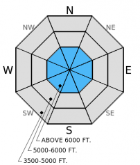
The persistent slab problem is back, but it's isolated. The only place we found the late January crust layer to be recently reactive in stability tests is the southern Whitefish Range. This layer still exists in other ranges throughout the advisory area, but has only fractured and propagated in isolated locations (like Wednesday). We have not observed or received reports of an avalanche on this layer in over a month. Why is it back on the problem list? Our stability test scores show that is again becoming easier for this layer to fracture and propagate across a column with these recent warm, springlike conditions. Triggering an avalanche on this layer is unlikely, but not impossible. It could manifest as a dry or wet slab avalanche. Recent warming and intense sunshine may have reawakened this layer. This makes it important to dig into the snowpack and identify this layer about 1.5-2.5 feet deep and perform a stability test to determine its reactivity. Assess all slopes particularly steep, rocky areas with a shallow snowpack where you are more likely to trigger an avalanche on this layer. Also, evaluate layers closer to the surface like the mid-February crust for any potential instabilities.
-
Type ?
-
Aspect/Elevation ?
-
Likelihood ?CertainVery LikelyLikelyPossible
 Unlikely
 -
Size ?HistoricVery LargeLargeSmall

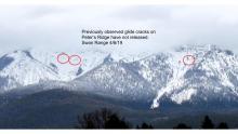
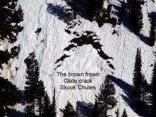
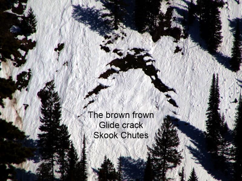
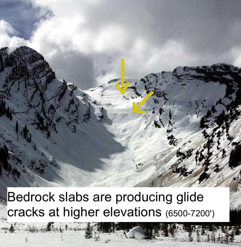
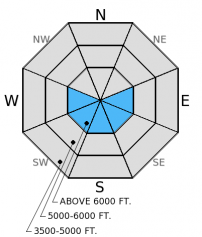
Multiple glide cracks have been observed in the Whitefish and Swan Ranges. With warm temperatures continuing and potential for rain to enhance water flow through the snow pack, these slopes should be avoided due to the unpredictable nature of glide avalanche failure. Also, warm and sunny weather likely weakened large cornices over the past few days. Avoid traveling below cornices and stay well behind the ridgeline when traveling above, as a bit of rain could tip the scale and cause them to break.
With the active weather pattern that is expected over the next couple of days it is important to change our mindset out of the "go anywhere" mentality. The hazard will be elevated over the next few days, so take a step back and carefully evaluate the changing conditions.
UPDATE (3/14/15 2:00 pm): Easily triggered wet, loose avalanches large enough to bury, injure, or kill a person (size D2) observed in the Skyland area (Flathead Range) near Marias Pass due to onset of rain. With more rain over the next 36 hours, expect the avalanche hazard to increase quickly. Human triggered wet loose, wet slab, and glide avalanches will be likely, and natural avalanches possible. Check the advisory tomorrow morning for more details, and pay attention to rapidly changing conditions.
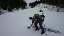
Yesterday we found generally stable conditions in the Blaine Mountain/Jenny Lake area in the Swan Range. Surface snow on sunny aspects became moist early in the day while a firm crust persisted on shadier aspects. We saw a few small, loose, wet avalanches that resulted from the warm temperatures and sunny skies in the previous days (photos). We also noted several glide cracks that had opened (photo).
On Wednesday in southern Whitefish Range we found the late January crust/surface hoar layer on an east facing slope, that fractured and propagated in every test on that slope. We found this layer to propagate with much easier force than just five days earlier in a nearby location. It appears the recent warming and solar input were beginning to affect this lingering weakness (video). On a southerly aspect not too far away, we found a strong and stable snowpack.
Mostly dry, warm, and stable conditions persisted across the area for the past week. Currently, mountain temperatures remain warm and range from 36º-46º F with winds out of the southwest at 9-11 mph gusting to 22 mph. The extended dry spell is expected to come to an end (unfortunately in the wrong form), with the arrival of a wet system late this morning. Today should see mostly cloudy skies with light rain showers beginning mid-day. Temperatures should remain in the upper 40s and snow levels will range from 7000 feet in the north part of the advisory area to 8000 feet farther south. Winds should increase out of the southwest at 15-25 mph with gusts in the 40s on the ridgetops. The precipitation is expected to continue into Monday with potentially lower snow levels late Sunday.
| 0600 temperature: | 36-46 deg. F. |
| Max. temperature in the last 24 hours: | 41-50 deg. F. |
| Average wind direction during the last 24 hours: | SW |
| Average wind speed during the last 24 hours: | 5-10 mph |
| Maximum wind gust in the last 24 hours: | 15-25 mph |
| New snowfall in the last 24 hours: | 0 inches |
| Total snow depth: | 59-88 inches |
This advisory applies only to backcountry areas outside established ski area boundaries. This advisory describes general avalanche conditions and local variations always occur. This advisory expires at midnight on the posted day unless otherwise noted. The information in this advisory is provided by the USDA Forest Service who is solely responsible for its content.


