| Tuesday | Tuesday Night | Wednesday | |
|---|---|---|---|
| Cloud Cover: | Sunny and warm. | Increasing clouds. | Increasing clouds, but still warming. Potential for precipitation in the afternoon/evening. |
| Temperatures: | 48-56 deg. F. | 30-38 deg. F. | 45-56 deg. F. |
| Wind Direction: | Southwest | Southwest | Southwest |
| Wind Speed: | 7-10 mph. | 5-10 mph with gusts to 21 mph. | 8-10 mph with gusts to 20 mph. |
| Snowfall: | 0 in. | 0 in. | 0 in. |
| Snow Line: |
Whitefish Range
Swan Range
Flathead Range and Glacier National Park
How to read the forecast
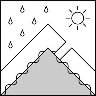
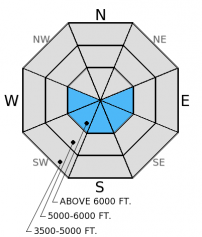
Spring like conditions will bring a few potential wet snow problems today. The hazard will begin LOW and rise to MODERATE as the day progresses. The wet snow hazard will increase as above normal temperatures and abundant sunshine affect sunny aspects. Glide avalanches are also possible in isolated locations. As the snow surface becomes moist throughout the day move to shadier terrain. Also, watch for lingering wind slabs in isolated locations near ridgetops.

2. Moderate
?
Above 6500 ft.
1. Low
?
5000-6500 ft.
1. Low
?
3500-5000 ft.
- 1. Low
- 2. Moderate
- 3. Considerable
- 4. High
- 5. Extreme
-
Type ?
-
Aspect/Elevation ?
-
Likelihood ?CertainVery LikelyLikelyPossible
 Unlikely
 -
Size ?HistoricVery LargeLargeSmall

Above normal temperatures today combined with plenty of sunshine will cause the wet snow hazard to increase as the day progresses. Thus far, reported and observed wet snow avalanche activity has been rather limited, but today should be the warmest day thus far and I expect more activity today. While overnight refreezing certainly helps stabilize the wet snow, we could begin to see human triggered and even natural wet loose activity today, particularly in steep, rocky areas. Manage this hazard by moving into more shaded areas in the afternoon or when the surface snow becomes wet and avoid being on or under sunny slopes. Signs of wet snow instability include roller balls and pin wheels.
Wet slab avalanches are less likely, but cannot be ruled out given the results of our stability tests yesterday. As the day warms and water moves through the snowpack again it will begin to weaken various layers, particularly above the numerous crusts within the top 1-2 feet of the snowpack. Deeper layers could also reawaken with enough water moving through the snowpack. Again, move to shadier terrain as the day heats up and slopes begin to see abundant sunshine.
-
Type ?
-
Aspect/Elevation ?

-
Likelihood ?CertainVery LikelyLikelyPossible
 Unlikely
 -
Size ?HistoricVery LargeLargeSmall

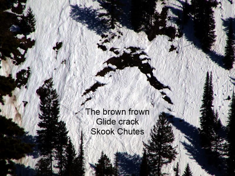
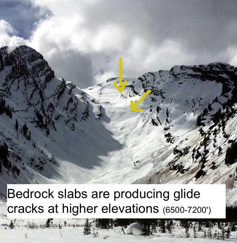
Glide avalanches are difficult to predict. Some glide cracks fail catastropically to the ground while others melt in place. The best way to manage them is to just avoid being on or under slopes with glide cracks. There are plenty of glide cracks out there, particularly in the Swan and Whitefish Ranges. Cornices are also a concern this time of year. The snow pack is generally stable but a cornice fall could still trigger a deeper avalanche in the right place, and cornice fall itself can be dangerous. Avoid traveling below cornices especially in the heat of the day. Also, give them a wide margin while traveling along ridges as they can pull back farther than expected.
The surface hoar/facets above the late January crust (the persistent slab problem) has been taken off of the problem list. We have not observed or received reports of an avalanche on this layer in over a month. This does not mean it is not a concern. Triggering an avalanche on this layer is unlikely, but not impossible. This layer still exists in spotty locations throughout the advisory area, and still fractures and propagates in isolated locations (as recently as 4 days ago in the Southern Whitefish Range). It is still important to dig into the snowpack and identify this layer about 2-2.5 feet deep and perform a stability test like the extended column test to determine its reactivity. Avoid steep, rocky areas with a shallow snowpack where you are more likely to trigger an avalanche on this layer.
Lingering isoalted wind slabs at the upper elevations near ridges still exist. These slabs are small and the recent warm weather should have helped strengthen this instability. Look for wind loaded pockets and asses their stability before committing to the slope.
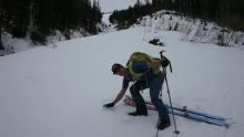
Spring-like conditions continue to dominate over the area. With plenty of sunshine and above freezing temps the snow surface became very wet on sunny aspects yesterday afternoon. We did not observe any natural wet, loose avalanche activity in either the southern Whitefish Range or John F. Stevens Canyon near Marias Pass. However, our stability tests illustrated wet snow instability potential. A layer of wet snow above a crust about a foot from the surface fractured and propagated with moderate force (video). This occurred mid-afternoon on a sunny slope. This shows us that as water moves through the snowpack and pools on various layers like crusts it can weaken neighboring layers above. Skier in the Middle Fork on Saturday observed softening wet snow surface and were able to trigger small wet sluffs (observation).
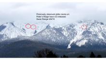
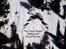
We also observed glide cracks becoming larger in numerous locations throughout the advisory area (photo1, photo2). Some glide cracks already failed earlier this season, but others remain in place.
One more day of spring like conditions before a short lived disturbance moves through region. Yesterday's high temperatures above 6000 feet reached into the mid to upper 40s F at most locations. As of 4:00 a.m. temperatures above 6000 ft. range from 22º-33º F with winds out of the southwest at 8-10 mph with gusts to 18 mph. Today, expect mostly sunny skies with temperatures warming into the upper 40s and low 50s F today. A brief disturbance moves through the region tomorrow afternoon into Thursday bringing a bit of moisture with snow levels around 6000 feet.
| 0600 temperature: | 28-33 deg. F. |
| Max. temperature in the last 24 hours: | 38-47 deg. F. |
| Average wind direction during the last 24 hours: | Southwest |
| Average wind speed during the last 24 hours: | 4-14 mph |
| Maximum wind gust in the last 24 hours: | 13-27 mph |
| New snowfall in the last 24 hours: | 0 inches |
| Total snow depth: | 62-90 inches |
This advisory applies only to backcountry areas outside established ski area boundaries. This advisory describes general avalanche conditions and local variations always occur. This advisory expires at midnight on the posted day unless otherwise noted. The information in this advisory is provided by the USDA Forest Service who is solely responsible for its content.


