| Saturday | Saturday Night | Sunday | |
|---|---|---|---|
| Cloud Cover: | Partly/mostly cloudy | Partly cloudy | Mostly sunny and warmer |
| Temperatures: | 38-48 deg. F. | 23-31 deg. F. | 38-47 deg. F. |
| Wind Direction: | SW | W/SW | SW |
| Wind Speed: | 6-9 gusts 20-24 | 6-7 gusts 16-20 | 7-10 gusts 17-25 |
| Snowfall: | 0 in. | 0 in. | 0 in. |
| Snow Line: |
Whitefish Range
Swan Range
Flathead Range and Glacier National Park
How to read the forecast
The hazard is MODERATE on wind loaded slopes steeper than 35º and could rise on sunny aspects as the day progresses with more sun than anticipated. Other terrain has a LOW hazard. Shifting winds in the past week drifted snow onto multiple aspects. These drifts have been slow to gain strength due to the slick surface and weak snow they were formed on. Continue to evaluate wind loaded terrain carefully and avoid sunny aspects if the snow surface becomes wet.

2. Moderate
?
Above 6500 ft.
1. Low
?
5000-6500 ft.
1. Low
?
3500-5000 ft.
- 1. Low
- 2. Moderate
- 3. Considerable
- 4. High
- 5. Extreme
-
Type ?
-
Aspect/Elevation ?
-
Likelihood ?CertainVery LikelyLikelyPossible
 Unlikely
 -
Size ?HistoricVery LargeLargeSmall

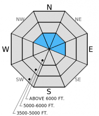
With the lack of recent snow, wind slabs formed over the past week are fairly thin, particularly in the Whitefish Range. These slabs have been observed up to 2 feet thick farther east in the advisory area and have been slow to gain strength due to the slick surface (mid-February crust) and weak snow they were formed on. The wind slab problem is easy to manage as they are small and located near ridgelines, but may also be encountered at mid elevations around crossloaded features like rock outcrops and gullies. Evaluate wind loaded slopes carefully and avoid consequential terrain with wind drifted snow
-
Type ?
-
Aspect/Elevation ?
-
Likelihood ?CertainVery LikelyLikelyPossible
 Unlikely
 -
Size ?HistoricVery LargeLargeSmall

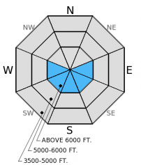
Above freezing temperatures are expected to continue today. If the sun peeks out for extended periods the wet avalanche hazard will increase on sunny aspects. Several locations did not see a re-freeze overnight, so even a small amount of sun could affect those slopes earlier. In some locations a foot or more of snow from the past two weeks sits atop a crust from mid-February. This crust provides a great bed surface for loose snow avalanches. Manage the loose snow avalanche hazard by moving out of avalanche terrain if the surface snow becomes wet. Good indicators that the snow is becoming unstable are roller-balls, pin wheels, and certainly if a light rain sneaks over the Continental Divide.
-
Type ?
-
Aspect/Elevation ?

-
Likelihood ?CertainVery LikelyLikelyPossible
 Unlikely
 -
Size ?HistoricVery LargeLargeSmall

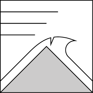
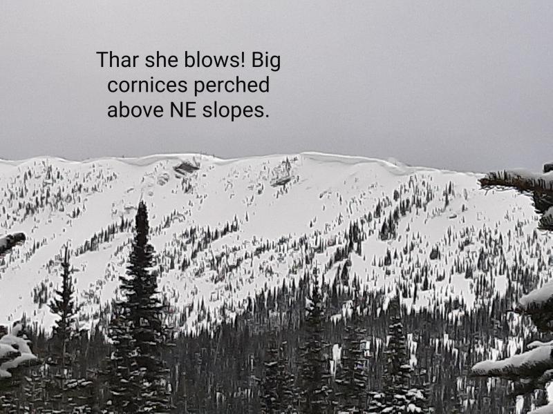
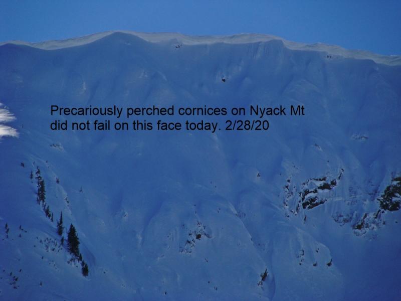
Given the time of year with longer days and recent above freezing temperatures we could see large cornices begin to weaken and fail. Luckily the snow pack is generally strong so a cornice fall is unlikely to trigger a deeper avalanche, but large cornices tumbling down the hill are still dangerous. Avoid traveling below cornices especially in the heat of the day. Also, give them a wide margin while traveling above as they can pull back farther than expected. Several glide cracks have been observed in the Whitefish and Flathead Ranges. With warm temperatures continuing, these slopes should be avoided due to the unpredictable nature of glide avalanche failure.
The surface hoar/facets above the late January crust (the persistent slab problem) has been taken off of the problem list. We have not observed or received reports of an avalanche on this layer in nearly a month. This does not mean it is not a concern. Triggering an avalanche on this layer is unlikely, but not impossible. This layer still exists in spotty locations throughout the advisory area, and still fractures and propagates in isolated locations. It is still important to dig into the snowpack and identify this layer about 2-2.5 feet deep and perform a stability test like the extended column test to determine its reactivity. Avoid steep, rocky areas with a shallow snowpack where you are more likely to trigger an avalanche on this layer.
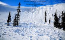
Yesterday in Canyon Creek in the southern Whitefish Range we found thin wind slabs along the ridgelines that were still reactive (video). These slabs were only 6 inches thick in this area but propagated fractures in extended column tests with easy force (photo). Erich was in the Marion Lake area in the Flathead Range on Wednesday and noted sensitive wind slabs that were 6-10 inches thick (photo). Another party of skiers in the Flathead Range observed small wind slabs in the Rescue Creek drainage.
The facets and/or surface hoar above the late January crust continue to show variable results in stability tests and this layer is becoming more isolated in nature. We re-visited a few locations where we previously found this layer to be reactive. Though some rounding and strengthening was observed since we were there almost a month ago, this layer continues to propagate a fracture with hard force in extended column tests (photo).
The unseasonably warm temperatures we saw yesterday will continue today. A few of the SNOTEL sites and remote weather stations reported highs in the low 40s. Currently, mountain temperatures range from 29º-34º F with winds out of the southwest 6-9 mph gusting to 15 mph. A weak disturbance passes through the area today bringing partly to mostly cloudy skies. No precipitation is expected except the slight chance of a light shower along the Continental Divide in the afternoon. Temperatures will be in the low to mid 40s and southwest winds will blow at 5-10 mph with gusts to the mid-20s on the ridges.
| 0600 temperature: | 29-34 deg. F. |
| Max. temperature in the last 24 hours: | 36-43 deg. F. |
| Average wind direction during the last 24 hours: | SW |
| Average wind speed during the last 24 hours: | 5-10 mph |
| Maximum wind gust in the last 24 hours: | 15-25 mph |
| New snowfall in the last 24 hours: | 0 inches |
| Total snow depth: | 64-90 inches |
This advisory applies only to backcountry areas outside established ski area boundaries. This advisory describes general avalanche conditions and local variations always occur. This advisory expires at midnight on the posted day unless otherwise noted. The information in this advisory is provided by the USDA Forest Service who is solely responsible for its content.


