| Tuesday | Tuesday Night | Wednesday | |
|---|---|---|---|
| Cloud Cover: | Sunny and cold. | Clear and cold. | Warming and sunny. Winds shifting to southwest. |
| Temperatures: | 10-21 deg. F. | -8 to 5 deg. F. | 23-34 deg. F. |
| Wind Direction: | North | North | Southwest |
| Wind Speed: | 5-10 mph. | 1-5 mph. | 5-6 mph. |
| Snowfall: | 0 in. | 0 in. | 0 in. |
| Snow Line: |
Whitefish Range
Swan Range
Flathead Range and Glacier National Park
How to read the forecast
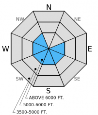
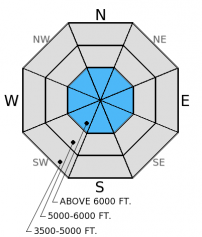
The avalanche hazard above 5000 feet is MODERATE due to strong winds and a bit of new snow over the past 24 hours and LOW below 5000 feet. Human triggered avalanches are possible particularly on wind loaded slopes today. In some areas a weak layer over the late January crust remains reactive in stability tests. It is unlikely to trigger this persistent slab, but not impossible. Evaluate snow and terrain carefully and identify features of concern like wind loaded slopes.

2. Moderate
?
Above 6500 ft.
2. Moderate
?
5000-6500 ft.
1. Low
?
3500-5000 ft.
- 1. Low
- 2. Moderate
- 3. Considerable
- 4. High
- 5. Extreme
-
Type ?
-
Aspect/Elevation ?

-
Likelihood ?CertainVery LikelyLikelyPossible
 Unlikely
 -
Size ?HistoricVery LargeLargeSmall

Moderate to strong north-northeast winds throughout the advisory area created sensitive fresh wind slabs. Even though total snow amounts aren't that impressive the wind slab problem is likely to be more widespread than recent days. Once again, the most snow fell near the Continental Divide. These new wind slabs formed over lingering slabs from late last week (video) and could be quite sensitive. In some locations (like closer to the Continental Divide) these wind slabs could be up to 2.5 feet thick and sit atop the mid-February crust which provides a great bed surface. Keep in mind that with strong winds these slabs may exist mid-slope or in cross-loaded gullies rather than just being isolated to near ridge tops, and could exist on most aspects. Shooting cracks and collapsing are obvious signs of instability. Avoid convex rollovers of wind drifted snow.
-
Type ?
-
Aspect/Elevation ?

-
Likelihood ?CertainVery LikelyLikelyPossible
 Unlikely
 -
Size ?HistoricVery LargeLargeSmall

The late January surface hoar (or facet) and crust layer 1.5-2.5 feet from the surface still exists in our advisory area. In some locations it fractures across the entire column and others it does not even break, and the distibution is spotty. We haven't observed or received reports of avalanche activity involving this layer in 3 weeks, but it is reactive enough in stability test to keep it as a problem. This makes it unlikely, but not impossible, to trigger a persistent slab avalanche. It's still important to dig into the snowpack and identify if the layer is present or not by performing a stability test like the extended column test. Also, please let us know what you find out there. We would love to know where you find this surface hoar and if it is reactive.
In many places the new snow fell on a crust from mid-February. Loose snow sluffs are possible on slopes greater than 35 degrees, but should not be very large. However, in high consequence terrain these sluffs can be dangerous.
The next regularly scheduled advisory will be issued Thursday, March 5, 2015.
There are a few spots left in the Avalanche Skills Course: Choosing Terrain this Saturday. Check here for details and to register. The class is free.
Winds were cranking yesterday. We observed active wind loading in the Six Mile Peak area of the Swan Range (photo, video). Wind slabs were beginning to form by early afternoon, and were then about 4-6 inches thick. Skiers in the Crown Bowl area of Noisy Basin in the Swan Range observed wind loading on west aspects as well and weak snow (facets) above and below the mid-February crust that did not propagate in stability tests.
We also found surface hoar above the late January crust on shaded north and east aspects. It did not propagate across the entire column in any of our stability tests. Skiers in the Middle Fork on Sunday reported a layer about 2 feet from the surface (likely the late Jan. crust) on east and south aspects to propagate in their extended column tests (observation).
A number of crusts surrounded by facets exist within the top foot of the snowpack now. Recent cold temps helped develop these layers of weak snow. It's important to dig into the snowpack and perform a stability test to see if any of these layers are reactive.
An arctic air mass infiltrated the area yesterday bringing moderate to strong winds and a bit of new snow. Pike Creek SNOTEL near Marias Pass shows the most accumulation with 4 inches of new snow while most other stations received 2 inches. North-northeast winds averaged 14-16 mph with gusts to 33 mph. As of 4:00 am temperatures above 6000 feet range from -13º to 4º F with winds moving out of the north-northeast at 11 mph gusting to 16 mph. Today, expect mostly sunny skies with cold temps to start but gradually rising throughout the day as the arctic air mass moves out of the region.
| 0600 temperature: | -13 to 4 deg. F. |
| Max. temperature in the last 24 hours: | 16-27 deg. F. |
| Average wind direction during the last 24 hours: | North-Northeast |
| Average wind speed during the last 24 hours: | 14-16 mph |
| Maximum wind gust in the last 24 hours: | 28-33 mph |
| New snowfall in the last 24 hours: | 2-4 inches |
| Total snow depth: | 65-92 inches |
This advisory applies only to backcountry areas outside established ski area boundaries. This advisory describes general avalanche conditions and local variations always occur. This advisory expires at midnight on the posted day unless otherwise noted. The information in this advisory is provided by the USDA Forest Service who is solely responsible for its content.


