| Friday | Friday Night | Saturday | |
|---|---|---|---|
| Cloud Cover: | Sunshine and above normal temps. | Increasing cloudiness. Cooling. | Mostly cloudy. Light rain and snow possible. |
| Temperatures: | 42-49 deg. F. | 30-35 deg. F. | 37-46 deg. F. |
| Wind Direction: | Southwest | Southwest | Southwest |
| Wind Speed: | 4-5 mph with gusts to 16 mph. | 4-5 mph. | 5-10 mph with gusts to 25 mph. |
| Snowfall: | 0 in. | 0 in. | 0-3 in. |
| Snow Line: |
Whitefish Range
Swan Range
Flathead Range and Glacier National Park
How to read the forecast
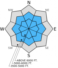
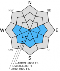
Unscheduled advisory update: The hazard is MODERATE above 5500 feet due to lingering storm and persistent slabs but will rise to CONSIDERABLE on sunny aspects today as skies clear. Both natural and human triggered wet, loose avalanches are likely today. Below 5500 feet the hazard is LOW. Ample sunshine, 1-2 feet of wet, heavy snow from 3-5 days ago, and well above freezing temperatures will cause a wet snow hazard today.

3. Considerable
?
Above 6500 ft.
2. Moderate
?
5000-6500 ft.
1. Low
?
3500-5000 ft.
- 1. Low
- 2. Moderate
- 3. Considerable
- 4. High
- 5. Extreme
-
Type ?
-
Aspect/Elevation ?
-
Likelihood ?CertainVery LikelyLikelyPossible
 Unlikely
 -
Size ?HistoricVery LargeLargeSmall

Natural wet, loose avalanches occured during this series of storms up to size D2 (large enough to bury, injure, or kill a person). Today, these avalanches are likely due to well above freezing temps and clearing skies. natural wet, loose activity could be fairly widespread today. We have already wet, new snow from last weekend and earlier in the week above 5500 feet and some stations at 6000 feet have not seen a refreeze since 8 days ago. Only the upper most elevations saw refreezing temps. Today will be the first full day of sunshine since those storms. Pay attention to changing conditions and adapt your plan accordingly. Rollerballs and pinwheels are bull-eye signs that the wet snow hazard is increasing so moving to shadier slopes and avoiding sunny aspects is a good way to manage this problem.
-
Type ?
-
Aspect/Elevation ?
-
Likelihood ?CertainVery LikelyLikelyPossible
 Unlikely
 -
Size ?HistoricVery LargeLargeSmall

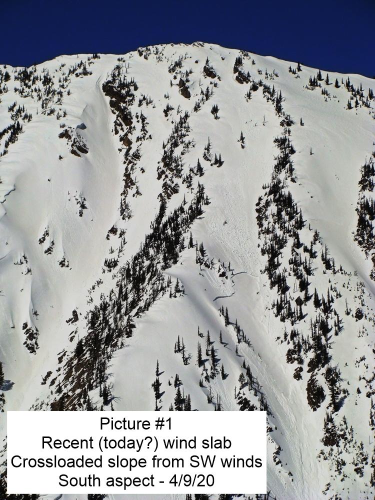
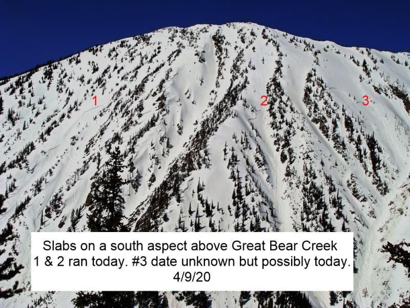
Both lingering storm and wind slabs of wet, heavy snow are still a concern, but with the above normal temps and sunshine these slabs are likely to be wet slabs today. Slabs from the storm can be up to 2.5 feet thick, and are more easily triggered at upper elevations. Avoid sunny aspects as the day progresses and move out from under slopes when the sun begins to hit them today.
-
Type ?
-
Aspect/Elevation ?
-
Likelihood ?CertainVery LikelyLikelyPossible
 Unlikely
 -
Size ?HistoricVery LargeLargeSmall

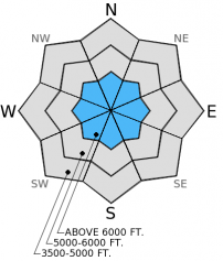
Because observations are limited we can't quite take the persistent slab problem off the list. The surface hoar/crust from late January was the failure layer for many of the storm slabs this past weekend, and it is still possible to trigger a slab involving this layer or the mid-January crust. Deeper weak layers are largely unreactive at this point. Locations where it may be easier to trigger deeper persistent slabs include steep, rocky slopes with a shallow snowpack. Dig down into the snowpack to assess these deeper insabilities and avoid slopes where they are reactive in stability tests.
The next regularly scheduled advisory will be issued Saturday, February 14, 2015.
Currently, it's a tale of two worlds. Below about 5500 feet, the snowpack is more spring like and disappering at the lowest elevations . At the upper elevations it is still mostly winter with rain mixed in from the series of warm, wet storms. It wasn't all rain at those elevations, though. In the Swan Range Wednesday we found about 2 feet of heavy, moist snow with a couple of rain crusts mixed in on a wind loaded slope around 7000 feet. On non-wind loaded slopes there was about a foot with those same rain crusts (photo). Visibility was limited but we observed some natural avalanche activity from the past few days in the form of both dry and wet, loose avalanches and small storm slabs (photo1, photo2). Similar conditions existed in the Flathead Range earlier in the week (video).
Stability tests results showed partial propagation within the storm snow and around the new rain crusts, and the late January crust showed no reactivity. The surface hoar above this crust appears to be mostly decomposing and moist. However, many avalanches during the storm over the weekend failed on this layer (photo), and could still be present in some locations.
Skiers on Elk Mountain in Glacier Park yesterday noted very warm temps and rollerball activity on sunny aspeccts during the brief break in cloudiness.
High pressure continues today over the region with mostly dry conditions through early Saturday. As of 4:00 am mountain temperatures range from 27º-36º F with winds moving out of the southwest at 4-8 mph gusting to 13 mph. Today, partly cloudy to mostly clear skies will prevail. Temperatures will rise to the mid 40s F with winds out of the southwest at 5-10 mph gusting to 15 mph.
| 0600 temperature: | 27-36 deg. F. |
| Max. temperature in the last 24 hours: | 33-40 deg. F. |
| Average wind direction during the last 24 hours: | Southwest |
| Average wind speed during the last 24 hours: | 5-15 mph |
| Maximum wind gust in the last 24 hours: | 10-20 mph |
| New snowfall in the last 24 hours: | 0 inches |
| Total snow depth: | 61-91 inches |
This advisory applies only to backcountry areas outside established ski area boundaries. This advisory describes general avalanche conditions and local variations always occur. This advisory expires at midnight on the posted day unless otherwise noted. The information in this advisory is provided by the USDA Forest Service who is solely responsible for its content.


