| Saturday | Saturday Night | Sunday | |
|---|---|---|---|
| Cloud Cover: | Continued rain/snow with high snow levels. | Light rain/snow continues. | Showers tapering, mostly cloudy |
| Temperatures: | 35-46 deg. F. | 30-37 deg. F. | 37-47 deg. F. |
| Wind Direction: | SW | SW | SW |
| Wind Speed: | 16-19 gusts 30-35 | 13-17 gusts 29-39 | 10-15 |
| Snowfall: | 0-4 in. | 0-4 in. | 0-2 in. |
| Snow Line: |
Whitefish Range
Flathead Range and Glacier National Park
How to read the forecast
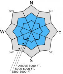
In many locations across the advisory area temperatures failed to drop below freezing in the past 24 hours. Warm temperatures combined with moderate to strong wind and rain on a previously weak snow structure created dangerous avalanche conditions. The hazard is HIGH on wind loaded slopes above 6000 feet and travel in this terrain and avalanche run-out zones is not recommended. Other terrain above 5000 feet is rated CONSIDERABLE and human triggered loose, wet and storm slab avalanches are likely.

4. High
?
Above 6500 ft.
3. Considerable
?
5000-6500 ft.
2. Moderate
?
3500-5000 ft.
- 1. Low
- 2. Moderate
- 3. Considerable
- 4. High
- 5. Extreme
-
Type ?
-
Aspect/Elevation ?
-
Likelihood ?CertainVery LikelyLikelyPossible
 Unlikely
 -
Size ?HistoricVery LargeLargeSmall

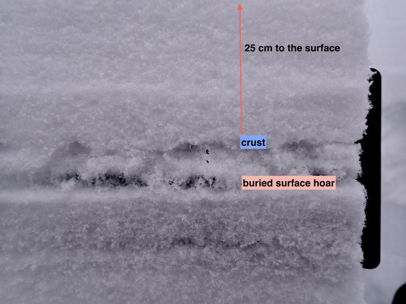
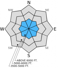
Storm slabs will be thicker the farther north you travel in the advisory area. Slabs that range from 10-24 inches sit atop the late January surface hoar/crust combination. Moderate to strong winds added depth to storm slabs found on leeward slopes. Pay attention to changing conditions in the backcountry today, particularly in areas where it begins to rain on the snow. Avoid wind loaded areas today and avalanche run-out zones.
-
Type ?
-
Aspect/Elevation ?
-
Likelihood ?CertainVery LikelyLikelyPossible
 Unlikely
 -
Size ?HistoricVery LargeLargeSmall

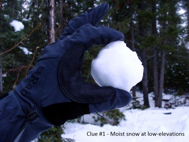
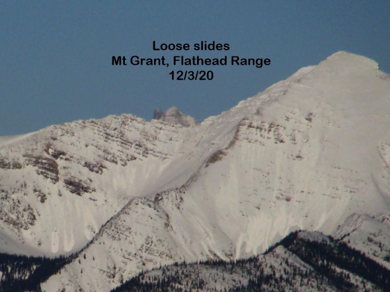
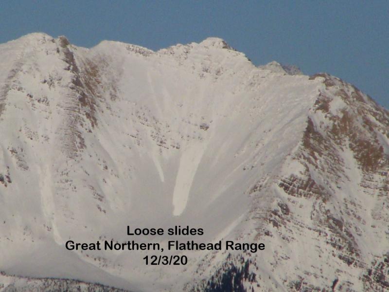
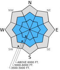
Until we get a substantial re-freeze, wet, heavy snow that fell over the past few days and continued rain on snow will increase the likelihood of natural and human triggered loose, wet avalanches. In steep terrain these avalaches can entrain a substantial amount of snow and pick up a good head of steam on top of the smooth melt-freeze crust. Roller balls or rain-on-snow are indicators that it is time to move out of avalanche terrain. Remember that even at lower elevations where loose, wet avalanches are likely to be small, they can have big consequences in terrain traps like cliff areas and gullies.
-
Type ?
-
Aspect/Elevation ?
-
Likelihood ?CertainVery LikelyLikelyPossible
 Unlikely
 -
Size ?HistoricVery LargeLargeSmall

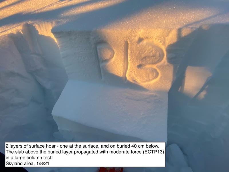
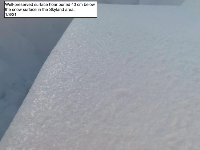
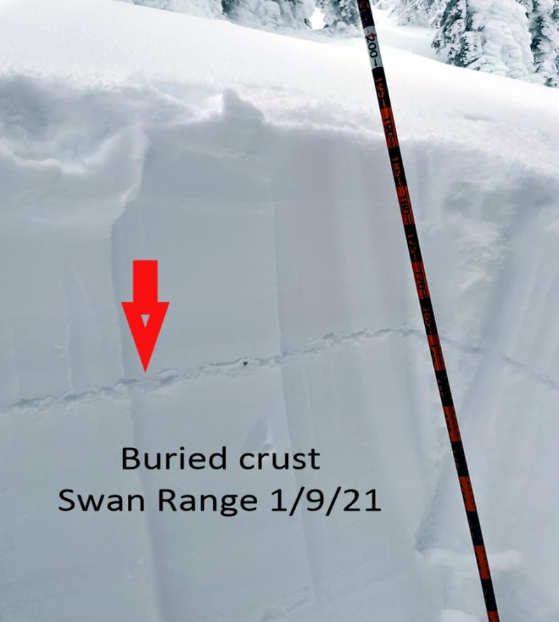
Still lingering concern with variable stability test results in the mid-January buried surface hoar layer. This layer has not given us any widespread issues to date, but with the added stress of the additional water weight it should not be written off. Continue to search for this layer, and where present and reactive, choose low angle terrain and avoid steep, rocky areas and convex roll-overs where you are most likely to trigger it.
Natural avalanche activity was observed yesterday in John F Stevens Canyon, Glacier National Park, and a size D3 on Nyack Mountain in the Flathead Range. Skiers in Canyon Creek in the southern Whitefish Range reported triggering a small storm slab and also noted multiple piles of avalanche debris in the canyon.
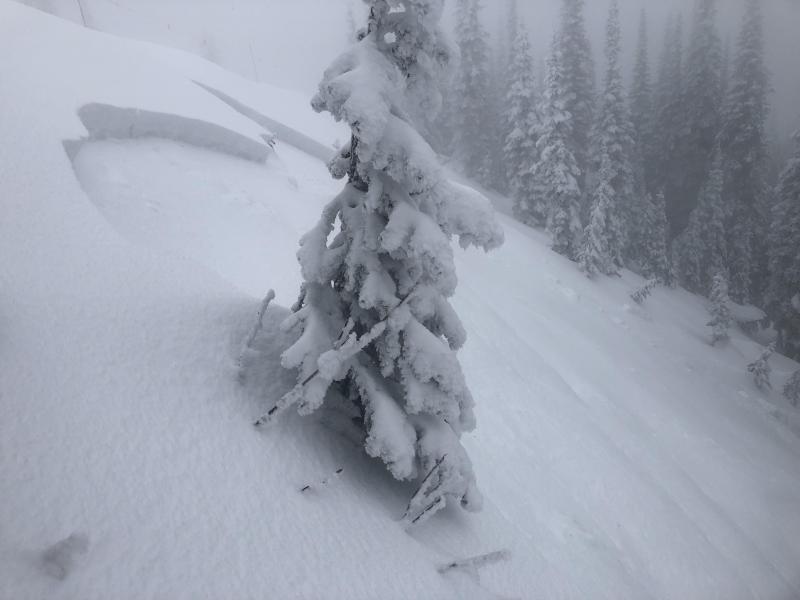
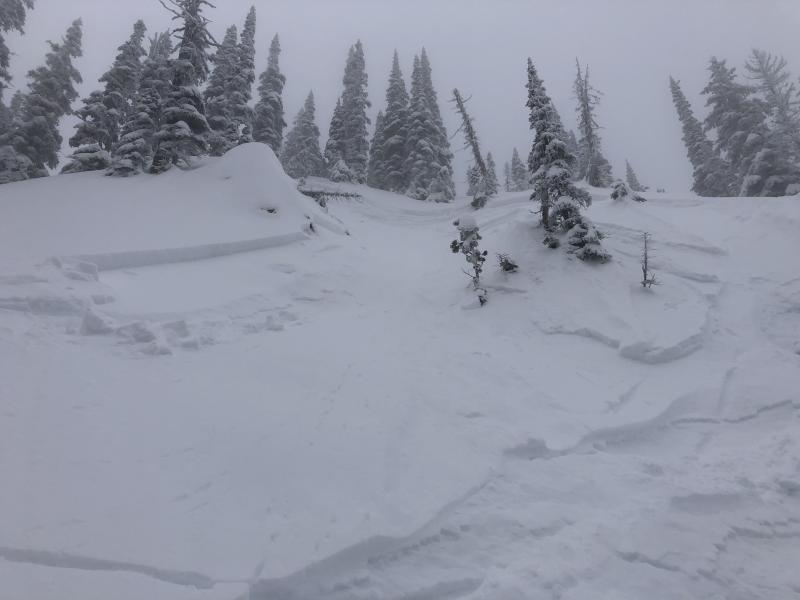
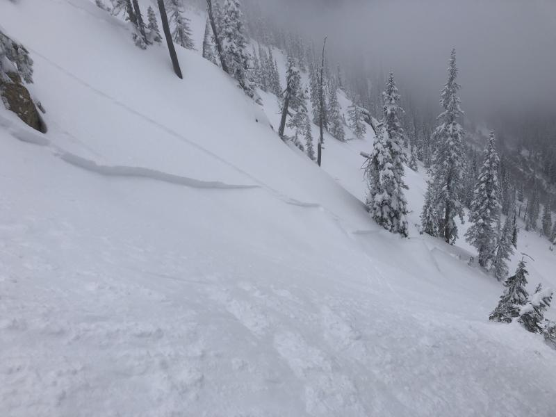
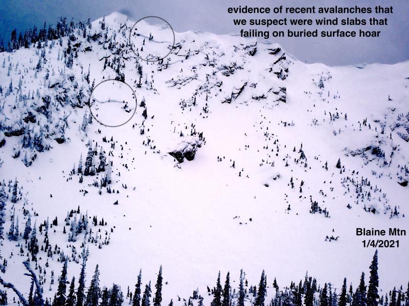
The weak upper snow pack structure seems fairly uniform across the area. Surface hoar preserved on top of a firm melt-freeze crust and weak (faceted) snow below. The variability in different areas is the depth and cohesion of the overlying snow from the past few days. The series of storms that moved through the area starting on Wednesday night favored the northern part of the advisory area. In places where this recent snow has formed a slab it has proven to be quite reactive, in other areas where less snow fell or storm snow has less cohesion it is less reactive. Yesterday, we were on Paola Ridge in the Flathead Range and found an upside down storm snow layer. At mid-elevations this heavy, wet snow on the surface created a slab that was able to propagate a fracture within the recent snow, we triggered several storm slab avalanches up to 1 foot thick while skiing down the ridge (photo). Above about 6500 feet, it took the help of the wind to create a slab. Profiles in wind loaded terrain revealed recently formed wind slabs 1.5-2 feet thick that formed on the crust/buried surface hoar and propagated fractures with moderate force in extended column tests (ECTP 10-11) (photo).
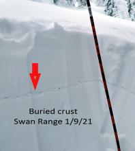
It was a different story in the Swan Range yesterday. Seth and Lucas were in Spider Bowl and noted the same crust and surface hoar combination, but with much less recent snow on top.
A series of warm storms continue to move through the area that heavily favored the northern end of the advisory area. Since the onset of the first precipitation Stahl Peak and Flattop Mountain SNOTEL sites recorded 1.00-2.9 inches of snow water equivalent compared to 0.3inches in the same period at Noisy Basin SNOTEL in the Swan Range. Yesterday, Flattop Mountain came out on top again with 0.7 inches of snow water equivalent while other stations only report 0-0.1 inch. Temperatures over the past 24 hours remained warm, only Big Mountain and Flattop Mountain stayed below freezing. Currently, mountain temperatures range from 30º-37º F and winds are out of the west and southwest 5-15 mph with gusts in the 20s. Today, expect another shot of substantial precipitation (in excess of 1.00 inch) falling as mostly rain below 6500 feet. Winds will continue out of the southwest at 15-25mph with stronger gusts on the ridgelines.
| 0600 temperature: | 30-37 deg. F. |
| Max. temperature in the last 24 hours: | 31-41 deg. F. |
| Average wind direction during the last 24 hours: | SW |
| Average wind speed during the last 24 hours: | 5-15 mph |
| Maximum wind gust in the last 24 hours: | 20-40 mph |
| New snowfall in the last 24 hours: | 0-1 inches |
| Total snow depth: | 60-90 inches |
This advisory applies only to backcountry areas outside established ski area boundaries. This advisory describes general avalanche conditions and local variations always occur. This advisory expires at midnight on the posted day unless otherwise noted. The information in this advisory is provided by the USDA Forest Service who is solely responsible for its content.


