| Friday | Friday Night | Saturday | |
|---|---|---|---|
| Cloud Cover: | Continued precipitation, moderate to strong winds, and rising temperatures/snow levels. | Continued precipitation and strong winds. | High snow levels and continued precipitation. |
| Temperatures: | 41-49 deg. F. | 33-37 deg. F. | 39-47 deg. F. |
| Wind Direction: | Southwest | Southwest | Southwest |
| Wind Speed: | 15-20 mph with gusts to 43 mph. | 15-25 mph with gusts to 55 mph. | 15-20 mph with gusts to 47 mph. |
| Snowfall: | 0-4 in. | 0-2 in. | 0-4 in. |
| Snow Line: |
Swan Range
How to read the forecast
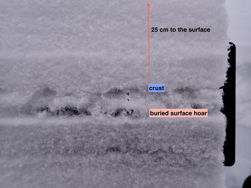
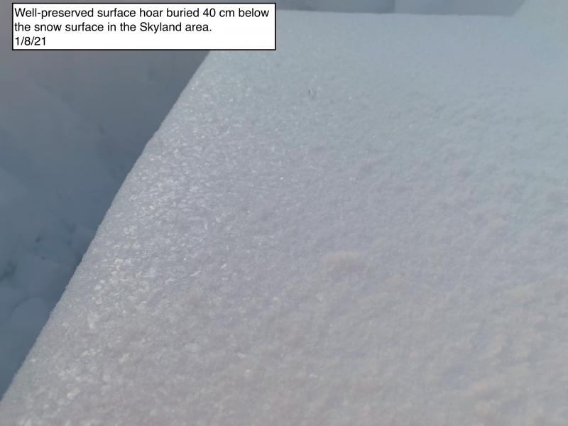
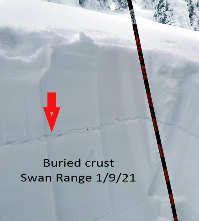
Due to new snow, rain, and moderate to strong winds the hazard is CONSIDERABLE above 5000 feet. Heavy, wet snow and rain on new snow continues to accumulate over a weak layer of buried surface hoar that sits on a crust throughout most of the advisory area. Dangerous avalanche conditions exist and both human triggered and natural avalanches will become more likely as the day progresses.

3. Considerable
?
Above 6500 ft.
3. Considerable
?
5000-6500 ft.
2. Moderate
?
3500-5000 ft.
- 1. Low
- 2. Moderate
- 3. Considerable
- 4. High
- 5. Extreme
-
Type ?
-
Aspect/Elevation ?
-
Likelihood ?CertainVery LikelyLikelyPossible
 Unlikely
 -
Size ?HistoricVery LargeLargeSmall

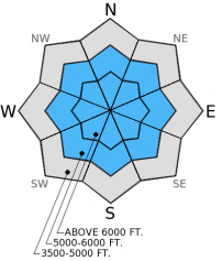
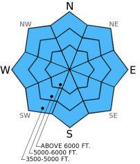
Storm slabs range from 7-10 inches above 6000 ft. (favoring the Glacier Park area) atop the late January surface hoar/crust combination. Moderate to strong winds (up to 50 mph) accompany this storm and will add to existing wind slabs on leeward slopes at upper elevations making slabs even thicker at those locations. The bond between this new snow and the late January buried surface hoar/crust combination is weak and the crust provides a great bed surface for avalanches to run on. Natural avalanches will become more likely as the day progresses. Pay attention to these changing conditions and watch for storm and wind slabs to become more sensitive to human triggering. Avoid avalanche terrain (including runout zones below avalanche paths) today as the snow piles up and rain falls on new snow.
-
Type ?
-
Aspect/Elevation ?
-
Likelihood ?CertainVery LikelyLikelyPossible
 Unlikely
 -
Size ?HistoricVery LargeLargeSmall

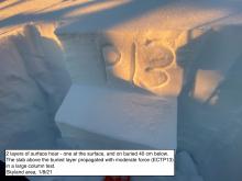
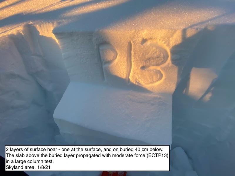
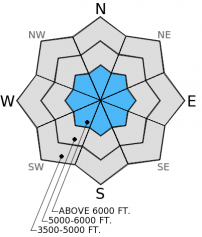
The persistent weak layers in our snowpack have not quite gone away enough to take the persistent slab problem off the list. These layers include the mid-January buried surface hoar layer (about 2 feet from the surface) which shows variable reactivity across the advisory. In some stability tests it propagates fractures and in others it does not even fracture. Then there is the mid-December layer which has remained quiet for about 10 days, but cannot be ruled out to become reactive again with a new load expected. Smaller storm avalanches have the potential to step down and trigger larger, deeper slabs. These layers are more likely triggered on steep, rocky slopes with a shallow snowpack so it is best to avoid these areas for now.
-
Type ?
-
Aspect/Elevation ?
-
Likelihood ?CertainVery LikelyLikelyPossible
 Unlikely
 -
Size ?HistoricVery LargeLargeSmall

With rain falling up to 7000 ft. today wet loose avalanches will become possible at all elevations. At lower elevations there is only a few inches that the rain can impact. However, as rain levels increase it will fall on more snow. Thus, rain induced wet avalanches are possible throughout the day and can entrain a substantial amount of snow. Rollerballs and small point releases are a good indication the snow surface is becoming unstable and it's time to move out of avalanche terrain. Even small avalanches can have big consequences in terrain traps like gullies and creek beds.
Dangerous avalanche conditions exist. The existing snow structure (surface hoar/crust combination) lends itself to a very unstable snowpack as the load above increases due to rain and wet, heavy snow. This storm appears to be favoring the northern portion of our advisory area including the Glacier Park and Flathead Ranges. The combination of heavy precipitation (whether heavy wet snow or rain) and a surface hoar/crust layer is undoubtedly a great recipe for avalanches. However, with only one observation yesterday our confidence in the extent of widespread avalanche activity is low. Thus, treating all avalanche terrain as suspect (particularly wind loaded slopes and slopes steeper than 35 degrees) would be good practice given the low confidence across the advisory area.
The next regularly scheduled advisory will be issued Saturday, February 7, 2015.
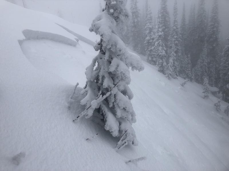
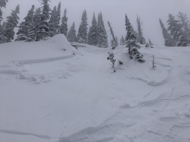
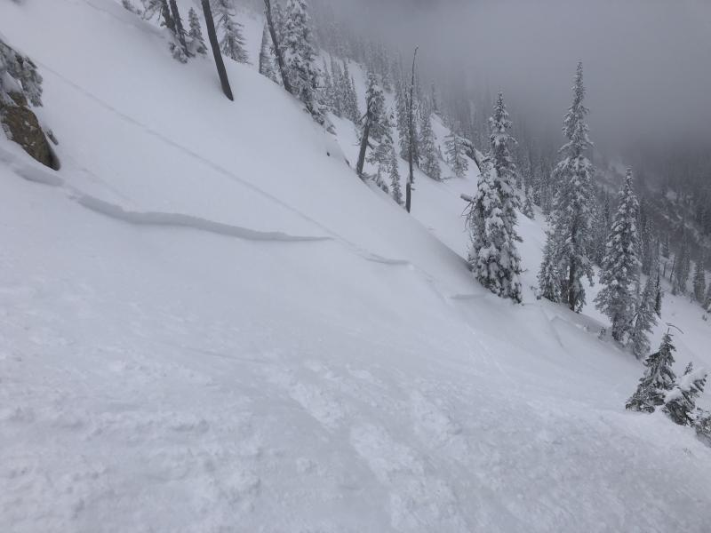
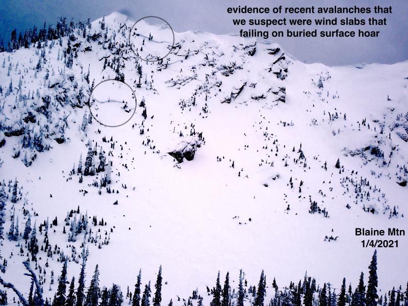
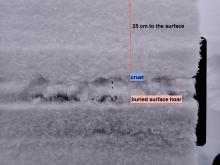
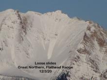
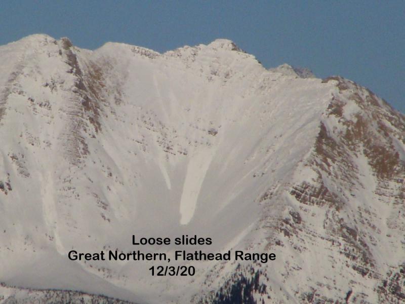
Observations across the advisory area reveal similar patterns. In most locations surface hoar from late January sits atop a melt-freeze crust with weak snow underneath (photo). The surface hoar above the crust and facets below the crust are both reactive in stability tests (video1, video2). Wind slabs exist at the upper elevations near ridgetops and skiers in the Marion Lake area near Essex reported easily triggering them earlier in the week. The mid-January buried surface hoar layer displays variable stabilty test results throughout the advisory area (some locations it propagates fractures and others it produces no fracture), and the mid-December crust/facet layer is largely unreactive at this point.
Skiers in the southern Whitefish Range yesterday morning reported easily triggering sluffs (point releases) that ran on the crust and they also noted warming temps with the new snow becoming more wet and heavy.
While the Swan Range has received less precipitation in this storm it also had the most new snow from earlier in the week (5-10 inches) sitting atop the surface hoar/crust layer.
A series of storms continues to move through the advisory area over the weekend. Precipitation began Wednesday night and within the past 24 hours the Glacier Park and Flathead Range received the most precipitation (13 inches of snow). The Swan Range received the least amount of precipitation thus far. Because this storm is so warm and wet with snow levels up to 7000 feet the new snow totals don't really paint a true picture of the storm's potentcy. Snow water equivalent (SWE) amounts over the past 30 hours in the Swan Range show 0.3 inches of new snow water equivalent and 2 inches of new snow.
As of 4:00 a.m. temperatures range from 31º to 37º F above 6000 feet with southwest winds moving at 10-20 mph with gusts to 45 mph. Today, expect precipitation to continue with increasing intensity. Snow levels will be around 6500-7000 feet. Accumulation of wet, heavy snow above 7000 feet will be in the 5-10 inch range by this afternoon with Glacier Park and the Flathead Range receiving the most precipitation.
| 0600 temperature: | 31-37 deg. F. |
| Max. temperature in the last 24 hours: | 37 deg. F. |
| Average wind direction during the last 24 hours: | Southwest |
| Average wind speed during the last 24 hours: | 10-20 mph |
| Maximum wind gust in the last 24 hours: | 32-45 mph |
| New snowfall in the last 24 hours: | 3-13 inches |
| Total snow depth: | 60-93 inches |
This advisory applies only to backcountry areas outside established ski area boundaries. This advisory describes general avalanche conditions and local variations always occur. This advisory expires at midnight on the posted day unless otherwise noted. The information in this advisory is provided by the USDA Forest Service who is solely responsible for its content.


