| Thursday | Thursday Night | Friday | |
|---|---|---|---|
| Cloud Cover: | Mostly sunny with temps just above freezing. | Mostly sunny with temps just above freezing. | Mostly sunny. |
| Temperatures: | 33-39 deg. F. | 17-26 deg. F. | 32-38 deg. F. |
| Wind Direction: | Southwest | Southwest | Southwest |
| Wind Speed: | 5-10 mph with gusts to 15 mph. | 4-8 mph. | 5-10 mph with gusts to 20 mph. |
| Snowfall: | 0 in. | 0 in. | 0 in. |
| Snow Line: |
Whitefish Range
Swan Range
Flathead Range and Glacier National Park
How to read the forecast
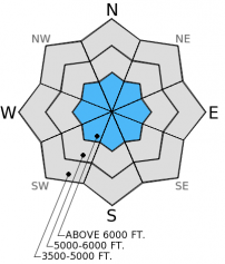
Cooling the past two nights helped stabilize the snowpack after unseasonably warm temperatures caused a wet avalanche cycle. A couple of layers within the top 2-3 feet of the snowpack still exhibit signs of instability, and natural and human triggered wet avalanches are possible today on sunny aspects. Thus, the hazard above 5000 ft. is MODERATE and LOW elsewhere. If temperatures rise more than expected with clear skies then the hazard could rise to CONSIDERABLE on sunny aspects.

2. Moderate
?
Above 6500 ft.
2. Moderate
?
5000-6500 ft.
1. Low
?
3500-5000 ft.
- 1. Low
- 2. Moderate
- 3. Considerable
- 4. High
- 5. Extreme
-
Type ?
-
Aspect/Elevation ?
-
Likelihood ?CertainVery LikelyLikelyPossible
 Unlikely
 -
Size ?HistoricVery LargeLargeSmall

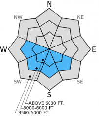
There was a time when I thought we could begin thinking about taking the persistent slab problem off of the list. Then, about 10 days ago we observed the mid-December surface hoar and facets become reactive again and propagate fractures in our stabilty tests after lying dormant for a while. May like weather exacerbated this problem and we saw a few natural dry and wet slab avalanches on steep, sunny aspects. Now it has cooled, but this layer still shows signs of instability. This layer appears to be more reactive on steep slopes with a shallow snowpack where it is more easily triggered. Choose simple, low angled terrain where this layer is present and reactive.
A layer of surface hoar and facets from mid-January persists in some locations about 1.5 to 2 feet from the surface. In some locations it propagates a fracture and, in other places, it fails but does not propagate in stability tests. I still don't trust it. Again, choose slopes less than 35 degrees to give yourself a wider margin for error with these persistent weak layers.
-
Type ?
-
Aspect/Elevation ?
-
Likelihood ?CertainVery LikelyLikelyPossible
 Unlikely
 -
Size ?HistoricVery LargeLargeSmall

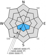
A nice refreeze the past two nights formed a melt-freeze crust which now caps the snowpack. This crust will soften today, but how much it softens depends on the amount of sunshine and the temperatures. The most southerly aspects where the sun hits slopes the longest will see wet, loose avalanches today. I don't expect these to be as large as previous days, but still large enough to cause problems especially in high consequence terrain like cliffs and terrain traps. If temperatures rise more than expected with no cloud cover then the wet avalanche hazard will rise. When the snow surface softens and you sink to your boot tops, or rollerballs and pinwheels form, then it is time to move to shadier aspects. Avoid being on or under these sunny slopes as the day progresses.
-
Type ?
-
Aspect/Elevation ?
-
Likelihood ?CertainVery LikelyLikelyPossible
 Unlikely
 -
Size ?HistoricVery LargeLargeSmall

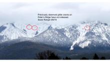
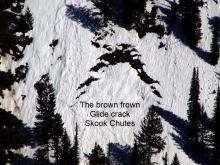
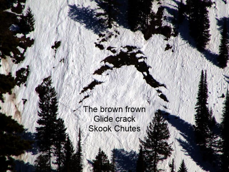
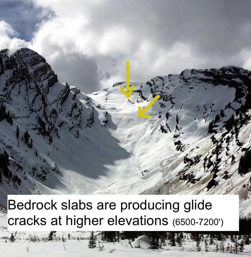
Glide avalanches occured in multiple locations across the advisory area over the past week (photo of Half Moon glide avalanche in southern Whitefish Range). Water is potentially still moving through the snowpack to the ground in some locations. It's like the plumbing in your house. When you turn the water off at the faucet it continues to move through the pipes for a while. Even though the water source at the surface turned off (surface refreezing) water can still travel through the snowpack. Glide avalanches are difficult to predict so the best way to manage them is to avoid slopes with glide cracks or previous glide avalanches. Some cracks fail in stages like the one in the Swan Range where a portion failed last week and the other half failed four days later.
Pay attention to changing conditions today. If temps creep up higher than expected and we have abundant sunshine, then we could begin to see more wet avalanche activity including both wet loose and wet slabs. The hazard will rise in this case. Avoid being on or under sunny slopes as the day progresses.
The next regularly scheduled advisory will be issued Saturday, Jan. 31, 2015.
Yesterday was the first day of no reported or observed avalanche activity in 4 days after unseasonably warm temps and abundant sunshine caused a round of wet avalanche activity that included wet loose, wet slab, and glide avalanches. Our Observations page highlights the cycle with some great images.
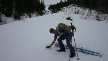
A firm melt-freeze crust formed after temps finally dropped below freezing. Below this crust still lurk a couple of concerning layers. In one of our pits on a north aspect in Marion Lake in the Flathead Range yesterday a layer of surface hoar (20 inches from the surface) from mid-January propagated fractures in our extended column tests (photo). On a south aspect with a very shallow snowpack a layer of facets above the mid-December melt-freeze crust (2 ft. from the surface) propagated fractures in our stability tests with moderate force (photo and video). This layer was responsible for a couple of slab avalanches in Hellroaring Basin on Sunday and Monday on steep, south facing aspects (video) and likely the culprit of a few wet slabs in Canyon Creek (Skook Chutes) as well. Just yesterday it was reported this layer still has the ability to propagate fractures in stability tests.
Skiers in the southern Whitefish Range yesterday reported no propagation in their stability tests on southerly aspects with a deeper snowpack. So, it's variable out there.
A ridge strenthens over our region bringing mostly sunny skies and mild temperatures. As of 4:00 a.m. mountain stations report temperatures ranging from 14º-25º F with winds moving out of the southwest at 2-9 mph with gusts to 19 mph. Today, expect partly cloudy skies with temperatures above 6000 ft. reaching into the upper 30s F. Wind will move out of the southwest at 5-10 mph with gusts to 20 mph.
| 0600 temperature: | 14-25 deg. F. |
| Max. temperature in the last 24 hours: | 28-34 deg. F. |
| Average wind direction during the last 24 hours: | Southwest |
| Average wind speed during the last 24 hours: | 2-9 mph |
| Maximum wind gust in the last 24 hours: | 18-19 mph |
| New snowfall in the last 24 hours: | 0 inches |
| Total snow depth: | 54-87 inches |
This advisory applies only to backcountry areas outside established ski area boundaries. This advisory describes general avalanche conditions and local variations always occur. This advisory expires at midnight on the posted day unless otherwise noted. The information in this advisory is provided by the USDA Forest Service who is solely responsible for its content.


