| Tuesday | Tuesday Night | Wednesday | |
|---|---|---|---|
| Cloud Cover: | Warm and sunny with increasing clouds tonight. Inversions will keep lowest elevations cooler this morning. | Weak disturbance moves south of advisory area. Increasing clouds with cooling temps. | Partly cloudy and warm, but cooler than previous days. |
| Temperatures: | 38-48 deg. F. | 27-31 deg. F. | 32-42 deg. F. |
| Wind Direction: | Southwest | West-Southwest | Southwest |
| Wind Speed: | 5-10 mph with gusts to 21 mph. | 5-10 mph with gusts to 25 mph. | 5-10 mph. |
| Snowfall: | 0 in. | 0 in. | 0 in. |
| Snow Line: |
Whitefish Range
Swan Range
Flathead Range and Glacier National Park
How to read the forecast
The hazard will begin MODERATE and rise to CONSIDERABLE on sunny aspects steeper than 35 degrees as the day progresses due to abundant sunshine and temperatures reaching into the upper 40s F. The hazard is MODERATE on all other terrain. Natural and human triggered wet avalanches are likely on steep, sunny slopes and avalanches involving deeper persistent weak layers are also still possible. As the day progresses move onto shadier slopes and avoid being on or under steep, sunny terrain.

3. Considerable
?
Above 6500 ft.
3. Considerable
?
5000-6500 ft.
2. Moderate
?
3500-5000 ft.
- 1. Low
- 2. Moderate
- 3. Considerable
- 4. High
- 5. Extreme
-
Type ?
-
Aspect/Elevation ?
-
Likelihood ?CertainVery LikelyLikelyPossible
 Unlikely
 -
Size ?HistoricVery LargeLargeSmall

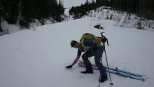
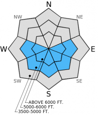
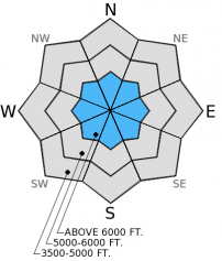
Radiational cooling will allow the top few inches of the snowpack to refreeze, but this will be short-lived and surface instabilities will be a concern again today. Human triggered loose, wet avalanches are likely again today and natural loose, wet avalanches remain possible as well on sunny aspects. Instability will begin on east-southeast aspects and follow around the south end of the compass today as the sun affects slopes. Signs of wet snow instability include roller balls, deep ski or boot penetration, and pinwheels (image). Avoid being on or under sunny slopes as soon as the sun hits and move to shadier terrain. Substantial loose, wet avalanches can reach into the mid-elevation zones. Even small avalanches can be dangerous in exposed terrain like cliff bands and terrain traps like gullies, creek beds, or roads.
-
Type ?
-
Aspect/Elevation ?
-
Likelihood ?CertainVery LikelyLikelyPossible
 Unlikely
 -
Size ?HistoricVery LargeLargeSmall

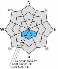
The avalanche in Picture Chutes in Hellroaring Basin is a great reminder that deeper, persistent weak layers still have the ability to produce avalanches. This slab avalanche failed in a steep, rocky area with a shallow snowpack where the weak layer was closer to the surface. These are the type of locations where you are more likely to trigger a persistent slab.
Without refreezing deeper in the snowpack free water will continue to move deeper into the snowpack. This free water could begin to affect these deeper, persistent weak layers by weakening the bonds between snow grains. This means that these persistent slabs could release as wet slab avalanches. While the mechanism by which they fail is different the results and consequences remain the same. These deeper slabs (whether wet or dry) could be large. Manage this avalanche problem by avoiding all slopes once the sun hits them as well as by avoiding steep, rocky areas with a shallow snowpack.
-
Type ?
-
Aspect/Elevation ?
-
Likelihood ?CertainVery LikelyLikelyPossible
 Unlikely
 -
Size ?HistoricVery LargeLargeSmall

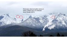
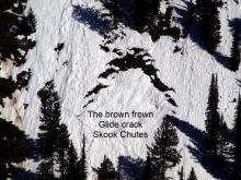
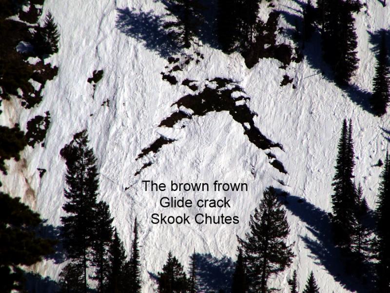
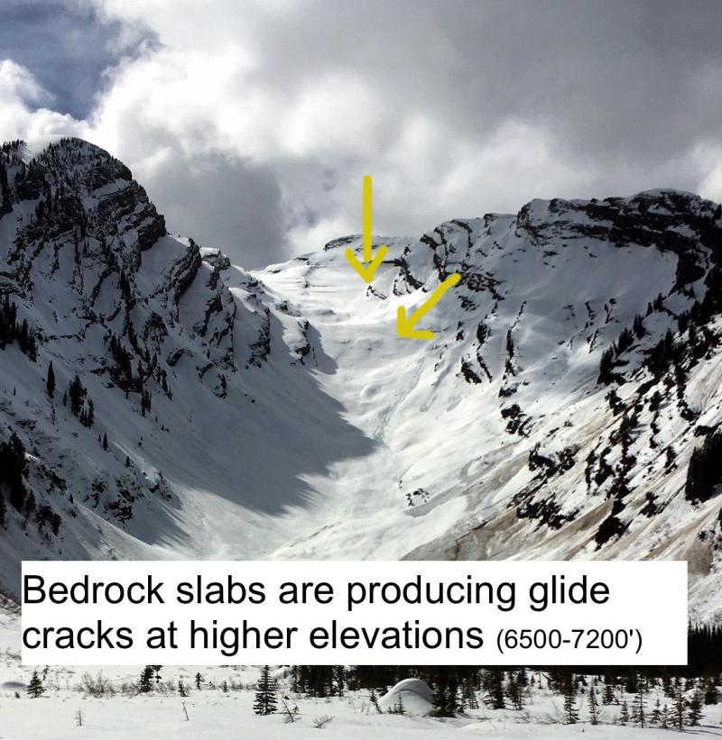
There were reports of glide avalanches in the Swan Range within the past week. A few more glide cracks were also observed. With unseasonably warm weather we've seen more cracks opening (image). Glide cracks are notoriously difficult to predict and the advice to manage this problem is simple: just avoid slopes where these cracks have formed.
The next regularly scheduled advisory will be issued Thursday, January 29, 2015.
There will be a Ladies Introduction to Avalanches course on Feb. 11,12, and 14. Look for more information and to register on the Education page later today.
Thanks to GlacierWorld for some of the images of the Picture Chutes avalanche. Please contact them before using the images.
Welcome to Juneuary! This is not good. It's not good for the skiing or riding and it's not good for the snowpack until we get a good solid refreeze. Numerous small (D1) wet, loose avalanches were observed Sunday throughout the advisory area (photo 1, photo 2, Observations). A few slides entrained a substantial amount of snow and reached up to size D2 and one knocked a snowmobiler off of her machine in Canyon Creek on Sunday in the Whitefish Range. The Canyon Creek snowmobile trail groomer reported one loose, wet slide that reached the trail Sunday night as well. Snowmobile guides reported debris that reached the trail yesterday afternoon as well.
A slab avalanche occurred in the Picture Chutes in Hellroaring Basin at Whitefish Mountain Resort on Sunday (image). Fortunately, no one was caught. It appears this slab was triggered by a wet, loose avalanche from above in a steep, rocky area with a shallow snowpack (video). It failed on a layer of wet facets above the mid-December melt-freeze crust buried 20-30 inches deep and deposited debris up to 7 feet deep in the runout zone (image). It ran about 300 vertical feet.
Observers in the Swan Range reported glide avalanches within the past week. A portion of one crack failed last Wednesday and the rest of the slope failed Sunday (image).


Wet, loose avalanche, Skookoleel Creek, Whitefish Range. 1/26/2015. Picture Chutes slab avalanche. Photo: GlacierWorld.com Glide avalanche, Swan Range. 1/25/2015. Photo: Keith Hammer.
High pressure continues to reside over the region bringing inversions with unseasonably warm temperatures in the mountains and abundant sunshine. As of 4:00 a.m. mountain stations report temperatures ranging from 36º-46º F with winds moving out of the southwest at 5-15 mph gusting to 28 mph. Today, temperatures will rise into the mid to upper 40s F once again, but perhaps remain slightly cooler than yesterday. Winds will be out of the southwest at 5-15 mph with gusts to the upper 20s. A quick shortwave disturbance moves through tonight into tomorrow hopefully bringing mountain temperatures below freezing tonight. Note: it has been 2-3 days since most mountain locations dipped to the freezing mark.
| 0600 temperature: | 36-43 deg. F. |
| Max. temperature in the last 24 hours: | 46-50 deg. F. |
| Average wind direction during the last 24 hours: | Southwest |
| Average wind speed during the last 24 hours: | 5-15 mph |
| Maximum wind gust in the last 24 hours: | 27-28 mph |
| New snowfall in the last 24 hours: | 0 inches |
| Total snow depth: | 56-88 inches |
This advisory applies only to backcountry areas outside established ski area boundaries. This advisory describes general avalanche conditions and local variations always occur. This advisory expires at midnight on the posted day unless otherwise noted. The information in this advisory is provided by the USDA Forest Service who is solely responsible for its content.


