| Sunday | Sunday Night | Monday | |
|---|---|---|---|
| Cloud Cover: | Lingering showers early, mostly/partly cloudy and warming. | Partly cloudy, continued warming trend | Warm, strengthening high pressure |
| Temperatures: | 43-51 deg. F. | 32-43 deg. F. | 41-53 deg. F. |
| Wind Direction: | SW | S/SW | S/SW |
| Wind Speed: | 14-19 gusts 29-39 | 11-13 gusts 23-31 | 11-14 gusts 28-31 |
| Snowfall: | 0 in. | 0 in. | 0 in. |
| Snow Line: |
Whitefish Range
Swan Range
Flathead Range and Glacier National Park
How to read the forecast
Mild temperatures and another shot of rain over night prevented the snow surface from re-freezing. Temperatures will continue to rise today contributing to increased loose, wet avalanche hazard at higher elevations. For today, the hazard is rated CONSIDERABLE above 5000 feet on slopes steeper than 35º. Choose low angle, unexposed terrain and assess the snow pack for deeper instability that may have become more reactive due to added weight over the past few days.

3. Considerable
?
Above 6500 ft.
3. Considerable
?
5000-6500 ft.
2. Moderate
?
3500-5000 ft.
- 1. Low
- 2. Moderate
- 3. Considerable
- 4. High
- 5. Extreme
-
Type ?
-
Aspect/Elevation ?
-
Likelihood ?CertainVery LikelyLikelyPossible
 Unlikely
 -
Size ?HistoricVery LargeLargeSmall

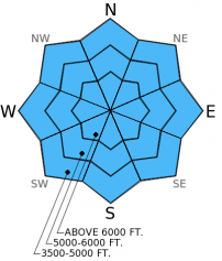
Unusual weather conditions breed unusual avalanche conditions. Upper elevation temperatures reaching the mid-40s in January certainly qualifies as unusual weather. With out a good re-freeze last night, the snow surface will start off wet before we reach the warmest part of the day. Natural loose, wet avalanches were reported in multiple locations yesterday and will be possible again today. Roller balls, deep ski or boot penetration, or surface snow with a slushy appearance are indicators that it's time to move out of avalanche terrain. Keep in mind that even small avalanches can be dangerous in exposed terrain like cliff bands and terrain traps like gullies and creek beds.
-
Type ?
-
Aspect/Elevation ?
-
Likelihood ?CertainVery LikelyLikelyPossible
 Unlikely
 -
Size ?HistoricVery LargeLargeSmall

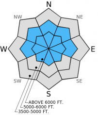
We have still not written off the weak snow near the mid-December crust. Though deeply buried and difficult to trigger, we have observed isolated areas where it is still reactive in stability tests. In most locations in the advisory area there is another layer of surface hoar buried 1-1.5 feet deep. This layer has produced variable results in stability tests, but should be treated with caution as the recent load put additional stress on this layer. Be sure to assess each slope you plan to ski or ride for persistent slab and choose conservative terrain where present. Consider the potential for a smaller loose, wet avalanche to step down and trigger a deeper persistent slab. Loose avalanches can be fairly easy to manage as they release below the trigger, but the stress they put on the snow pack could be enough to trigger a slab from above.
-
Type ?
-
Aspect/Elevation ?
-
Likelihood ?CertainVery LikelyLikelyPossible
 Unlikely
 -
Size ?HistoricVery LargeLargeSmall

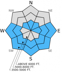
There was a report of a glide avalanche in the Swan Range last week and a few more glide cracks were observed nearby. With recent rain-on-snow and unseasonal warm weather we may start to see more cracks opening. It is nearly impossible to predict when a glide avalanche will occur, due to the high level of uncertainty it is best to simply avoid slopes where these cracks have formed. Large cornices could also become sensitive as temperatures rise in the upper elevations, particularly if exposed to the sun for prolonged periods. Avoid traveling below large cornices and give them a wide margin of safety when traveling above them as they can break behind the ridgeline farther back than expected.
BNSF Avalanche Safety reported a size D2 avalanche in the John F Stevens Canyon yesterday.
Snowmobilers in Canyon Creek in the southern Whitefish Range observed loose, wet avalanche activity begining in the afternoon. The Flathead Snowmobile Association groomer was also in Canyon Creek last night and reported several natural avalanches that deposited up to 4 feet of debris that nearly reached the groomed snowmobile trail (Photo).
Yesterday we were in the 6-Mile area in the Swan Range. Fog obscured the visibility and we were unable to see if there was any avalanche activity on surrounding peaks. At low elevation we were able to see several small, loose, wet avalanches. Below 6500 feet we found that the rain had penetrated the top 5 inches of snow and it was dry below that. We identified three layers of buried surface hoar in this area, including those formed in mid-December and mid-January. These layers failed in stability tests but did not propagate a fracture.
Yesterday temperatures were warm across the region and continued to rise overnight. Light precipitation over the past 24 hours fell as mostly rain/freezing rain up to about 6000 feet. Winds have been blowing out of the west/southwest 5-15 mph with gusts in the mid-20s. Currently, mountain temperatures are 29º-39º F and winds remain out of the west/southwest 7-13 mph with gusts to 22 mph. For today, expect rain showers to taper this morning and become partly cloudy as a ridge of high pressure builds over the area. Winds will be 10-20 mph out of the west/southwest with gusts in the 30s and mountain temperatures will continue to rise to the mid 40s.
| 0600 temperature: | 32-39 deg. F. |
| Max. temperature in the last 24 hours: | 32-39 deg. F. |
| Average wind direction during the last 24 hours: | SW |
| Average wind speed during the last 24 hours: | 5-15 mph |
| Maximum wind gust in the last 24 hours: | 11-22 mph |
| New snowfall in the last 24 hours: | 1-3 inches |
| Total snow depth: | 58-90 inches |
This advisory applies only to backcountry areas outside established ski area boundaries. This advisory describes general avalanche conditions and local variations always occur. This advisory expires at midnight on the posted day unless otherwise noted. The information in this advisory is provided by the USDA Forest Service who is solely responsible for its content.


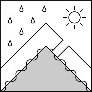
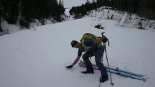
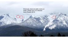

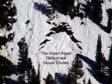
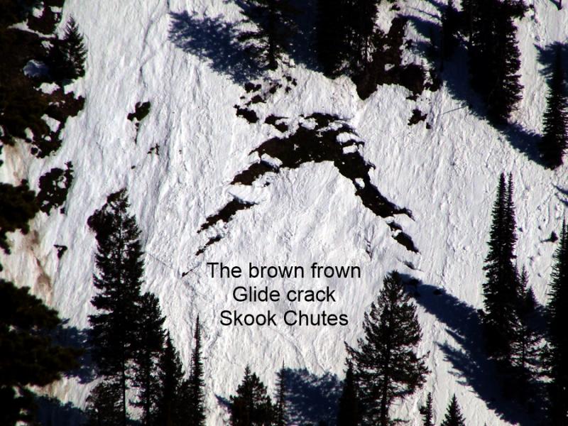
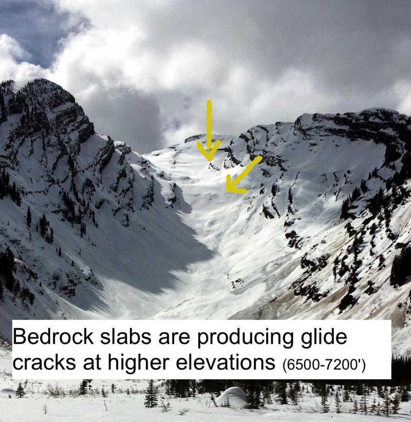
 Photo: Brad Lamson


