| Sunday | Sunday Night | Monday | |
|---|---|---|---|
| Cloud Cover: | Mostly cloudy, snow tapering mid-morning | Partly/mostly cloudy | partly cloudy with light flurries |
| Temperatures: | 25-30 deg. F. | 13-21 deg. F. | 25-32 deg. F. |
| Wind Direction: | E/NE | S | W/SW |
| Wind Speed: | 3-7 | 2-4 | 5-7 |
| Snowfall: | 0-2 in. | 0 in. | 0 in. |
| Snow Line: |
Whitefish Range
Swan Range
Flathead Range and Glacier National Park
How to read the forecast
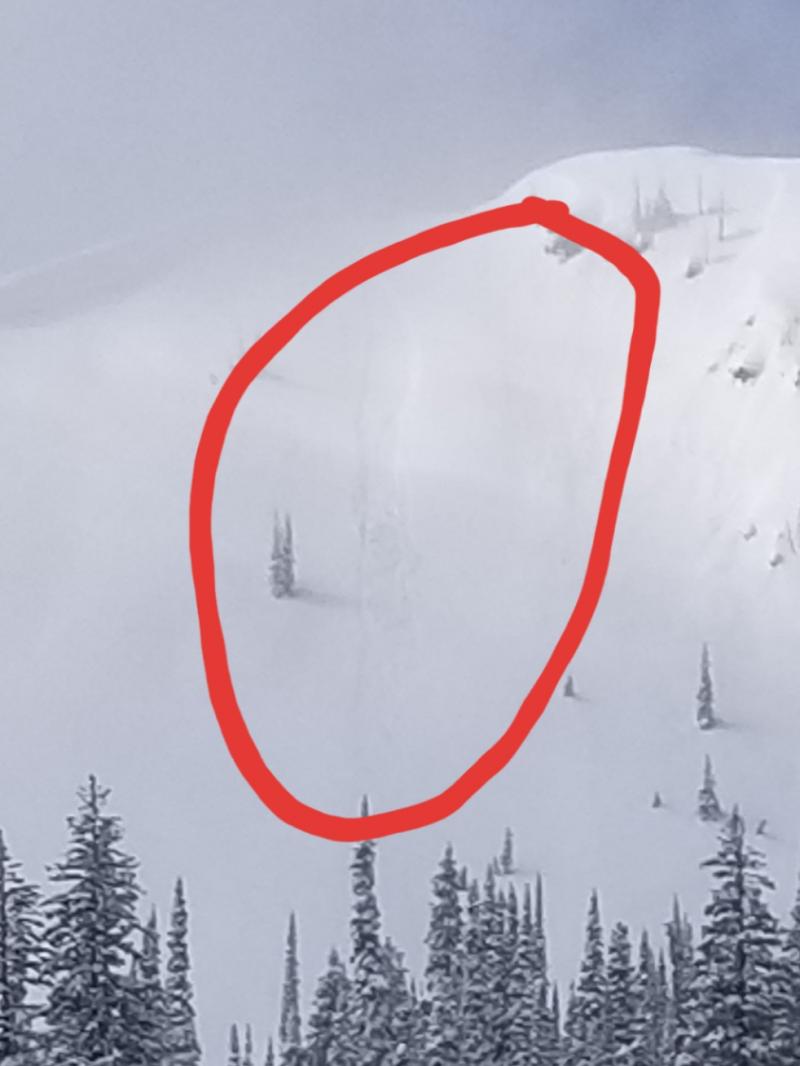
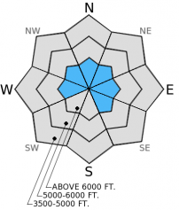
The avalanche hazard is MODERATE in steep, upper elevation wind loaded terrain due to lingering instability in wind slabs, you may also find thin, fresh wind slabs. Pay attention to loose, dry avalanches (sluffs) as new snow likely bonded poorly with last week's rain crust. Below 6000 feet the hazard is LOW, continue to take normal backcountry precautions and assess each slope for stability and only expose one skier or rider to avalanche terrain at a time.

2. Moderate
?
Above 6500 ft.
1. Low
?
5000-6500 ft.
1. Low
?
3500-5000 ft.
- 1. Low
- 2. Moderate
- 3. Considerable
- 4. High
- 5. Extreme
-
Type ?
-
Aspect/Elevation ?
-
Likelihood ?CertainVery LikelyLikelyPossible
 Unlikely
 -
Size ?HistoricVery LargeLargeSmall

Though the wind slab problem seems fairly confined to steep, upper-elevation terrain, recently wind loaded slopes still warrant extra caution and evaluation. New wind slabs that formed in the last 24 hours will be thin but sensitive. Remember that small avalanches can be very dangerous when traveling in and around terrain traps like confined gullies, cliffs, or timber.
-
Type ?
-
Aspect/Elevation ?
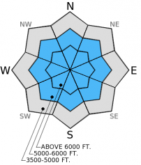
-
Likelihood ?CertainVery LikelyLikelyPossible
 Unlikely
 -
Size ?HistoricVery LargeLargeSmall

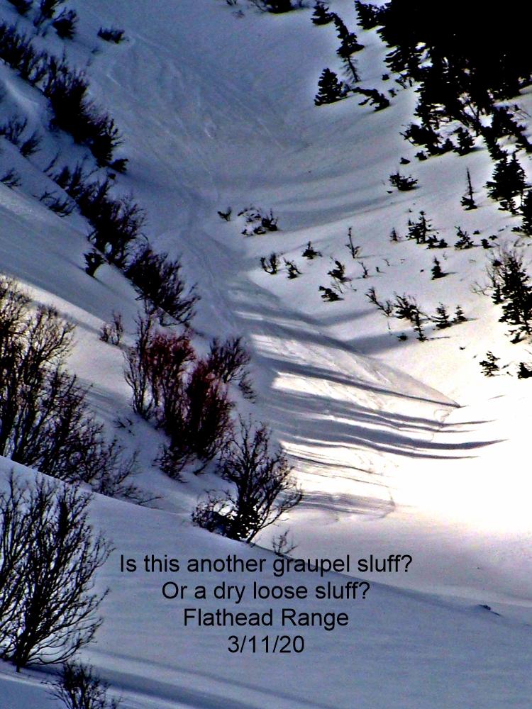
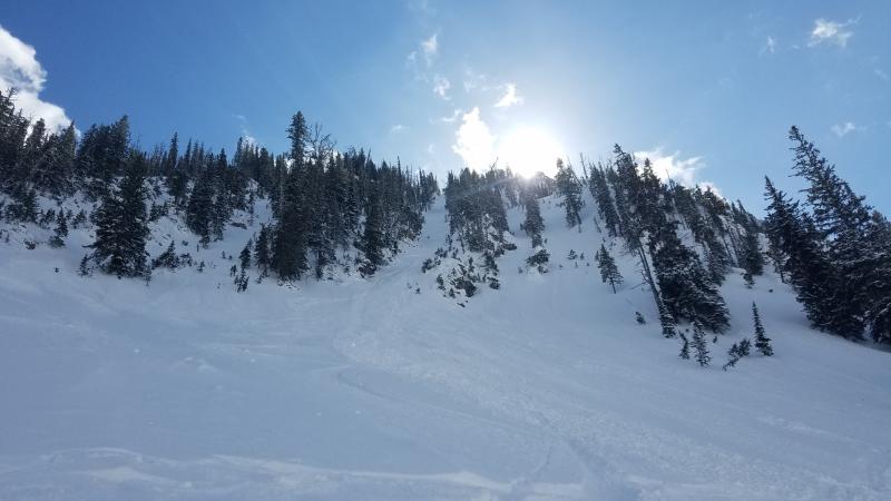
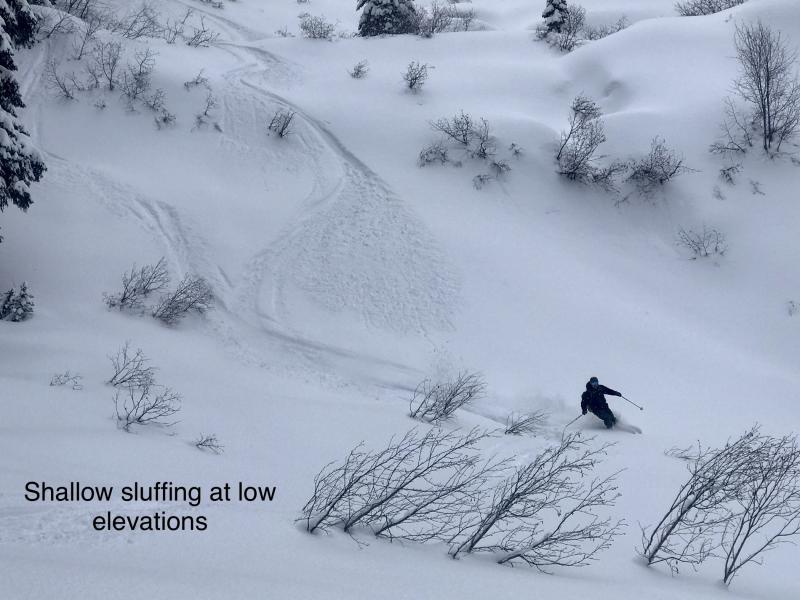
Loose, dry avalanches (sluffs) will be more of a management concern in the Swan Range than in other areas as they picked up the bulk of the new snow. These should be pretty shallow, but given the poor bond with the rain crust they can certainly pack a punch if they get a head of steam. Unlike a slab avalanche, a loose, dry avalanche releases below the trigger so they are more manageble. The consequence of a small, dry, loose avalanche increases in and around terrain traps such as cliff areas and trees where you dont want to get knocked off your feet.
I have not seen or heard of any sign of instability associated with persistent slab in about a week. That said, it's a big area and though unreactive to recent stability testing, we continue to find weak snow in the mid-snow pack. We have taken persistent slab out of the problems because it is unlikely to trigger a persistent slab avalanche, but not impossible. Keep these deep, weak layers in mind before skiing or riding in steep, rocky terrain and consider the consequence of triggering a deep slab in such terrain.
Yesterday we were on Skookoleel Ridge in the southern Whitefish Range. Based on observations from the previous day in the same area, the surface crust had started to decompose and was actually quite manageable to ski. Our snow pits showed a good snow structure with density increasing with depth with the exception of the buried surface hoar layer that did not produce any failure in stability tests. In most areas, close examination of the snow surface revealed weak snow in the form of surface hoar and/or near surface facets that were likely preserved with new snow overnight (photo). This weak snow will not cause a problem until a slab forms on top of it, but its a good idea to keep a mental map of the distribution of this now buried weak snow.
In the past 24 hours we picked up between 1 and 5 inches of new snow. Winds were light out of the southwest with gusts on the ridgetops up to 22 mph. Currently, mountain temperatures range from 21º to 26º F and winds are light out of the north. Today we'll see mostly cloudy skies and lingering light snow showers through mid-day with 1-2 inches of additional accumulation. Winds will be 5-10 mph out the east and northeast.
Note - The wind sensor at the Big Mountain Summit weather station is down for repairs, any wind information from this station will be inaccurate.
| 0600 temperature: | 21-26 deg. F. |
| Max. temperature in the last 24 hours: | 24-29 deg. F. |
| Average wind direction during the last 24 hours: | SW |
| Average wind speed during the last 24 hours: | 5-7 mph |
| Maximum wind gust in the last 24 hours: | 9-22 mph |
| New snowfall in the last 24 hours: | 1-5 inches |
| Total snow depth: | 60-93 inches |
This advisory applies only to backcountry areas outside established ski area boundaries. This advisory describes general avalanche conditions and local variations always occur. This advisory expires at midnight on the posted day unless otherwise noted. The information in this advisory is provided by the USDA Forest Service who is solely responsible for its content.


