| Saturday | Saturday Night | Sunday | |
|---|---|---|---|
| Cloud Cover: | Slightly warmer with continued snow showers | Increasing snow intensity | Continued snow |
| Temperatures: | 10-20 deg. F. | -3-9 deg. F. | 8-20 deg. F. |
| Wind Direction: | East | East/Southeast | East/Northeast |
| Wind Speed: | 4-5 | 4-7 gusts 20 | 6-7 |
| Snowfall: | 0-1 in. | 1-4 in. | 1-3 in. |
| Snow Line: |
Whitefish Range
Swan Range
Flathead Range and Glacier National Park
How to read the forecast
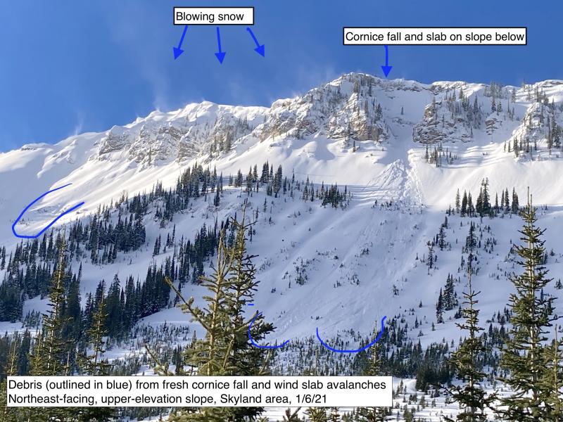
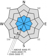
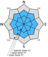
Wind slabs at upper elevations continue to show signs of instability and the possibility to trigger persistent slabs (buried surface hoar and facets) still exists. The hazard is CONSIDERABLE on wind loaded slopes above 6000 feet and MODERATE on other terrain above 5000 feet. It remains important to carefully evaluate the snow pack in the areas you ski or ride by assessing the sensitivity of weak snow 2-4 feet deep and recent wind drifted snow.

3. Considerable
?
Above 6500 ft.
2. Moderate
?
5000-6500 ft.
1. Low
?
3500-5000 ft.
- 1. Low
- 2. Moderate
- 3. Considerable
- 4. High
- 5. Extreme
-
Type ?
-
Aspect/Elevation ?
-
Likelihood ?CertainVery LikelyLikelyPossible
 Unlikely
 -
Size ?HistoricVery LargeLargeSmall

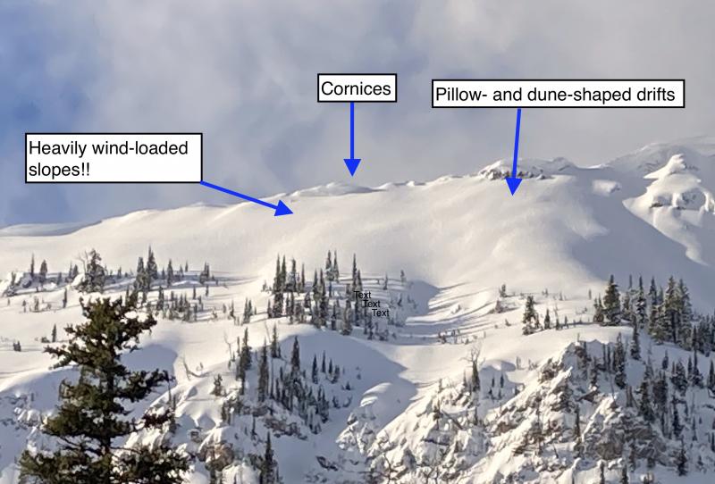
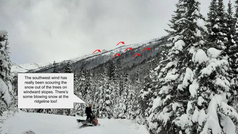
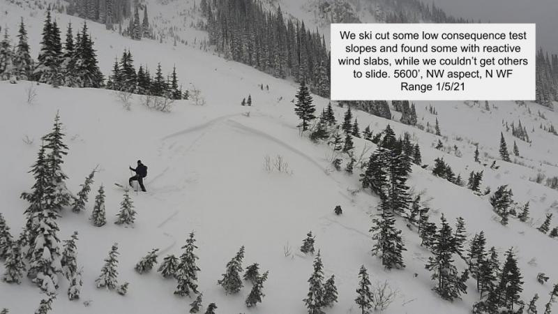
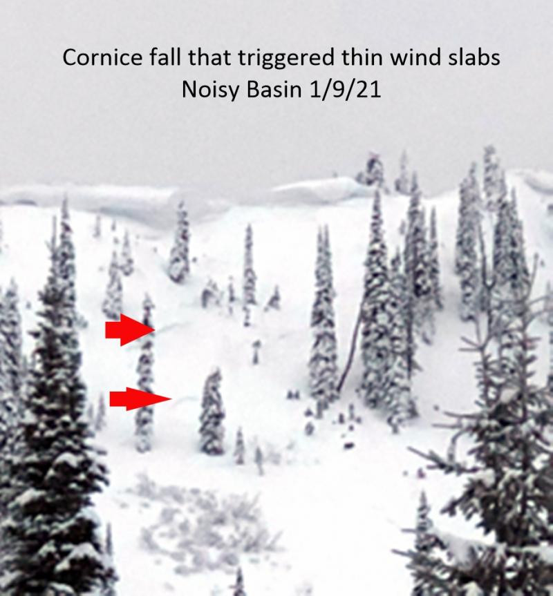
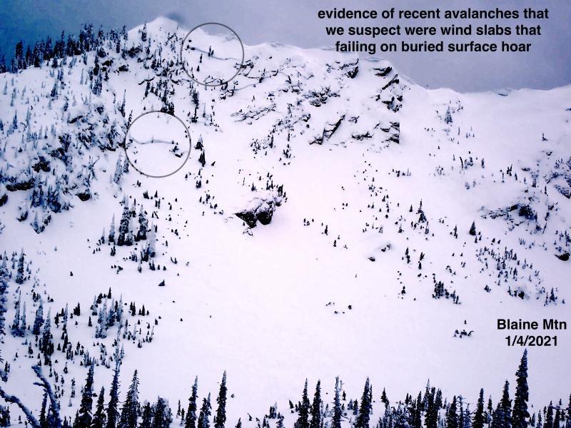
With the variability of wind direction over the past several days it is possible to encounter recently formed wind slabs on any aspect at high elevation. Under normal circumstances wind slabs can take several days to a week to gain strength and become less reactive. Unfortunately, wind transported snow onto slopes with preserved buried surface hoar in many locations, which created a more persistent wind slab problem. In some areas these slabs are less reactive, but an observed failure yesterday by simply approaching the slope is evidence that they should not be trusted just yet. Stick to more sheltered terrain where the wind has not created these potentially sensitive drifts.
-
Type ?
-
Aspect/Elevation ?
-
Likelihood ?CertainVery LikelyLikelyPossible
 Unlikely
 -
Size ?HistoricVery LargeLargeSmall

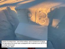
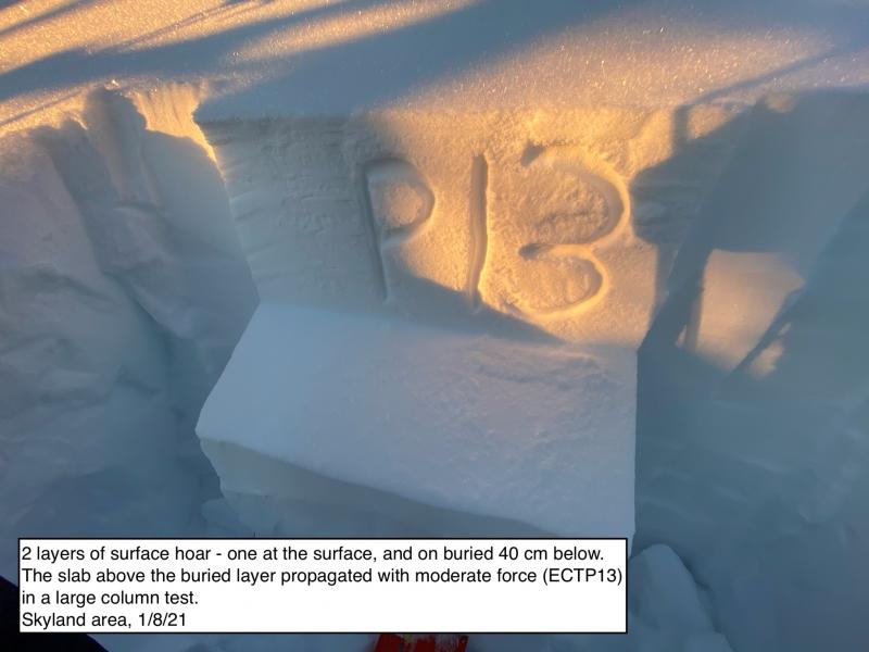
The persistent slab problem associated with weak snow buried 2-4 feet deep continues to show signs of improvement. There have been fewer reports of natural and human triggered avalanches, and stability testing is producing more variable results. A week ago we were hard pressed to find an area where an extended column test did not propagate a fracture. Given the consequence, I still dont like the odds of gambling on terrain and diving in without carefully evaluating it first. We continue to find areas that have proven the ability to propagate a fracture. Avoid terrain where these weak layers are closer to the surface and steep, convex terrain where you are most likely to trigger a persistent slab.
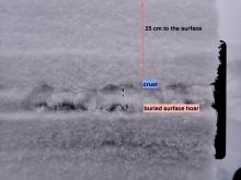
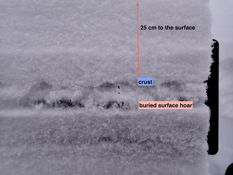
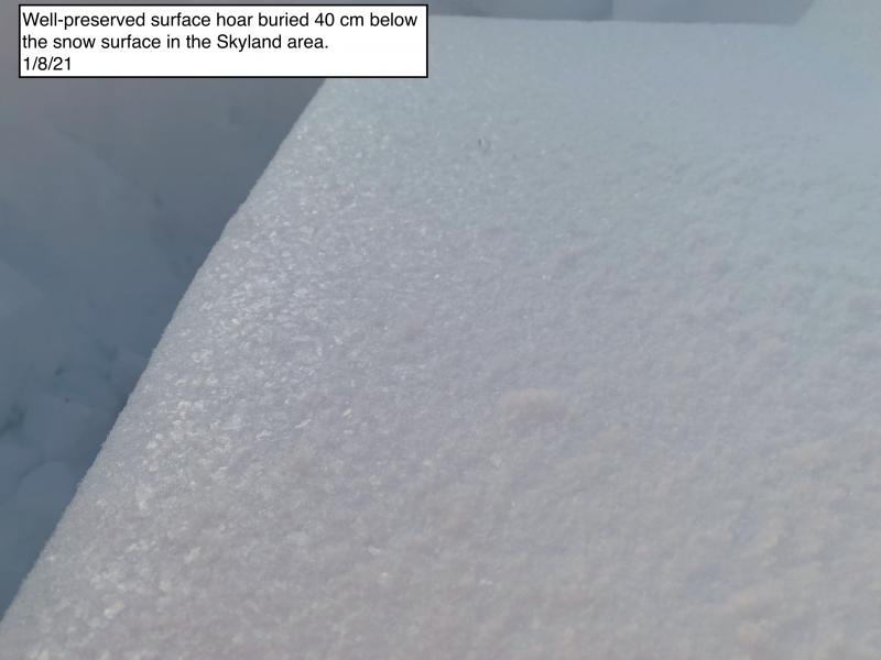
Yesterday we were in Canyon Creek and the Half Moon area in the southern Whitefish Range. We were there to assess the sensitivity of the buried surface hoar layer that was responsible for several recent human triggered avalanches in the area. We found this layer to be much less obvious in the snow pit walls than we had seen recently. Also, in 3 out of 4 snow pits we were not able to propagate a fracture in stability tests. The problem was that one test did show unstable results proving that we cannot turn our back on this buried surface hoar yet.
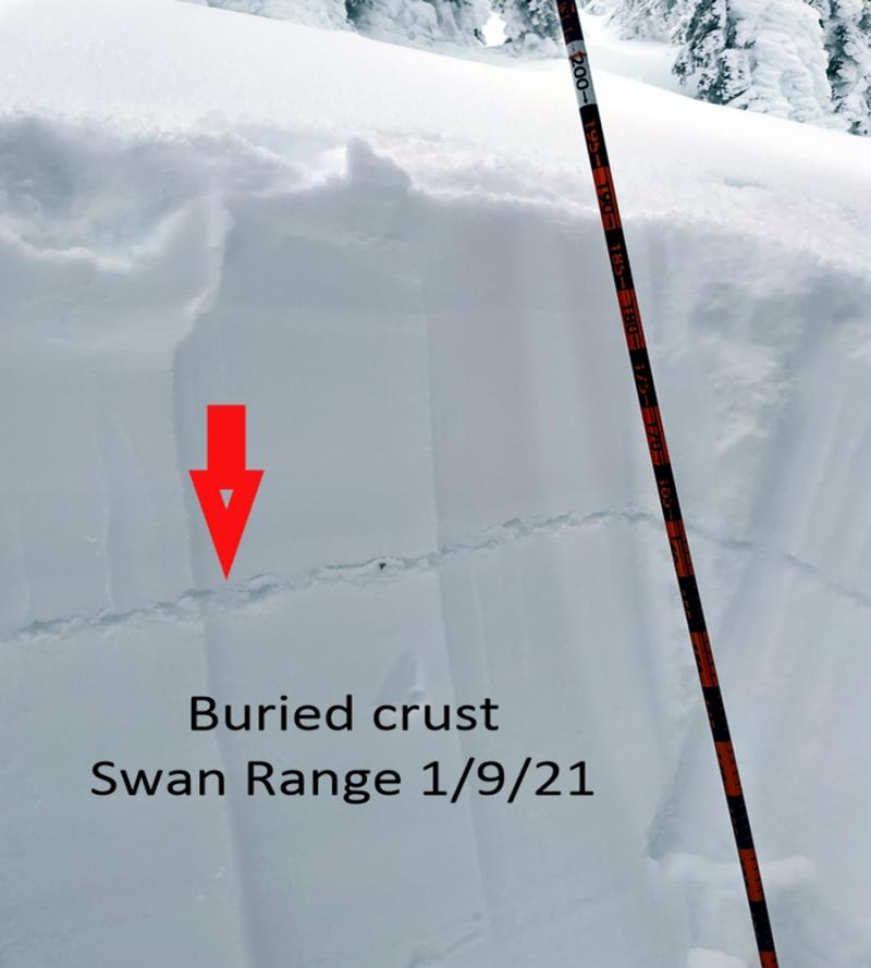
Yesterday, Erich and Lucas rode into the Lost Johnny drainage in the Swan Range where they encountered some sensitive wind slabs (photo and video). Stability tests also showed variable results within the buried surface hoar layer, but some tests continued to show signs of instability in this layer (video).
Skiers that recently traveled in both the Whitefish and Flathead Ranges found mixed results in assessing buried surface hoar instability. They also noted new surface hoar developing in some locations (observation).
In the past 24 hours the area received between 2 to 4 inches of new snow. Winds were light to moderate (10 -20 mph) out of the south and southwest and shifted out of the north overnight. Mountain temperatures remain cold across the advisory area, as of 4:00 am temperatures range from -7 -13º F and winds are 5-15 mph out of the north. Today should see mostly cloudy skies, temperatures reaching the high-teens to low-20s with lingering snow showers possible this morning. Another storm system moves into the area late this afternoon and is expected to continue overnight.
| 0600 temperature: | -5-13 deg. F. |
| Max. temperature in the last 24 hours: | 15-22 deg. F. |
| Average wind direction during the last 24 hours: | South/Southwest |
| Average wind speed during the last 24 hours: | 10-15 mph |
| Maximum wind gust in the last 24 hours: | 35-36 mph |
| New snowfall in the last 24 hours: | 2-4 inches |
| Total snow depth: | 54-76 inches |
This advisory applies only to backcountry areas outside established ski area boundaries. This advisory describes general avalanche conditions and local variations always occur. This advisory expires at midnight on the posted day unless otherwise noted. The information in this advisory is provided by the USDA Forest Service who is solely responsible for its content.


