| Sunday | Sunday Night | Monday | |
|---|---|---|---|
| Cloud Cover: | Mostly cloudy, snow tapering in the afternoon | Cold with a few lingering flurries | Partly/mostly cloudy and cold |
| Temperatures: | 16-25 deg. F. | -6-6 deg. F. | -2-9 deg. F. |
| Wind Direction: | NE | NE | NE |
| Wind Speed: | 13-15 gusts 32 | 18-20 gust 33 | 12-18 gusts 37 |
| Snowfall: | 2-5 in. | 0-1 in. | 0 in. |
| Snow Line: |
Whitefish Range
Flathead Range and Glacier National Park
How to read the forecast
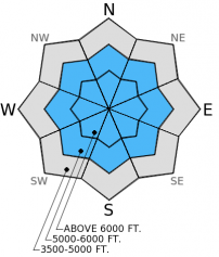
Substantial new snowfall and wind drifted snow in the past 24 hours added a considerable amount stress to a previously weak snow pack. Today, wind loaded terrain is rated as HIGH, travel in this terrain is not recommended. Non-windloaded slopes are rated CONSIDERABLE meaning that human triggered avalanches remain likely. Conservative decision making and terrain selection are essential today. Avoid wind loaded terrain and run-out zones.

4. High
?
Above 6500 ft.
3. Considerable
?
5000-6500 ft.
2. Moderate
?
3500-5000 ft.
- 1. Low
- 2. Moderate
- 3. Considerable
- 4. High
- 5. Extreme
-
Type ?
-
Aspect/Elevation ?

-
Likelihood ?CertainVery LikelyLikelyPossible
 Unlikely
 -
Size ?HistoricVery LargeLargeSmall

Persistent slabs can be frustrating, and the snow pack is sending us some mixed messages. It is important to remember that a persistent slab can present a problem in the snow pack for weeks or even months, and the deeper they get, the harder they are to trigger. Skiing or riding on simple, low angle slopes without issue combined with stability test's failure to produce alarming results can increase confidence in tricky conditions. Continue to resist the urge to inch into steeper, more complex terrain. There is excellent skiing and riding on low angle slopes where the likelihood of triggering a persistent slab avalanche is much less.
-
Type ?
-
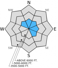
Aspect/Elevation ?
-
Likelihood ?CertainVery LikelyLikelyPossible
 Unlikely
 -
Size ?HistoricVery LargeLargeSmall

It did not take much wind to transport the recent, low density snow onto leeward slopes and create sensitive wind slabs yesterday. Additionally, in exposed areas where surface hoar would typically be destroyed prior to burial, we found it preserved in the snow pack beneath the wind drifted snow. A wind shift today will load snow on to different aspects that were not previously windloaded. Pay attention to where the snow is drifting today, and choose more sheltered terrain where the snow surface does not appear smooth and pillowy.
-
Type ?
-
Aspect/Elevation ?
-
Likelihood ?CertainVery LikelyLikelyPossible
 Unlikely
 -
Size ?HistoricVery LargeLargeSmall

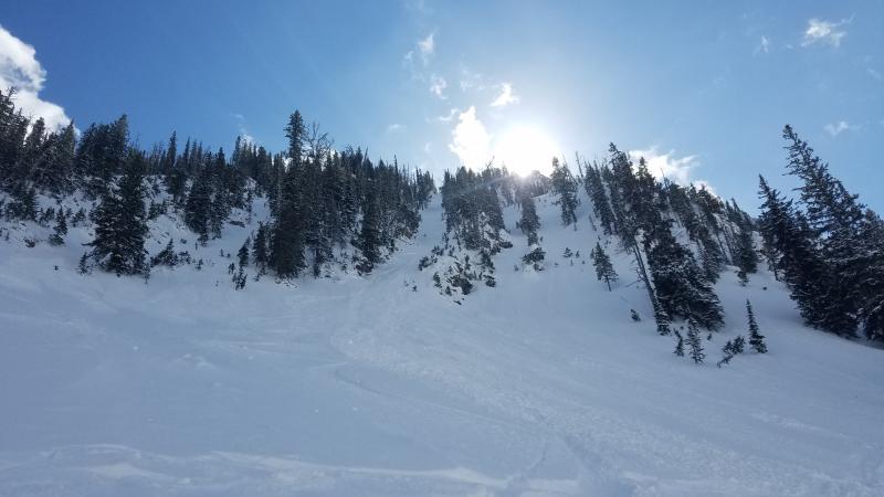
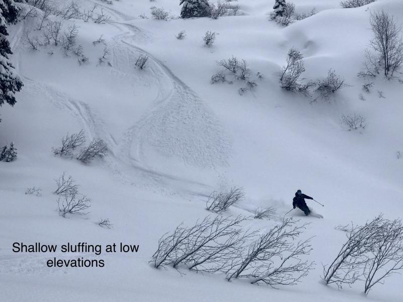
Dry, loose avalanches or sluffs are relatively easy to manage as they release below you, but they can pack a punch if you get in front of them, particularly in steep terrain or in terrain traps. A dry, loose avalanche also has the ability step down to weak snow deeper in the snow pack, triggering a much deeper slide.
Yesterday I used an example from last week that illustrates the complexity of managing the persistent slab problem. In this example skiers found seemingly stable results in stability tests at a similar elevation, aspect, and on the same peak as a skier triggered avalanche one day earlier. Those bulls eye clues to instability (recent avalanches) may not always be present to aid in decision making. Remember to search for signs of instability rather than stability when choosing terrain.
Four snowmobilers were caught in an avalanche near Seeley Lake yesterday, two were fully buried and two partially buried. Luckily everyone was able to ride away from the accident. Even though this incident occured outside of the advisory area it serves a good reminder of dangerous conditions that exist in the region and the neccesity of practicing safe travel technique in the backcountry.
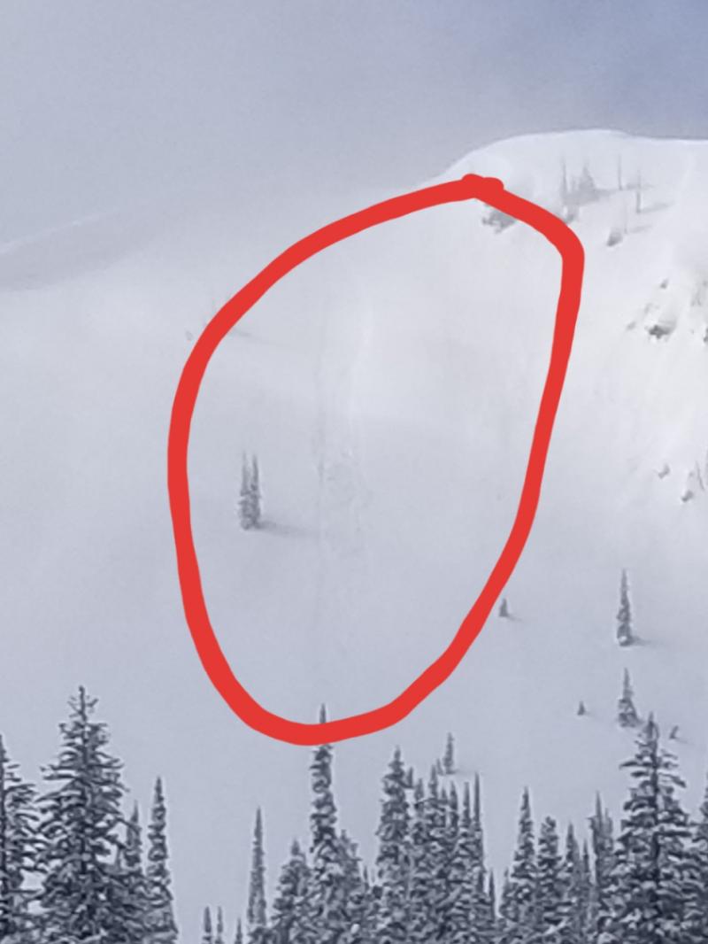
Yesterday we were in the Doris Drainage in the Swan Range. We have received very few observations from the Swan Range and wanted to assess distribution and sensitivity of persistent slabs in the area. Like most other locations we visited recently we found a layer of buried surface hoar that ranged from 1.5 up to 3 feet deep in the snow. The overlying slab that was formed during storms last week was more dense than in other locations and slightly more stubborn in stability tests. It is important to consider that hard force in a stability test does not neccesarily mean the weak snow has gained strength, its just harder to trigger, but still capable of propagating a fracture and producing an avalanche. The wind speeds picked up in the afternoon, but the light breeze from earlier in the day had already drifted the recent low density snow and formed sensitive wind slabs near the ridge lines (photo).
We received a vague report of human triggered avalanches in the 6-mile area in the Swan Range from Friday, December, 26, 2014. No one was caught or injured.
Once again the Swan Range was the big winner in snow fall totals with 21 inches of new snow and 1.6 inches of snow water equivalent (SWE) at Noisy Basin SNOTEL in the past 24 hours. Other locations received between 10 and 13 inches of snow and 0.6-0.7 inches of SWE. Mountain temperatures have been in the teens to low-20s and winds were 5-15 mph out of the southwest. This morning it is still snowing in most areas and light winds have shifted out the northeast. For today, snow should continue through mid-day and northeast winds will increase in speed as the day progresses. Much colder temperatures are expected for tomorrow and we should start to see temperatures fall this afternoon.
| 0600 temperature: | 15-23 deg. F. |
| Max. temperature in the last 24 hours: | 18-23 deg. F. |
| Average wind direction during the last 24 hours: | SW |
| Average wind speed during the last 24 hours: | 5-15 mph |
| Maximum wind gust in the last 24 hours: | 21-24 mph |
| New snowfall in the last 24 hours: | 10-21 inches |
| Total snow depth: | 63-83 inches |
This advisory applies only to backcountry areas outside established ski area boundaries. This advisory describes general avalanche conditions and local variations always occur. This advisory expires at midnight on the posted day unless otherwise noted. The information in this advisory is provided by the USDA Forest Service who is solely responsible for its content.


