| Thursday | Thursday Night | Friday | |
|---|---|---|---|
| Cloud Cover: | Mostly cloudy with some clearing. | Mostly cloudy. | Mostly cloudy. |
| Temperatures: | 21-27 deg. F. | 10-19 deg. F. | 19-25 deg. F. |
| Wind Direction: | Northwest through Southwest | West | Southwest |
| Wind Speed: | 5-10 mph with gusts to 20 mph. | 3-5 with gusts to 10 mph. | 5-10 mph |
| Snowfall: | 0-1 in. | 0-1 in. | 0-1 in. |
| Snow Line: |
Whitefish Range
Swan Range
Flathead Range and Glacier National Park
How to read the forecast
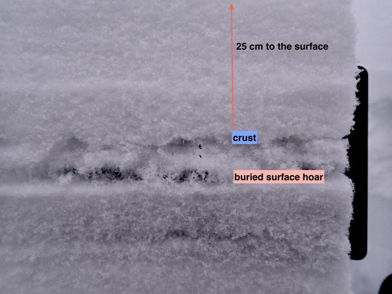
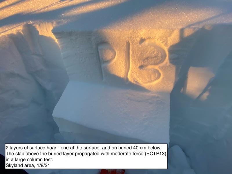
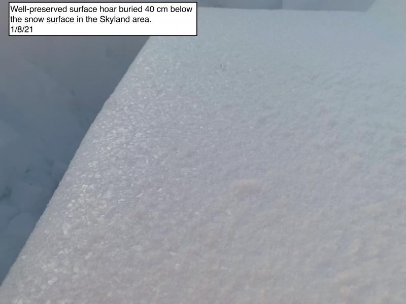
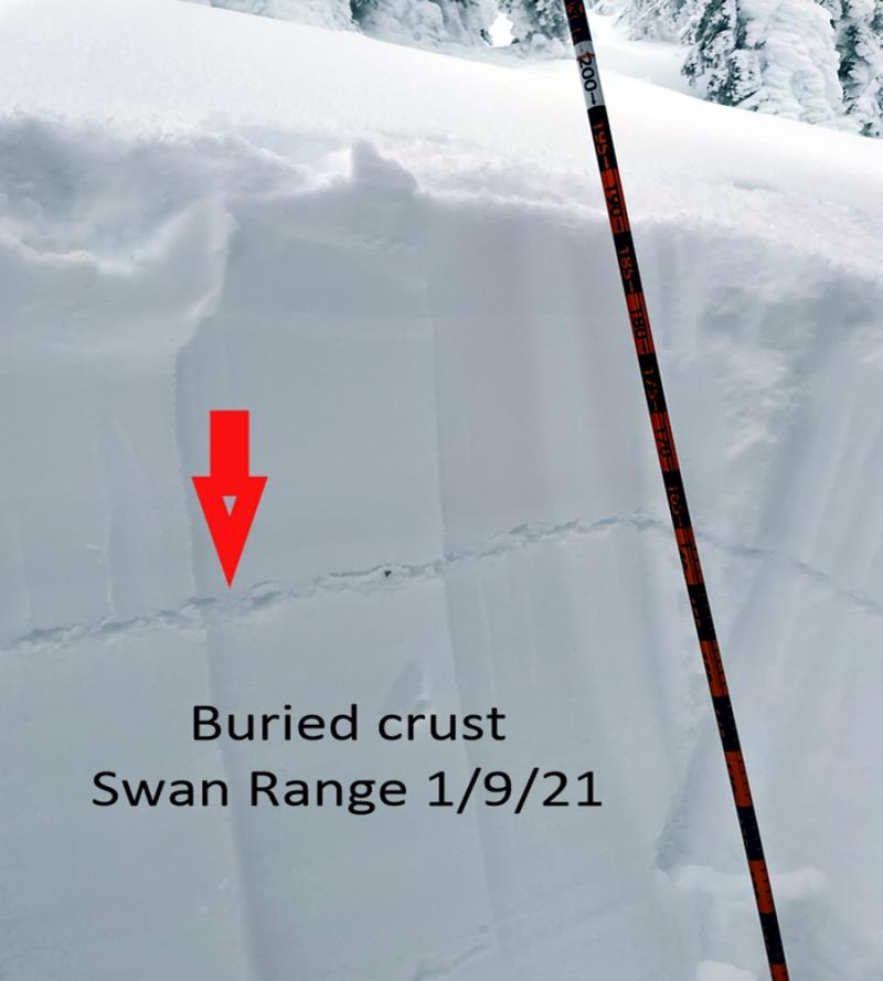
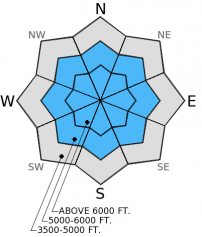
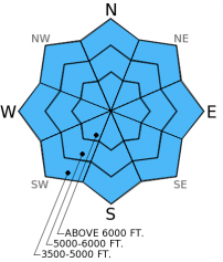
AVALANCHE WARNING above 5000 ft. continues. HIGH hazard exists above 5000 ft. as human triggered avalanches are very likely on slopes steeper than 34 degrees. It's still likely to trigger an avalanche on less steep slopes and lower elevations where there is a CONSIDERABLE hazard. A weak layer (buried surface hoar) 2-3 feet below the surface continues to cause problems. Avalanches were reported every day since last Saturday and current conditions require sticking to simple low angled terrain.

4. High
?
Above 6500 ft.
4. High
?
5000-6500 ft.
3. Considerable
?
3500-5000 ft.
- 1. Low
- 2. Moderate
- 3. Considerable
- 4. High
- 5. Extreme
-
Type ?
-
Aspect/Elevation ?
-
Likelihood ?CertainVery LikelyLikelyPossible
 Unlikely
 -
Size ?HistoricVery LargeLargeSmall

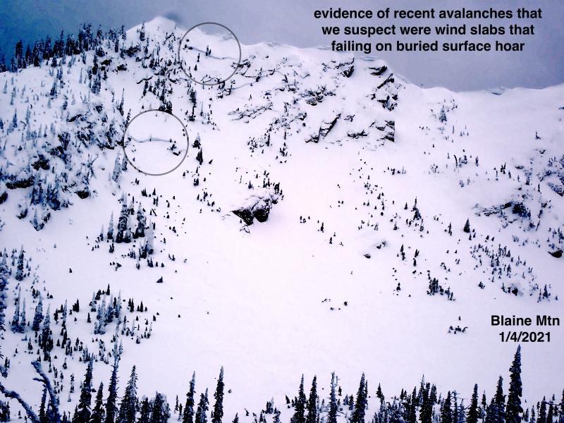
Recent avalanche activity is bullseye information that the snowpack is unstable. The layer of buried surface hoar now about 20-30 inches from the surface continues to cause problems across the advisory area. This weak layer is sensitive and has the propensity to propagate far and wide. Reports of human triggered slides over the past 5 days illustrate the ability of this layer to be quite persistent. With yesterday's new snow the slab that rests above this weak layer is even larger and more cohesive allowing it to propagate further. These avalanches can be unpredictable and surprising and require a wide safety buffer to handle the uncertainty. This includes sticking to simple low angled terrain without convex rollovers and recognizing terrain above you when you are in a runout zone.
-
Type ?
-
Aspect/Elevation ?
-
Likelihood ?CertainVery LikelyLikelyPossible
 Unlikely
 -
Size ?HistoricVery LargeLargeSmall

New snow over the past 36 hours with moderate southwest winds at upper elevations make lingering storm slabs and wind slabs a problem today. Storm slabs are about 10-15 inches thick and added more stress to an already weak layer of surface hoar. If triggered, storm and wind slabs have the ability to step down to the layer of buried surface hoar 2-3 feet from the surface. Avoid wind loaded slopes on lee sides of ridges or cross-loaded slopes as well as steep slopes.
Even though precipitation has mostly ended, the elevated avalanche hazard has not. Given that human triggered avalanches were reported every day over the past 5 days and we received a new load on the snowpack, it is still very likely to trigger an avalanche on slopes greater than 34 degrees. Don't let the new snow and a yearning for powder cloud your judgement. Stick to the less steep slopes until this layer becomes less reactive, which could be a while.
This advisory will either be allowed to expire or updated by tomorrow morning at 7:00 am. The next regularly scheduled advisory is Saturday, December 27, 2014.
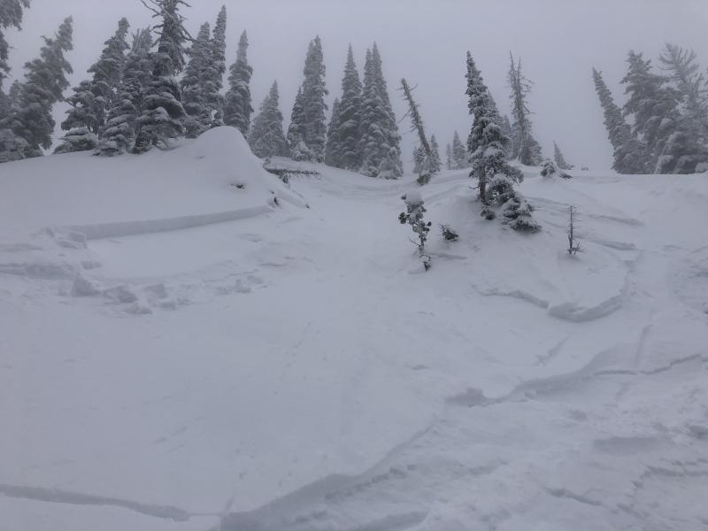
While Santa certainly brought us a nice gift of new snow he also brought us a lump of coal from the avalanche perspective. A natural avalanche cycle occurred last Sunday and human triggered avalanches have been reported every day since then. Yesterday was no exception. Visibility was poor, but we noticed a crown in the distance in the southern Whitefish Range just outside the boundary of Whitefish Mountain Resort. Within minutes of our short tour while safely traveling along a ridge, we triggered an avalanche as we approached the top of a slope (image and video). The slide was about 250 feet wide and 60-75 cm (2-2.5 ft.) deep and failed on a layer of surface hoar that sits a couple of inches above a crust. This confirmed our suspicion that this layer is very sensitive to human triggering. Other folks we saw in the area stuck to low angled slopes (< 30 degrees) and avoided traveling under steep slopes.
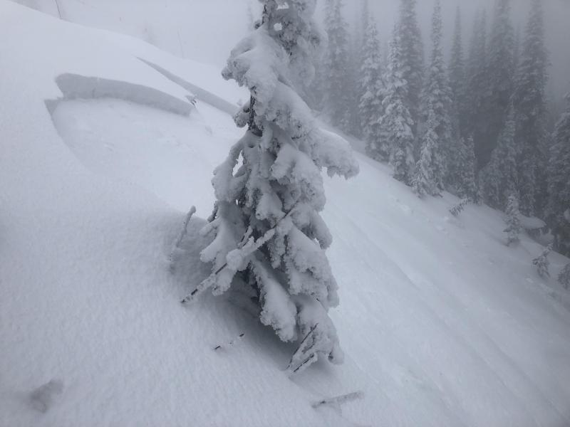
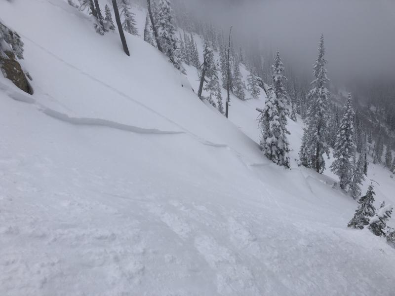
BNSF Avalanche Safety reported collapsing of the snowpack Tuesday in John F. Stevens Canyon in southern Glacier Park. They also reported natural activity from last weekend with a crown that reached back into lower angled terrain (image).
We received no observations from others yesterday.


Human triggered avalanche in southern Whitefish Range that failed 2-2.5 feet deep on surface hoar. Cut bank along the road to Red Meadow Lake (from 12/22).
Merry Christmas! Santa delivered a bit early this year, but that is ok. The storm began late Tuesday night. We'll let the storm totals tell the story:
Snowfall and (SWE) since 10:00 pm Tuesday night
(keep in mind that SNOTEL sites typically report every 3 hours and settlement of snow can occur with those intervals so snowfall amounts could be higher).
Noisy Basin SNOTEL: 14 inches (2.4 inches SWE)
Pike Creek SNOTEL: 17 inches (1.3 inches SWE)
Flattop Mt. SNOTEL: 11 inches (1.2 inches SWE)
Stahl Peak SNOTEL: 10 inches (1.2 inches SWE)
Big Mt. Summit: 16 inches (1.2 inches SWE)
Shed 7: 12.8 inches
So, seemingly once again Noisy Basin and the Swan Range come out as the big winners. 2.4 inches of SWE is a lot of weight to the snowpack!
Currently, temperatures range from 14º-21º F with winds out of the north at 5-10 mph. Today, a drier air mass moves over the region with temperatures reaching the mid-to upper 20s F, winds out of the west-northwest at 5-10 mph with gusts into the 20 mph range.
| 0600 temperature: | 14-21 deg. F. |
| Max. temperature in the last 24 hours: | 26-31 deg. F. |
| Average wind direction during the last 24 hours: | South-Southwest turning to North-Northeast |
| Average wind speed during the last 24 hours: | 8-10 mph |
| Maximum wind gust in the last 24 hours: | 25 mph |
| New snowfall in the last 24 hours: | 4-12 inches |
| Total snow depth: | 53-67 inches |
This advisory applies only to backcountry areas outside established ski area boundaries. This advisory describes general avalanche conditions and local variations always occur. This advisory expires at midnight on the posted day unless otherwise noted. The information in this advisory is provided by the USDA Forest Service who is solely responsible for its content.


