THIS AVALANCHE FORECAST EXPIRED ON December 7, 2014 @ 11:59 pm
Avalanche Forecast published on December 7, 2014 @ 6:59 am
Issued by Todd Hannan - Flathead National Forest

Whitefish Range
Swan Range
Flathead Range and Glacier National Park

How to read the forecast

Wind transported snow at high elevations formed fresh wind slabs for today. The avalanche hazard is rated considerable on wind loaded slopes above 6000 feet. The potential also remains to trigger a deeper persistent slab avalanche in weak snow (facets) near the ground as well as weak snow adjacent to the Thanksgiving crust. Avoid wind loaded slopes in the high elevations and continue to choose terrain conservatively.

3. Considerable

?

Above 6500 ft.
Dangerous avalanche conditions. Careful snowpack evaluation, cautious route-finding and conservative decision-making essential.

2. Moderate

?

5000-6500 ft.
Heightened avalanche conditions on specific terrain features. Evaluate snow and terrain carefully; identify features of concern.

2. Moderate

?

3500-5000 ft.
Heightened avalanche conditions on specific terrain features. Evaluate snow and terrain carefully; identify features of concern.
    Dangerous avalanche conditions. Careful snowpack evaluation, cautious route-finding and conservative decision-making essential.
  • 1. Low
  • 2. Moderate
  • 3. Considerable
  • 4. High
  • 5. Extreme
Avalanche Problem 1: Wind Slab
  • Type ?
  • Aspect/Elevation ?
  • Likelihood ?
    Certain
    Very Likely
    Likely
    Possible
    Unlikely
  • Size ?
    Historic
    Very Large
    Large
    Small

Moderate (17-25 mph) to strong (26-38 mph) winds drifting snow created fresh wind slabs at higher elevations. A relatively small amount of snow can form surprisingly thick wind slabs that can take as long as a week to gain strength. Remember that windslabs are not simply confined to leeward ridges, crossloading can form slabs mid-slope on terrain features such as spur ridges, rock bands, and along gulley walls. It is important to give a windloaded slopes time to adjust to the new load and best to avoid this terrain today

Avalanche Problem 2: Persistent Slab
  • Type ?
  • Aspect/Elevation ?
  • Likelihood ?
    Certain
    Very Likely
    Likely
    Possible
    Unlikely
  • Size ?
    Historic
    Very Large
    Large
    Small

We have observed persistent slabs across the entire advisory area in different forms. The first of which is the weak (faceted) snow near the ground that was formed during the mid-November cold spell. This layer has shown signs of strengthening, but should still be treated as suspect until proven innocent. We have also found a layer of weak snow varying from 1-2.5 feet deep in the snowpack, adjacent to the Thanksgiving crust. Dig into the snow, look for these layers and assess their stability in the areas you intend to ski or ride. Where these layers of weak snow are present, avoid terrain where you are most likely to trigger an avalanche in them like steep, rocky areas and areas with shallow snow. 

recent observations

Yesterday we rode to Werner Peak in the Whitefish Range to assess instability of persistent slabs and recently formed wind slabs. Small cornices were forming along the ridgeline and thin wind slab (2-4 inches) was in the early stage of development on leeward slopes. We found weak snow (facets) near the ground that was increasingly difficult to propagate a fracture in, but should still be approached with caution.  In several locations we observed a thin layer of facets adjacent to the Thanksgiving crust buried 1-2 feet in the snow pack that readily failed in stability testing (video). We were able to propagate fractures in this layer with easy to moderate force in extended column tests (ECT).

There was a vague report of a small snowmobile triggered slide outside of Olney in the Whitefish Range yesterday. We will try to get more information today. Other recent observations in southern Whitefish Range found weak snow near the ground and below the Thanksgiving crust to be reactive in areas of shallow snow.


Weather and CURRENT CONDITIONS
weather summary

Today, temperatures should reach the high 30s in some locations, winds will be light to moderate out of the west and southwest. A short break in precipitation is expected for today and tomorrow. In the past 24 hours we picked up an additional 2-6 inches of snow across the advisory area, winds were moderate (17-25 mph) with strong gusts out of the southwest.

Today’s weather observations near 6000 feet in the region
0600 temperature: 26-33 deg. F.
Max. temperature in the last 24 hours: 42 deg. F.
Average wind direction during the last 24 hours: SW
Average wind speed during the last 24 hours: 10 mph
Maximum wind gust in the last 24 hours: 30 mph
New snowfall in the last 24 hours: 2-6 inches
Total snow depth: 13-50 inches
Two-Day Mountain Weather Forecast Produced in partnership with the Missoula NWS
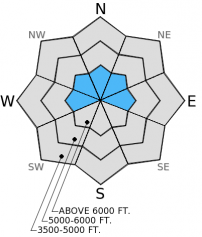
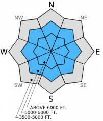
For 5000 ft. to 7000 ft.
Sunday Sunday Night Monday
Cloud Cover: Partly to mostly cloudy. Chance of lingering snow showers in the morning. Partly cloudy Partly/mostly cloudy, gradual warming
Temperatures: 30-40 deg. F. 19-25 deg. F. 30-40 deg. F.
Wind Direction: W-SW S-SW S-sw
Wind Speed: 6-10 Gusts to 35 3-5 4-6
Snowfall: 0 in. 0 in. 0 in.
Snow Line:
Disclaimer

This advisory applies only to backcountry areas outside established ski area boundaries. This advisory describes general avalanche conditions and local variations always occur. This advisory expires at midnight on the posted day unless otherwise noted. The information in this advisory is provided by the USDA Forest Service who is solely responsible for its content.