THIS AVALANCHE FORECAST EXPIRED ON December 7, 2014 @ 12:02 am
Avalanche Forecast published on December 6, 2014 @ 7:02 am
Issued by Todd Hannan - Flathead National Forest

Whitefish Range
Flathead Range and Glacier National Park

How to read the forecast

The recent storm snow and wind formed wind slabs at upper elevations. Wind slab avalanches are likely above 6000 feet, with the possibility of avalanches breaking in deeper layers. Cautious route finding and conservative decision making are essential.

3. Considerable

?

Above 6500 ft.
Dangerous avalanche conditions. Careful snowpack evaluation, cautious route-finding and conservative decision-making essential.

2. Moderate

?

5000-6500 ft.
Heightened avalanche conditions on specific terrain features. Evaluate snow and terrain carefully; identify features of concern.

2. Moderate

?

3500-5000 ft.
Heightened avalanche conditions on specific terrain features. Evaluate snow and terrain carefully; identify features of concern.
    Dangerous avalanche conditions. Careful snowpack evaluation, cautious route-finding and conservative decision-making essential.
  • 1. Low
  • 2. Moderate
  • 3. Considerable
  • 4. High
  • 5. Extreme
Avalanche Problem 1: Wind Slab
  • Type ?
  • Aspect/Elevation ?
  • Likelihood ?
    Certain
    Very Likely
    Likely
    Possible
    Unlikely
  • Size ?
    Historic
    Very Large
    Large
    Small

Strong winds at high elevations created new wind slabs on lee slopes. It can take up to a week for wind slabs to gain strength. It is best to avoid steep, windloaded terrain until newly formed wind slabs have had time to settle. Human triggered avalanches are likely in steep wind loaded terrain today. Look for obvious signs of instability like recent avalanche activity, cracking, and collapsing.

Avalanche Problem 2: Persistent Slab
  • Type ?
  • Aspect/Elevation ?
  • Likelihood ?
    Certain
    Very Likely
    Likely
    Possible
    Unlikely
  • Size ?
    Historic
    Very Large
    Large
    Small

A layer of weak snow exists in the snowpack about 2 feet down that readiliy failed in stability testing in previous observations. Also, weak faceted snow near the ground exists in all ranges in the advisory area. It remains possible to trigger an avalanche in these deep layers. Avoid terrain where triggering these layers is most likely such as in steep, rocky areas with shallow snow. Dig into the snow and assess each area you intend to ski or ride.

Forecast discussion

The snowpack will need time to adjust to this new load. Continue to make conservative decisions in the backcountry and avoid steep terrain until the snow has had time to adjust to the recent burden. Though seemingly less reactive than in previous observations, weak (faceted) snow near the ground exists in most locations in the advisory area. Consider the places where you are most likely to trigger an avalanche on these layers such as steep, rocky terrain. Even though the obvious signs of instability such as collapsing (whumpfing), shooting cracks, or recent avalanche activity may not be present, it remains important to seek out instability in the snowpack. The snow is still fairly shallow so digging to the ground to assess problem layers does not take much time. It is also important to note the distribution of these early issues in the snowpack as the snow continues to pile up.

recent observations

Yesterday, we traveled in the Kimmerly Basin and Canyon Creek areas of the southern Whitefish Range. The new snow sluffed on steep slopes but lacked cohesiveness in most areas. However, we found isolated wind slabs on leeward slopes near ridgetops that cracked and showed signs of instability. In our stability tests a layer of weak (faceted) snow below the Thanksgiving crust propagated fractures. This is yet another sign of instability with weak layers deeper in the snowpack. We also found the weak (faceted) snow near the ground in multiple pit locations and this layer propagated fractures as well in some of our stability tests (video).

WMR ski patrol was able to trigger a storm slab using explosives Friday and other observations in the southern Whitefish Range found weak snow near the ground to be reactive in areas of shallow snow. 

Recent images from the nearby Swan Range (see Swan Range advisory as well)

Weather and CURRENT CONDITIONS
weather summary

 The last storm deposited 4-8 inches of new snow and snow water equivalent of 0.4-0.6 inches.  For today, expect temperatures to climb above freezing at mid-elevations and then begin to fall by late afternoon. Continued precipitation will become more showery by the afternoon and into the evening. Currently mountain temperatures in the Whitefish and Flathead ranges as well as the southern portion of Glacier Park are in the low to upper 20s to mid-30s.

Today’s weather observations near 6000 feet in the region
0600 temperature: 30-35 deg. F.
Max. temperature in the last 24 hours: 29-35 deg. F.
Average wind direction during the last 24 hours: S-SW
Average wind speed during the last 24 hours: 2-11 mph
Maximum wind gust in the last 24 hours: 30 mph
New snowfall in the last 24 hours: 2-4 inches
Total snow depth: 41-47 inches
Two-Day Mountain Weather Forecast Produced in partnership with the Missoula NWS
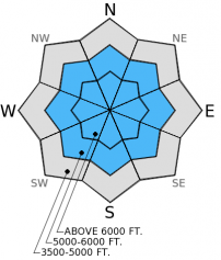
For 5000 ft. to 7000 ft.
Saturday Saturday Night Sunday
Cloud Cover: Continued precipitation with lowering snow levels. Snow showers Mostly cloudy
Temperatures: 32-40 deg. F. 27-32 deg. F. 30-39 deg. F.
Wind Direction: SW SW SW
Wind Speed: 7-32 14-40 7-32
Snowfall: 1-2 in. 2-3 in. 0 in.
Snow Line:
Disclaimer

This advisory applies only to backcountry areas outside established ski area boundaries. This advisory describes general avalanche conditions and local variations always occur. This advisory expires at midnight on the posted day unless otherwise noted. The information in this advisory is provided by the USDA Forest Service who is solely responsible for its content.